Download
Preview
Add to list
More
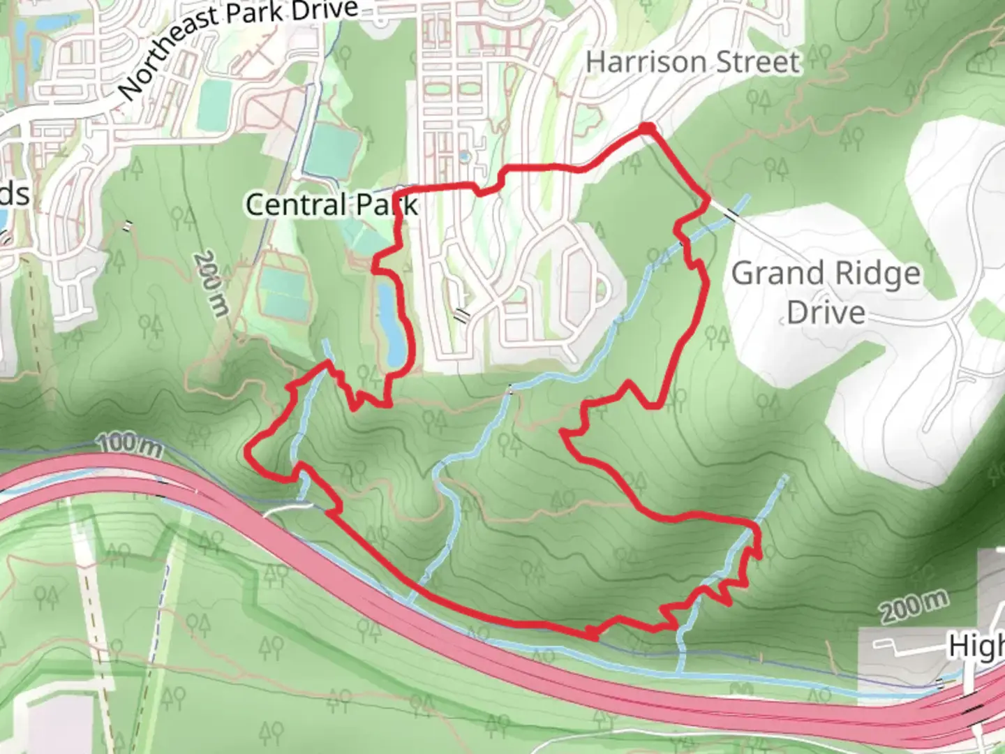
6.2 km
~1 hrs 42 min
283 m
Loop
“Explore a scenic 6 km loop with forest views, rich history, and moderate hiking challenges in Issaquah.”
Starting near King County, Washington, the East Fork Trail and Issaquah Preston Trail form a scenic loop of approximately 6 km (3.7 miles) with an elevation gain of around 200 meters (656 feet). This trail is rated as medium difficulty, making it suitable for moderately experienced hikers.
Getting There
To reach the trailhead, you can drive or use public transportation. If driving, head towards the Issaquah Alps area, and you can park near the High Point Trailhead, which is the closest significant landmark. For those using public transport, take a bus to the Issaquah Transit Center and then a short taxi or rideshare to the trailhead.
Trail Overview
The trail begins with a gentle ascent through a lush forest of Douglas firs and western red cedars. The first kilometer (0.6 miles) is relatively easy, with a gradual incline that allows you to warm up. As you continue, the trail becomes steeper, gaining most of its elevation in the next 2 kilometers (1.2 miles).
Points of Interest
At around the 2 km (1.2 miles) mark, you'll come across a small, picturesque creek. This is a great spot to take a short break and enjoy the sound of flowing water. Continuing on, you'll reach a viewpoint at approximately 3 km (1.9 miles) into the hike. From here, you can see panoramic views of the surrounding Issaquah Alps and, on a clear day, even catch a glimpse of Mount Rainier in the distance.
Flora and Fauna
The trail is rich in biodiversity. Keep an eye out for native plants like salal, Oregon grape, and sword ferns. Wildlife is abundant; you might spot black-tailed deer, various bird species, and if you're lucky, a black bear or two. Always remember to keep a safe distance from wildlife and follow Leave No Trace principles.
Historical Significance
The Issaquah Alps have a rich history, once home to the Snoqualmie and Sammamish tribes. The area later became a hub for coal mining in the late 19th and early 20th centuries. Remnants of old mining operations can still be found along the trail, adding a historical dimension to your hike.
Navigation
For navigation, it's highly recommended to use the HiiKER app, which provides detailed maps and real-time updates. The trail is well-marked, but having a reliable navigation tool can enhance your hiking experience and ensure you stay on track.
Final Stretch
The final 1.5 km (0.9 miles) of the trail is a descent back towards the trailhead. This section is less steep but can be slippery, especially after rain, so watch your footing. The loop concludes as you return to the starting point, having experienced a diverse and enriching hike through one of Washington's beautiful natural areas.

What to expect?
Activity types
Comments and Reviews
User comments, reviews and discussions about the East Fork Trail and Issaquah Preston Trail, Washington.
4.89
average rating out of 5
9 rating(s)