Download
Preview
Add to list
More
4.3 km
~1 hrs 15 min
244 m
Out and Back
“Discover Coal Creek Trail's natural beauty and historical intrigue on this moderately challenging 4-kilometer hike.”
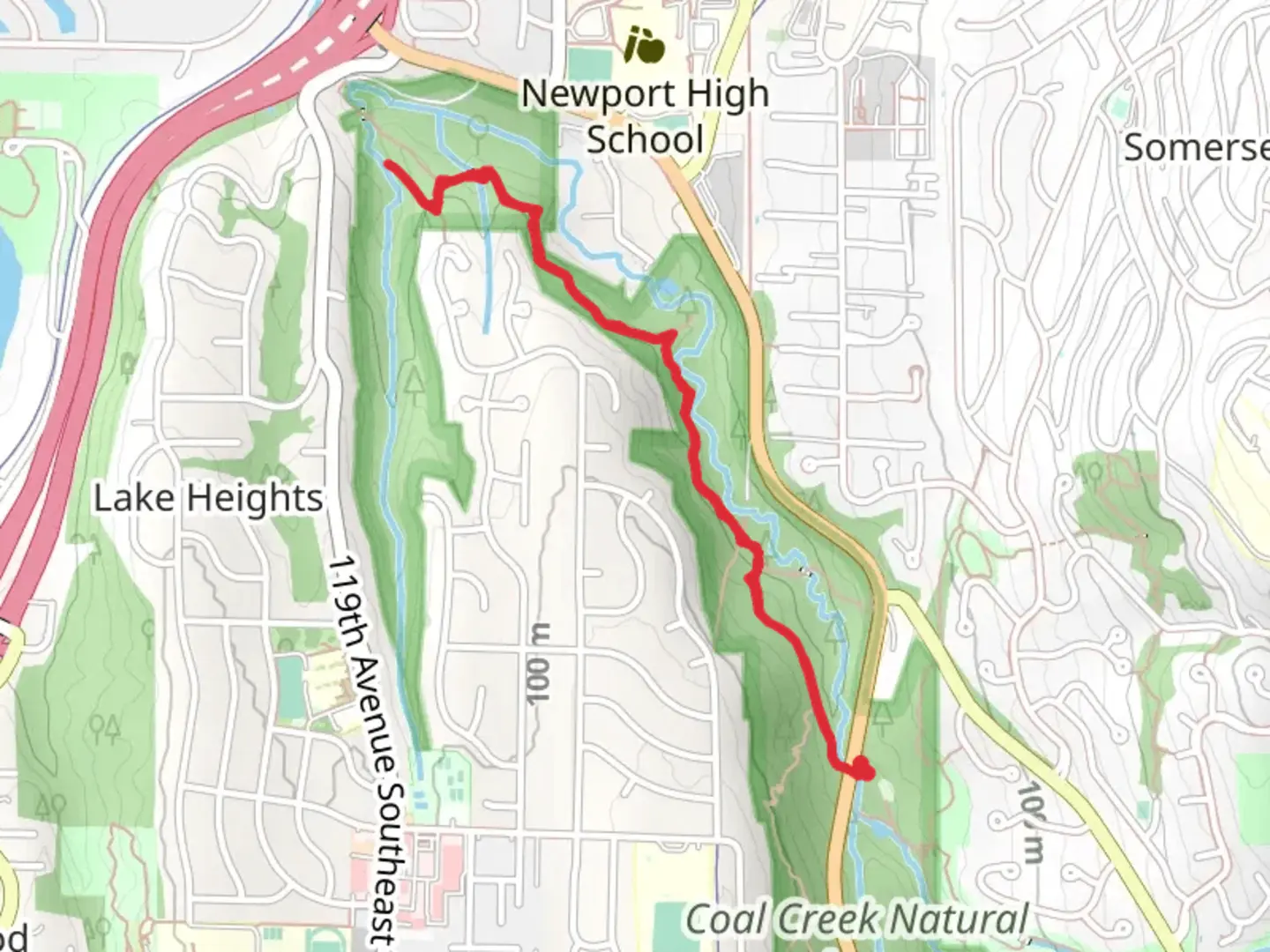
Starting near King County, Washington, the Coal Creek Trail and Sewer Utility offers a moderately challenging hike that spans approximately 4 kilometers (2.5 miles) with an elevation gain of around 200 meters (656 feet). This out-and-back trail is perfect for those looking to immerse themselves in the natural beauty and historical richness of the area.### Getting There To reach the trailhead, you can drive or use public transportation. If driving, head towards the Coal Creek Parkway SE and look for the trailhead near the Coal Creek Natural Area. For those using public transport, the nearest bus stop is at Coal Creek Parkway SE & Forest Drive SE, serviced by King County Metro Transit. From there, it's a short walk to the trailhead.### Trail Overview The trail begins with a gentle ascent through a lush forest, characterized by towering Douglas firs and Western red cedars. As you progress, the path becomes steeper, offering a good workout for your legs. The trail is well-marked, but it's always a good idea to have a navigation tool like HiiKER to ensure you stay on track.### Significant Landmarks and Nature At approximately 1 kilometer (0.6 miles) into the hike, you'll come across the remnants of old coal mining operations, a nod to the area's historical significance. These remnants include rusted mining equipment and old rail tracks, providing a fascinating glimpse into the past.Continuing along the trail, you'll encounter Coal Creek itself, a serene waterway that runs parallel to the path for a significant portion of the hike. The creek is home to various species of fish and amphibians, making it a great spot for nature enthusiasts.### Wildlife The trail is teeming with wildlife. Keep an eye out for black-tailed deer, which are commonly seen grazing in the meadows. Birdwatchers will also be delighted by the variety of species, including woodpeckers, owls, and the occasional bald eagle soaring overhead.### Elevation and Terrain As you approach the 2-kilometer (1.2 miles) mark, the trail reaches its highest point, offering panoramic views of the surrounding forest and distant mountains. The elevation gain of 200 meters (656 feet) is gradual but steady, making it manageable for most hikers with a moderate level of fitness.### Historical Significance The Coal Creek area has a rich history dating back to the late 19th century when it was a bustling coal mining region. The trail itself follows the route of an old mining railway, and interpretive signs along the way provide insights into the lives of the miners who once worked here.### Final Stretch The final stretch of the trail leads you back down towards the trailhead, offering a gentle descent that allows you to take in the beauty of the forest one last time. The entire hike can be completed in about 2 to 3 hours, depending on your pace and how often you stop to enjoy the scenery.### Preparation Tips Given the moderate difficulty of the trail, it's advisable to wear sturdy hiking boots and bring plenty of water. The trail can be muddy in sections, especially after rain, so be prepared for potentially slippery conditions. Always check the weather forecast before heading out and consider using HiiKER for real-time trail updates and navigation assistance.

What to expect?
Activity types
Comments and Reviews
User comments, reviews and discussions about the Coal Creek Trail and Sewer Utility, Washington.
4.29
average rating out of 5
17 rating(s)