Download
Preview
Add to list
More
15.2 km
~4 hrs 58 min
1160 m
Loop
“Embark on the scenic and moderately challenging Chirico Trail to Poo Poo Point, a hiker's delight in the verdant Issaquah Alps.”
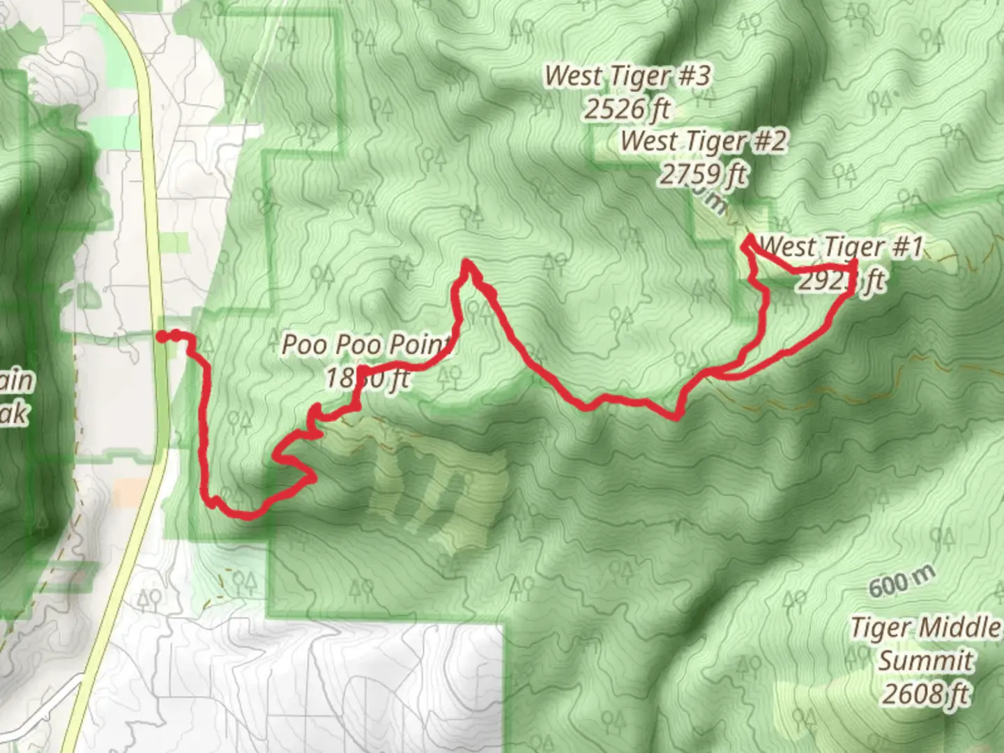
The Chirico Trail to Poo Poo Point offers a rewarding hike in the Issaquah Alps, near King County, Washington. This loop trail spans approximately 15 kilometers (about 9.3 miles) and features an elevation gain of around 1100 meters (roughly 3600 feet), presenting a moderate challenge suitable for hikers with some experience.
Getting to the Trailhead
To reach the trailhead, if you're driving, take I-90 to exit 17 and head south on Front Street. Continue as it becomes Issaquah-Hobart Road SE for about 3.6 kilometers (2.2 miles). The trailhead parking lot is on the left side of the road, just past the paragliding landing field. Public transport options include taking a bus to Issaquah Transit Center and then a short taxi or ride-share to the trailhead.
The Ascent
Starting from the trailhead, the Chirico Trail begins with a steady climb through a lush forest. The canopy of Douglas firs and Western red cedars provides shade, making this initial section a cool and pleasant start. After about 2 kilometers (1.2 miles), the trail opens up to provide the first of several viewpoints. Here, hikers can take a moment to enjoy the vistas of the surrounding valleys and peaks.
Wildlife and Flora
As you ascend, keep an eye out for local wildlife, including black-tailed deer, and listen for the calls of pileated woodpeckers. The underbrush is rich with ferns and mosses, indicative of the Pacific Northwest's damp environment. During the spring and early summer, the trailside blooms with wildflowers, adding splashes of color to the greenery.
Poo Poo Point
The trail's midpoint and primary destination is Poo Poo Point, a large clearing that serves as a popular launch site for paragliders. The name "Poo Poo Point" references the steam whistle sounds from the logging era, a nod to the area's historical significance in the timber industry. From this vantage point, approximately 7.5 kilometers (4.7 miles) from the start, hikers are rewarded with panoramic views of Mount Rainier and Lake Sammamish.
The Descent and Loop Completion
Continuing the loop, the trail descends along the Poo Top Trail, which meanders back down to the trailhead. This section can be steep in places, so trekking poles may be helpful. The descent offers a different perspective of the landscape, with occasional clearings providing opportunities to gaze out over the Issaquah Plateau.
Navigation and Preparation
For navigation, HiiKER is an excellent tool to keep track of your progress along the trail. It's advisable to download the trail map on HiiKER before you set out, as cell service can be spotty in the mountains.
Before embarking on the hike, ensure you have adequate water, snacks, and layers of clothing to adapt to changing weather conditions. The trail can be muddy or snowy depending on the season, so appropriate footwear is essential.
Remember to leave no trace, pack out all your garbage, and respect the natural environment to preserve it for future hikers.

What to expect?
Activity types
Comments and Reviews
User comments, reviews and discussions about the Chirico Trail and Poo Top Trail, Washington.
4.3
average rating out of 5
10 rating(s)