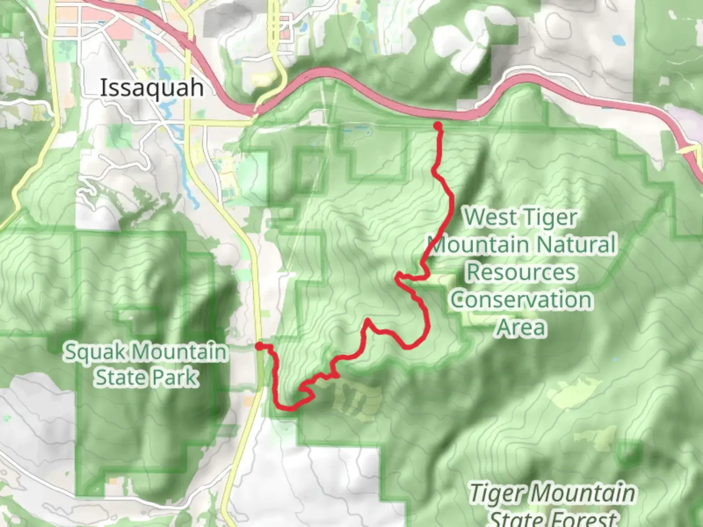
Chirico, Poo-Poo Point, West Tiger 3 and Cable Line Trail
Download
3D Flyover
Add to list
More
10.1 km
~3 hrs 30 min
896 m
Point-to-Point
“Embark on a diverse, historic hike featuring challenging climbs, stunning vistas, and serene forests in the Issaquah Alps.”
Starting near King County, Washington, this trail offers a diverse and rewarding hiking experience. The trailhead is conveniently accessible by car, with parking available at the Issaquah Alps Trail Center. For those using public transport, you can take a bus to the Issaquah Transit Center and then a short taxi or rideshare to the trailhead.
Chirico Trail to Poo-Poo Point
The first section of the hike begins with the Chirico Trail, which leads you to Poo-Poo Point. This segment is approximately 2 miles (3.2 km) long with an elevation gain of about 1,760 feet (536 meters). The trail is well-marked and starts with a moderate incline through dense forest. As you ascend, you'll encounter several switchbacks that make the climb more manageable. Keep an eye out for paragliders launching from Poo-Poo Point, a popular spot for aerial sports. The viewpoint offers stunning vistas of Lake Sammamish and the surrounding valleys.
Transition to West Tiger 3 Trail
From Poo-Poo Point, the trail continues towards West Tiger 3. This section is less crowded and provides a more serene hiking experience. The trail meanders through lush forest, featuring Douglas firs, western hemlocks, and sword ferns. The path is relatively flat for the first mile (1.6 km) before it begins to climb again. You’ll gain approximately 1,000 feet (305 meters) in elevation over the next 1.5 miles (2.4 km). Along the way, you might spot wildlife such as black-tailed deer, various bird species, and occasionally black bears. Make sure to carry bear spray and know how to use it.
Cable Line Trail Descent
The final leg of the hike is the descent via the Cable Line Trail. This trail is known for its steep and challenging terrain, dropping about 2,000 feet (610 meters) over 2 miles (3.2 km). The path is rugged and can be slippery, especially after rain, so good hiking boots with strong grip are essential. Trekking poles can also be very helpful for stability. The Cable Line Trail is less maintained than the previous sections, so be prepared for a more rugged experience. As you descend, you'll pass through old-growth forest and cross several small streams.
Historical Significance
The Issaquah Alps, where this trail is located, have a rich history. The area was originally inhabited by the Snoqualmie and other Coast Salish tribes. In the late 19th and early 20th centuries, the region saw significant logging and coal mining activity. Remnants of this history can still be seen along the trails, including old mining equipment and logging roads.
Navigation and Safety
For navigation, it’s highly recommended to use the HiiKER app, which provides detailed maps and real-time GPS tracking. This will help you stay on course, especially in the less marked sections of the trail. Always check the weather forecast before you go, as conditions can change rapidly in the Pacific Northwest. Carry enough water, snacks, and a first aid kit.
This trail offers a mix of challenging climbs, rewarding views, and a touch of history, making it a must-do for any hiking enthusiast in the region.

What to expect?
Activity types
Comments and Reviews
User comments, reviews and discussions about the Chirico, Poo-Poo Point, West Tiger 3 and Cable Line Trail, Washington.
4.5
average rating out of 5
8 rating(s)