Download
Preview
Add to list
More
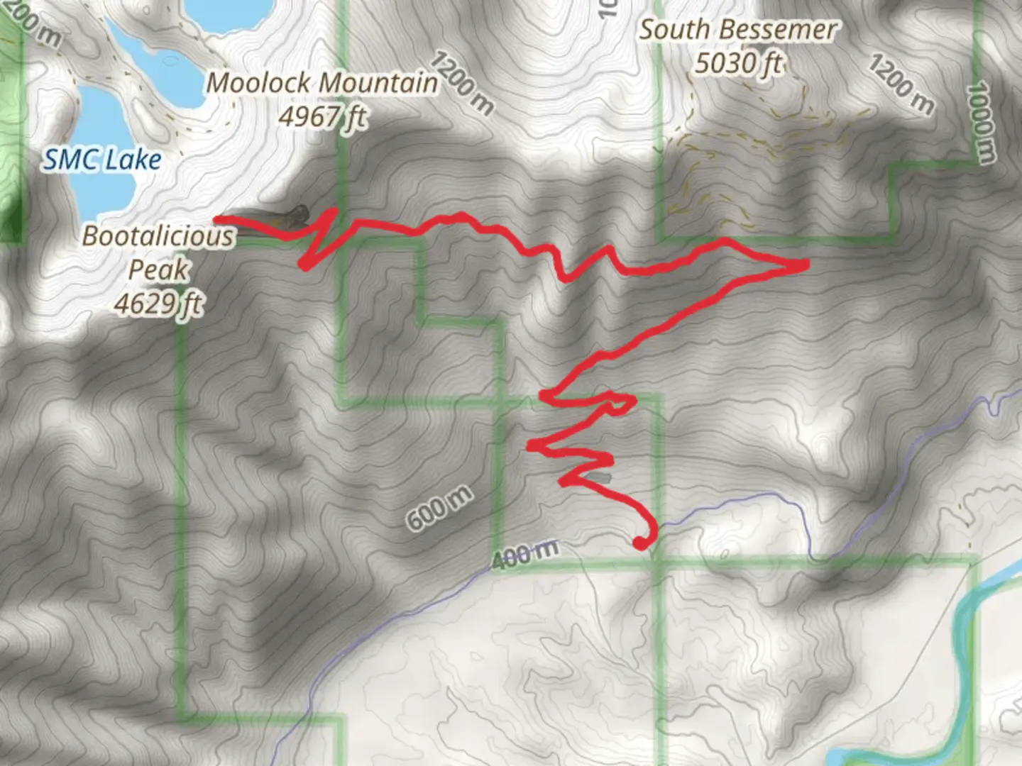
16.7 km
~5 hrs 16 min
1161 m
Out and Back
“The Bessemer Road trail offers a scenic 17 km hike with significant elevation gain, ideal for experienced hikers.”
Starting near King County, Washington, the Bessemer Road trail offers a rewarding out-and-back hike of approximately 17 km (10.5 miles) with an elevation gain of around 1100 meters (3609 feet). This trail is rated as medium difficulty, making it suitable for hikers with some experience and a good level of fitness.
Getting There
To reach the trailhead, you can drive or use public transportation. If driving, head towards the nearest known address, which is the vicinity of North Bend, WA. From North Bend, take the I-90 East and exit at 38 for SE Homestead Valley Road. Follow this road until you reach the trailhead parking area. For those using public transport, take a bus to North Bend and then a taxi or rideshare to the trailhead.
Trail Overview
The trail begins with a gentle ascent through a dense forest of Douglas fir and western hemlock. The first 3 km (1.9 miles) are relatively easy, with an elevation gain of about 200 meters (656 feet). This section is well-marked and offers a good warm-up for the more challenging parts ahead.
Mid-Trail Landmarks
Around the 5 km (3.1 miles) mark, you'll encounter a series of switchbacks that significantly increase the elevation gain. This section can be strenuous, so take breaks as needed. At approximately 6 km (3.7 miles), you'll reach a small clearing with a stunning view of Mount Si to the west. This is a great spot for a quick rest and some photos.
Continuing on, the trail becomes rockier and more rugged. At around 8 km (5 miles), you'll come across an old mining site, a remnant of the area's historical significance. The Bessemer Road was originally used for transporting ore from the mines, and you can still see some of the old mining equipment scattered around.
Flora and Fauna
The trail is rich in biodiversity. Keep an eye out for black-tailed deer, which are commonly seen in the area. Birdwatchers will enjoy spotting species like the varied thrush and the Steller's jay. In the spring and early summer, the trail is adorned with wildflowers such as trillium and lupine.
Final Ascent
The last 2 km (1.2 miles) to the turnaround point are the most challenging, with an elevation gain of about 400 meters (1312 feet). The trail narrows and becomes steeper, requiring careful footing. Upon reaching the highest point, you'll be rewarded with panoramic views of the Cascade Range and the Snoqualmie Valley.
Navigation
Given the trail's varying terrain and potential for confusing switchbacks, it's advisable to use a reliable navigation tool like HiiKER to stay on track. The app provides detailed maps and real-time updates, ensuring you don't miss any important turns or landmarks.
Return Journey
The return journey follows the same path back to the trailhead. While descending, take your time to enjoy the scenery and perhaps spot some wildlife you may have missed on the way up. The descent is generally easier but still requires caution, especially on the steeper sections.
This trail offers a mix of natural beauty, historical interest, and physical challenge, making it a fulfilling hike for those prepared to tackle its demands.

What to expect?
Activity types
Comments and Reviews
User comments, reviews and discussions about the Bessemer Road, Washington.
4.5
average rating out of 5
14 rating(s)