Download
Preview
Add to list
More
9.6 km
~2 hrs 22 min
274 m
Loop
“An enchanting 10-kilometer loop blending lush forests, panoramic views, and rich history in Jefferson County.”
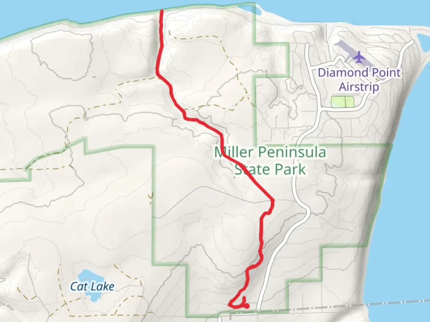
Starting near Jefferson County, Washington, the Trailhead and East Diamond Point Trail is a captivating loop trail that spans approximately 10 kilometers (6.2 miles) with an elevation gain of around 200 meters (656 feet). This medium-difficulty trail offers a diverse hiking experience, blending natural beauty with historical significance.
Getting There
To reach the trailhead, you can drive or use public transport. If you're driving, head towards Jefferson County and look for the parking area near the intersection of Highway 101 and East Diamond Point Road. For those using public transport, the nearest bus stop is at the Quilcene Ranger Station, which is about a 15-minute walk from the trailhead.
Trail Overview
The trail begins with a gentle ascent through a lush forest of Douglas firs and western hemlocks. The first kilometer (0.6 miles) is relatively easy, allowing you to acclimate to the surroundings. As you progress, the trail becomes steeper, gaining about 100 meters (328 feet) in elevation over the next 2 kilometers (1.2 miles).
Significant Landmarks
East Diamond Point
Around the 3-kilometer (1.9-mile) mark, you'll reach East Diamond Point, a prominent lookout offering panoramic views of the Olympic Mountains and the Strait of Juan de Fuca. This is an excellent spot for a break and some photography.
Historical Significance
The region around Jefferson County has a rich history, dating back to the Native American tribes who originally inhabited the area. The trail itself was used by early settlers and loggers in the 19th century, and remnants of old logging equipment can still be seen along the path.
Flora and Fauna
As you continue, the trail meanders through a variety of ecosystems. You'll encounter dense underbrush, including salal and Oregon grape, and might spot wildlife such as black-tailed deer, Douglas squirrels, and a variety of bird species like the Steller's jay and the pileated woodpecker.
Navigation and Safety
The trail is well-marked, but it's always a good idea to have a reliable navigation tool. HiiKER is an excellent app for this purpose, providing detailed maps and real-time updates. Be sure to carry enough water, wear sturdy hiking boots, and bring layers as the weather can change rapidly.
Final Stretch
The last 2 kilometers (1.2 miles) of the trail loop back towards the trailhead, descending gradually through a mixed forest of alder and maple trees. This section is less strenuous, allowing you to enjoy the serene environment as you make your way back.
Practical Tips
- Parking: Available at the trailhead near East Diamond Point Road.
- Restrooms: None available on the trail, so plan accordingly.
- Best Time to Hike: Late spring to early fall for the best weather and trail conditions.
This trail offers a balanced mix of natural beauty, moderate physical challenge, and historical intrigue, making it a rewarding experience for hikers of all levels.

What to expect?
Activity types
Comments and Reviews
User comments, reviews and discussions about the Trailhead and East Diamond Point Trail, Washington.
4.56
average rating out of 5
18 rating(s)