Download
Preview
Add to list
More
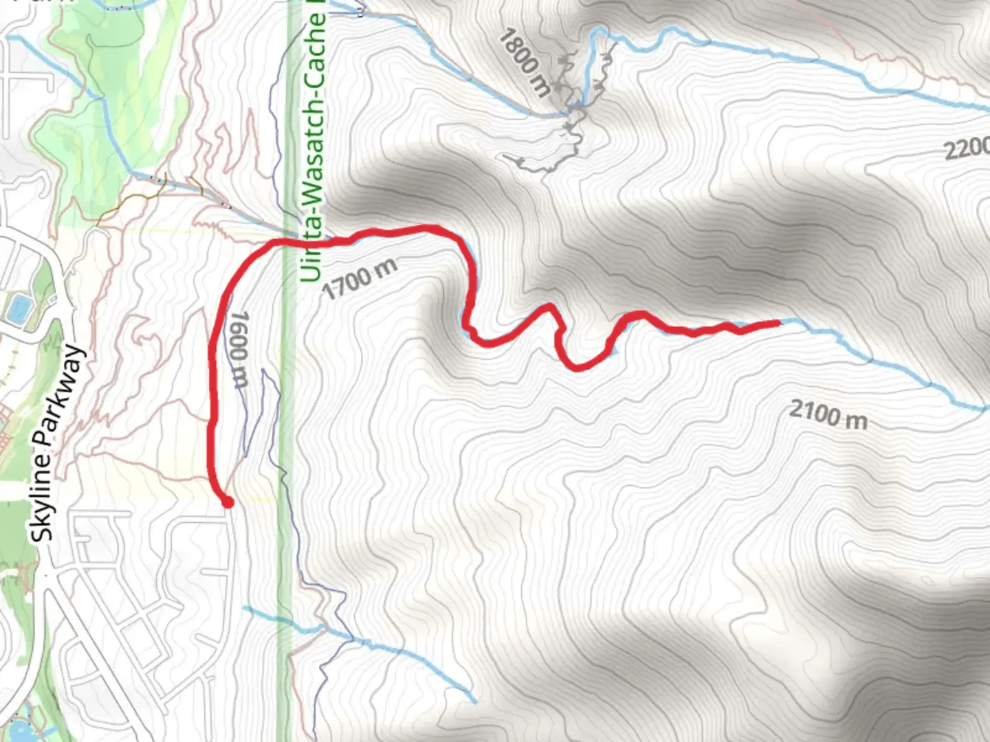
5.9 km
~1 hrs 55 min
449 m
Out and Back
“Discover the natural beauty and history of Strong Canyon Trail on a moderately challenging 6 km hike!”
Starting near Weber County, Utah, the Strong Canyon Trail offers a moderately challenging hike with a total distance of approximately 6 km (3.7 miles) and an elevation gain of around 400 meters (1,312 feet). This out-and-back trail is perfect for those looking to experience the natural beauty and historical significance of the region.
Getting There
To reach the trailhead, you can drive or use public transportation. If driving, head towards the nearest known address, which is the North Ogden Divide Trailhead, located at 2750 N Mountain Rd, North Ogden, UT 84414. For those using public transport, take a bus to the North Ogden area and then a short taxi or rideshare to the trailhead.
Trail Overview
The trail begins with a gentle ascent through a mixed forest of pine and aspen trees. As you progress, the path becomes steeper, offering a good workout for your legs. The first significant landmark you'll encounter is a small, picturesque creek about 1 km (0.6 miles) into the hike. This is a great spot to take a short break and enjoy the serene surroundings.
Wildlife and Flora
Keep an eye out for local wildlife, including deer, squirrels, and various bird species. The area is also rich in wildflowers during the spring and summer months, adding vibrant colors to your hike.
Mid-Trail Highlights
At around the 3 km (1.9 miles) mark, you'll reach a scenic overlook that provides stunning views of the surrounding canyon and distant mountains. This is one of the most rewarding parts of the hike, so take some time to soak in the scenery and snap a few photos.
Historical Significance
The region around Strong Canyon has a rich history, with Native American tribes having inhabited the area for centuries. Artifacts and remnants of their presence can sometimes be found along the trail, so tread lightly and respect the historical significance of the land.
Navigation and Safety
For navigation, it's highly recommended to use the HiiKER app, which provides detailed maps and real-time updates. The trail is well-marked, but having a reliable navigation tool can enhance your hiking experience and ensure you stay on track.
Final Stretch
The final stretch of the trail involves a steady climb to the turnaround point, where you'll be rewarded with panoramic views of the canyon. This is a great spot to rest, have a snack, and prepare for the descent back to the trailhead.
Return Journey
The return journey follows the same path, allowing you to revisit the beautiful spots you encountered on the way up. Remember to pace yourself and enjoy the downhill trek, which is generally easier but still requires attention to footing.
By the end of your hike, you'll have covered a total of 6 km (3.7 miles) and experienced an elevation gain of 400 meters (1,312 feet), making for a fulfilling and invigorating outdoor adventure.

What to expect?
Activity types
Comments and Reviews
User comments, reviews and discussions about the Strong Canyon Trail, Utah.
4.7
average rating out of 5
10 rating(s)