Download
Preview
Add to list
More
4.7 km
~1 hrs 25 min
286 m
Out and Back
“The Goodale Creek trail near Weber County offers a 5-kilometer hike with stunning views and diverse wildlife.”
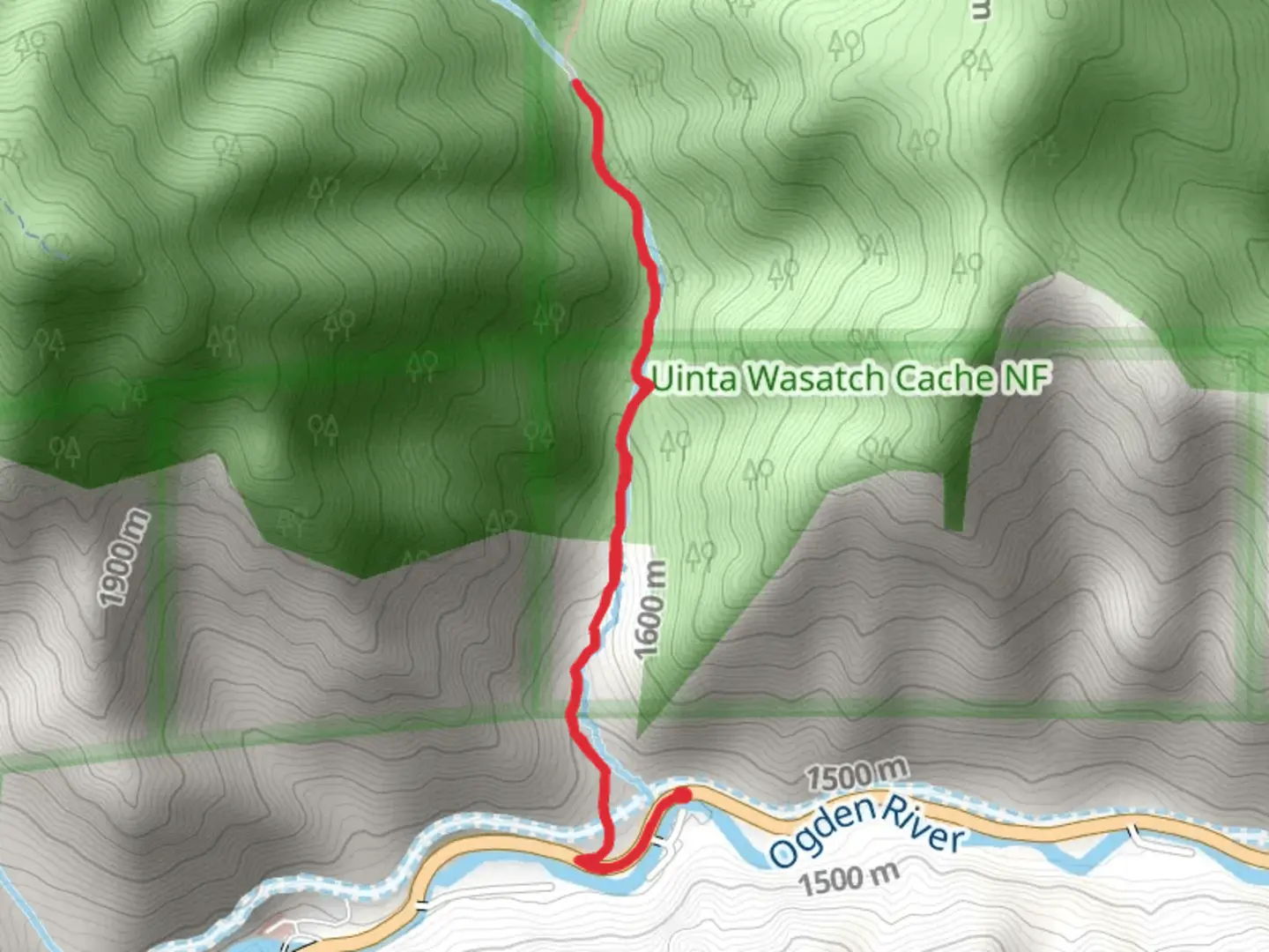
Starting near Weber County, Utah, the Goodale Creek trail offers a moderately challenging hike with a total distance of around 5 kilometers (approximately 3.1 miles) and an elevation gain of about 200 meters (656 feet). This out-and-back trail is perfect for those looking to experience the natural beauty of the region without committing to a full-day trek.
Getting There
To reach the trailhead, you can drive or use public transportation. If driving, head towards Weber County and look for parking near the intersection of 12th Street and Harrison Boulevard in Ogden, Utah. For those using public transport, the nearest bus stop is at the Ogden Transit Center, from where you can take a local bus or taxi to the trailhead.
Trail Overview
The trail begins with a gentle ascent through a mixed forest of pine and aspen trees. The initial 1 kilometer (0.6 miles) is relatively easy, making it a good warm-up for the more strenuous sections ahead. As you continue, the trail becomes steeper, gaining most of its elevation in the next 2 kilometers (1.2 miles).
Landmarks and Points of Interest
At approximately 1.5 kilometers (0.9 miles) into the hike, you'll come across a small, picturesque waterfall fed by Goodale Creek. This is a great spot to take a short break and enjoy the soothing sounds of flowing water.
Further along, around the 3-kilometer (1.9-mile) mark, the trail opens up to a stunning viewpoint overlooking the Weber Valley. This vantage point offers panoramic views that are particularly breathtaking during the fall when the foliage is ablaze with color.
Flora and Fauna
The trail is home to a variety of plant and animal life. Keep an eye out for mule deer, which are commonly seen grazing in the area. Birdwatchers will also appreciate the diverse avian population, including species like the American kestrel and the mountain bluebird.
Historical Significance
The region around Goodale Creek has a rich history. It was originally inhabited by the Shoshone people, and later became a significant area during the westward expansion of the United States. The nearby Weber Valley was a crucial route for pioneers traveling along the Mormon Trail in the mid-1800s.
Navigation and Safety
Given the moderate difficulty of the trail, it's advisable to use a reliable navigation tool like HiiKER to ensure you stay on course. The trail is well-marked, but having a digital map can provide extra peace of mind.
Final Stretch
The last kilometer (0.6 miles) of the trail is a gradual descent back to the trailhead, allowing you to cool down and reflect on the natural beauty you've just experienced. Remember to pack out all trash and respect the natural environment to keep this trail enjoyable for future hikers.

What to expect?
Activity types
Comments and Reviews
User comments, reviews and discussions about the Goodale Creek, Utah.
4.67
average rating out of 5
12 rating(s)