Download
Preview
Add to list
More
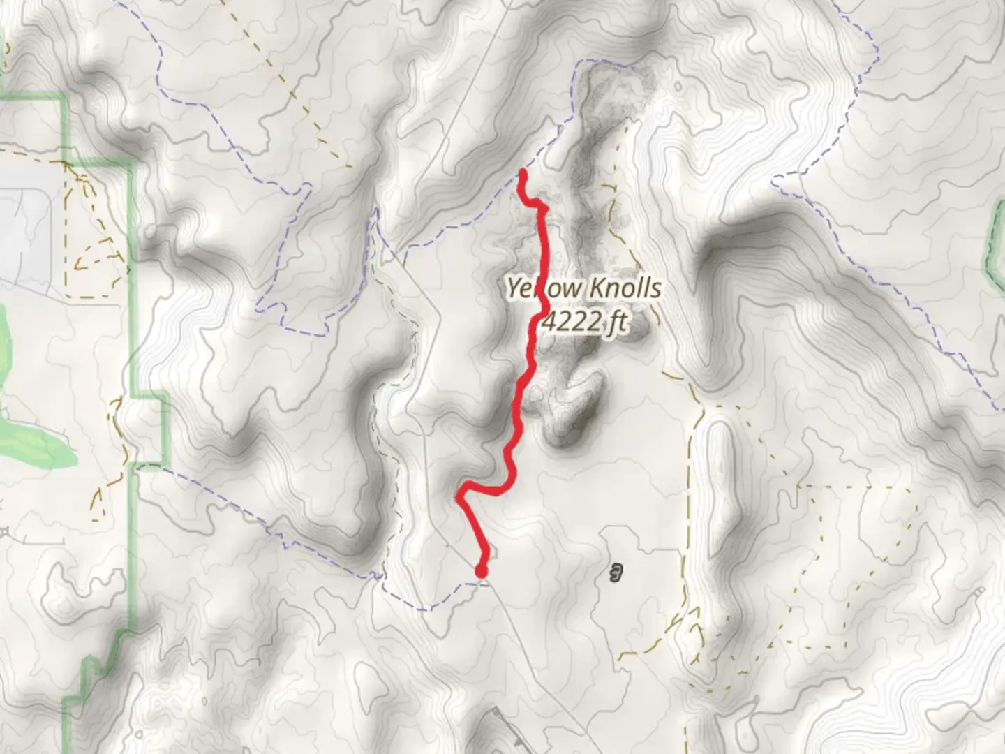
6.3 km
~1 hrs 32 min
171 m
Out and Back
“Embark on the Yellow Knolls Trail for a 6 km journey through stunning desert landscapes and historical landmarks.”
Starting near Washington County, Utah, the Yellow Knolls Trail offers a captivating 6 km (approximately 3.7 miles) out-and-back journey with an elevation gain of around 100 meters (328 feet). This medium-difficulty trail is perfect for hikers looking to explore the unique landscapes of the region.
Getting There
To reach the trailhead, you can drive or use public transport. If driving, head towards the Red Cliffs Desert Reserve, located near the town of Washington. The nearest significant landmark is the Red Cliffs Recreation Area. From there, follow the signs to the Yellow Knolls Trailhead. For those using public transport, the nearest bus stop is in Washington, Utah. From the bus stop, you may need to arrange a taxi or rideshare service to cover the remaining distance to the trailhead.
Trail Overview
The trail begins with a gentle ascent, allowing hikers to gradually acclimate to the terrain. The first kilometer (0.6 miles) is relatively easy, with a well-marked path that meanders through a mix of desert scrub and juniper trees. Keep an eye out for the vibrant wildflowers that bloom in the spring, adding splashes of color to the arid landscape.
Significant Landmarks and Nature
As you progress, you'll encounter the first significant landmark at around 2 km (1.2 miles) in: the Yellow Knolls themselves. These striking rock formations are composed of Navajo sandstone, which has been sculpted by wind and water over millions of years. The knolls are a brilliant yellow hue, especially striking in the early morning or late afternoon light.
Continuing on, the trail becomes slightly steeper, gaining most of its elevation in the next 1.5 km (0.9 miles). This section offers panoramic views of the surrounding desert and distant mountain ranges. Be sure to bring a camera, as the vistas are truly breathtaking.
Wildlife and Flora
The area is home to a variety of wildlife, including desert tortoises, lizards, and a range of bird species such as hawks and falcons. If you're lucky, you might even spot a mule deer or two. The flora is equally diverse, with sagebrush, yucca, and various cacti dotting the landscape.
Historical Significance
The region around the Yellow Knolls Trail has a rich history. It was once inhabited by the Ancestral Puebloans, and you may notice remnants of their presence in the form of pottery shards or petroglyphs. Please remember to leave these artifacts undisturbed, as they are protected by law.
Navigation and Safety
For navigation, it's highly recommended to use the HiiKER app, which provides detailed maps and real-time updates. The trail is well-marked, but having a reliable navigation tool can enhance your hiking experience and ensure you stay on track.
Final Stretch
The final stretch of the trail leads you to a scenic overlook, offering a perfect spot to rest and take in the views before heading back. The return journey retraces your steps, allowing you to enjoy the landscape from a different perspective.
Remember to carry plenty of water, wear sun protection, and check the weather forecast before setting out. The desert environment can be harsh, and it's essential to be well-prepared.

What to expect?
Activity types
Comments and Reviews
User comments, reviews and discussions about the Yellow Knolls Trail, Utah.
4.52
average rating out of 5
21 rating(s)