Download
Preview
Add to list
More
14.7 km
~4 hrs 29 min
937 m
Loop
“Embark on a 15 km scenic loop, exploring lush forests, meadows, and stunning ridge line views.”
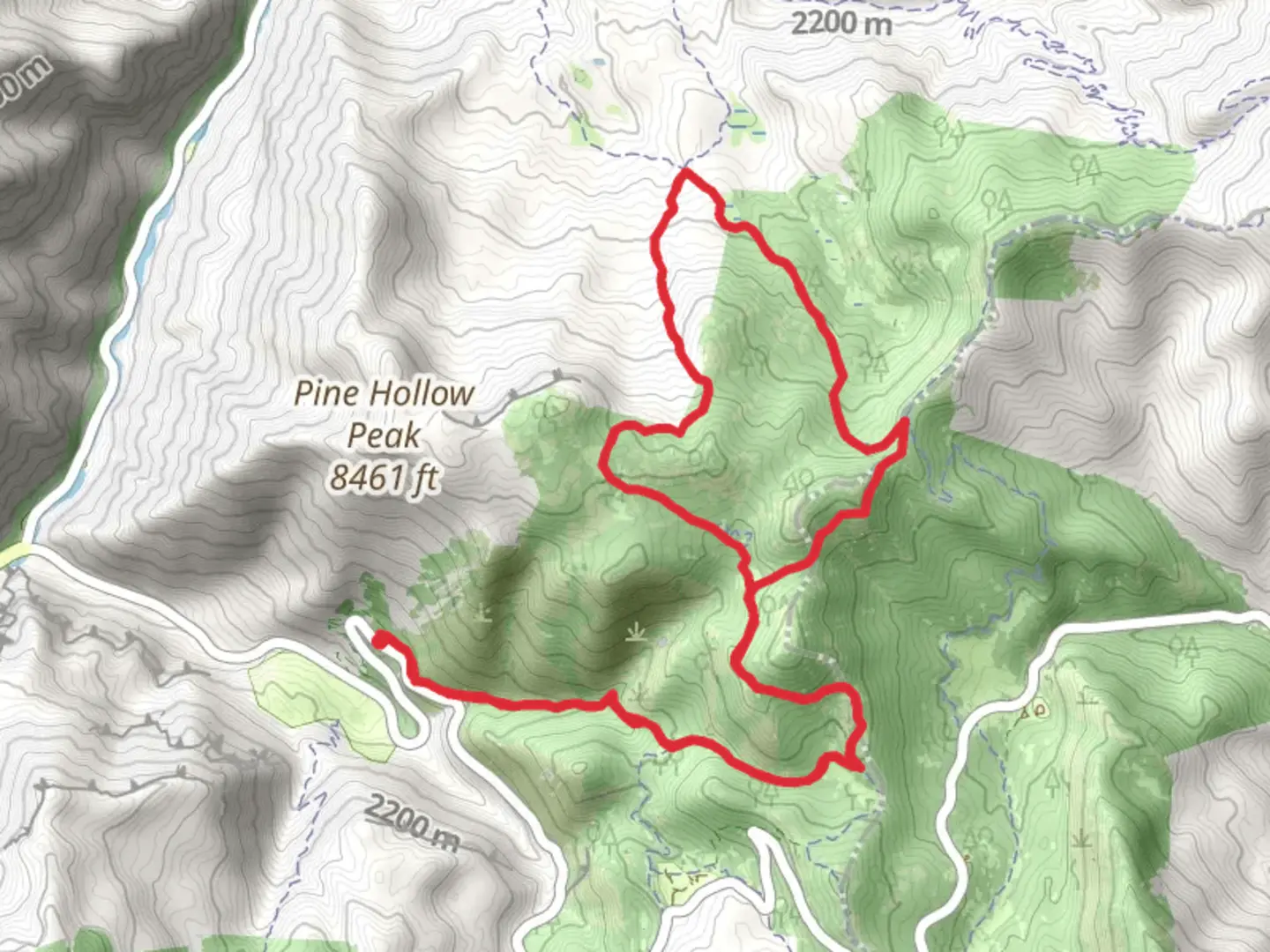
Starting near Utah County, Utah, the Mud Springs Trail and Tibble Fork Trail form a scenic loop of approximately 15 km (9.3 miles) with an elevation gain of around 900 meters (2,950 feet). This medium-difficulty trail offers a diverse range of landscapes, from lush forests to open meadows, and provides hikers with a rewarding experience.### Getting There To reach the trailhead, you can drive or use public transportation. If driving, head towards American Fork Canyon, accessible via UT-92. The nearest significant landmark is Tibble Fork Reservoir, where you can find parking. For those using public transport, the closest bus stop is in American Fork, from where you can take a taxi or rideshare service to the trailhead.### Trail Overview The loop begins near Tibble Fork Reservoir, a popular spot for fishing and picnicking. From here, the trail ascends gradually through dense forests of aspen and pine. After about 2 km (1.2 miles), you will reach the first significant elevation gain, climbing approximately 300 meters (985 feet) over the next 3 km (1.9 miles).### Key Landmarks and Sections
Mud Springs
At around the 5 km (3.1 miles) mark, you will encounter Mud Springs, a small but picturesque spring surrounded by lush vegetation. This is a great spot to take a break and enjoy the natural beauty.#### Ridge Line Views Continuing from Mud Springs, the trail ascends another 200 meters (656 feet) over the next 2 km (1.2 miles) to reach a ridge line. Here, you will be rewarded with panoramic views of the surrounding mountains and valleys. On clear days, you can see as far as Mount Timpanogos.#### Wildlife and Flora The trail is home to a variety of wildlife, including deer, elk, and occasionally black bears. Birdwatchers will also find a plethora of species, from hawks to songbirds. The flora is equally diverse, with wildflowers blooming in the spring and summer months.### Historical Significance The area around American Fork Canyon has a rich history, dating back to the Native American tribes who originally inhabited the region. In the late 19th century, the canyon was a hub for mining activities, and remnants of old mining equipment can still be found along the trail.### Navigation and Safety Given the trail's moderate difficulty, it's advisable to use a reliable navigation tool like HiiKER to keep track of your progress and ensure you stay on the correct path. The trail is well-marked, but weather conditions can change rapidly, so be prepared for sudden shifts.### Final Descent The final section of the trail descends back towards Tibble Fork Reservoir, covering approximately 5 km (3.1 miles) with a descent of around 400 meters (1,312 feet). This part of the trail is less strenuous and offers a relaxing end to your hike.By the time you complete the loop, you will have experienced a diverse range of Utah's natural beauty, from dense forests to open meadows and panoramic ridge line views.

What to expect?
Activity types
Comments and Reviews
User comments, reviews and discussions about the Mud Springs Trail and Tibble Fork Trail, Utah.
4.25
average rating out of 5
16 rating(s)