Download
Preview
Add to list
More
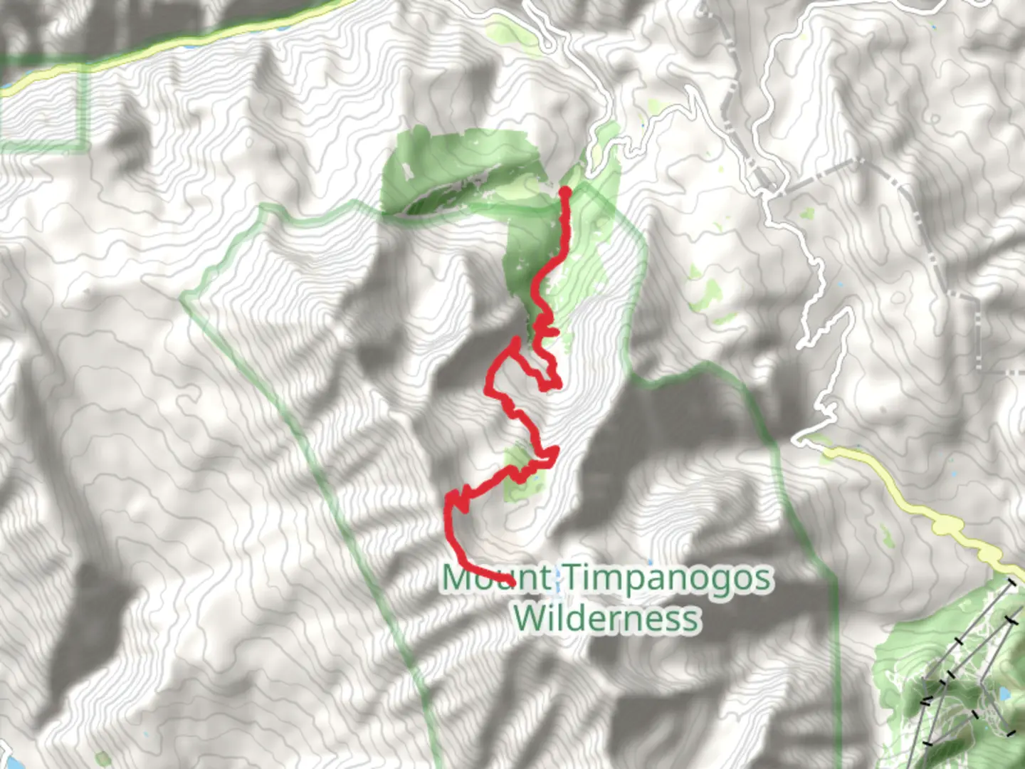
22.9 km
~7 hrs 23 min
1691 m
Out and Back
“Embark on the Timpooneke Trail for a rewarding, moderately challenging hike to Mount Timpanogos' stunning summit.”
Starting your adventure near Utah County, Utah, the Timpooneke Trailhead is your gateway to the Mount Timpanogos hike. This trail spans approximately 23 kilometers (14.3 miles) round trip, with an elevation gain of around 1,600 meters (5,249 feet). The trail is classified as medium difficulty, making it accessible for moderately experienced hikers.
Getting There
To reach the Timpooneke Trailhead, you can drive or use public transport. If driving, head towards the Alpine Loop Scenic Byway, which is accessible from both Provo Canyon and American Fork Canyon. The nearest significant landmark is the Timpooneke Campground, where you can find parking. For those using public transport, the nearest bus stop is in American Fork, from where you can arrange a taxi or rideshare to the trailhead.
Trail Overview
The trail begins at an elevation of approximately 2,300 meters (7,546 feet) and ascends steadily through a series of switchbacks. Early on, you'll traverse through dense forests of aspen and pine, offering shade and a cool environment. At around 3 kilometers (1.9 miles) in, you'll reach Scout Falls, a picturesque waterfall that serves as a great spot for a short break.
Mid-Trail Landmarks
As you continue, the trail opens up into alpine meadows filled with wildflowers during the summer months. Around the 7-kilometer (4.3-mile) mark, you'll encounter the Timpanogos Basin, a broad, open area that provides stunning views of the surrounding peaks. This is also a good spot to watch for wildlife, including mountain goats and marmots.
Summit Push
The final push to the summit is the most challenging part of the hike. The trail becomes steeper and rockier as you approach the saddle, located at approximately 10 kilometers (6.2 miles) from the trailhead. From the saddle, it's another 1.5 kilometers (0.9 miles) to the summit, with an elevation gain of about 300 meters (984 feet). The summit, standing at 3,582 meters (11,752 feet), offers panoramic views of Utah Valley, the Great Salt Lake, and the Wasatch Range.
Historical Significance
Mount Timpanogos holds cultural and historical significance for the local Native American tribes, particularly the Ute people. The name "Timpanogos" is derived from the Timpanogots tribe, meaning "rock" and "canyon." The area was also explored by early Mormon settlers in the 19th century, adding layers of historical context to your hike.
Navigation and Safety
Given the trail's length and elevation gain, it's crucial to be well-prepared. Use HiiKER for accurate trail maps and real-time updates. Weather can change rapidly, so pack layers and be prepared for sudden temperature drops, especially near the summit. Carry plenty of water, snacks, and a first-aid kit.
Flora and Fauna
The trail is rich in biodiversity. In the lower sections, you'll find a variety of wildflowers, including columbine and Indian paintbrush. As you ascend, the flora transitions to hardy alpine species. Wildlife is abundant; keep an eye out for deer, elk, and a variety of bird species.
Final Stretch
After enjoying the summit, retrace your steps back to the Timpooneke Trailhead. The descent offers a different perspective and is a great opportunity to take in any sights you may have missed on the way up.
This trail offers a rewarding experience with its diverse landscapes, rich history, and stunning vistas, making it a must-do for any hiking enthusiast.

What to expect?
Activity types
Comments and Reviews
User comments, reviews and discussions about the Mount Timpanogos via Timpooneke Trail, Utah.
4.44
average rating out of 5
16 rating(s)