Download
Preview
Add to list
More
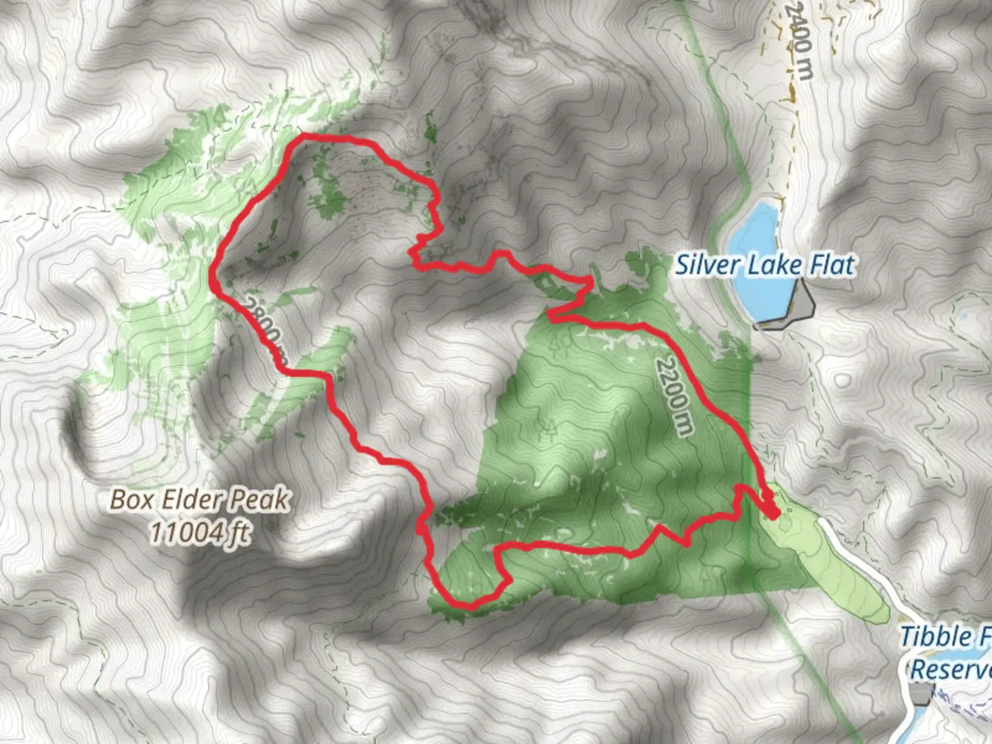
12.6 km
~4 hrs 30 min
1185 m
Loop
“Embark on the Box Elder and White Canyon Loop for a challenging, scenic 13 km hike with rich history.”
Starting your adventure near Utah County, Utah, the Box Elder Trail and White Canyon Loop Trail offers a challenging yet rewarding experience. This 13 km (approximately 8 miles) loop trail features an elevation gain of around 1100 meters (3600 feet), making it a medium difficulty hike suitable for those with a moderate level of fitness.
Getting There
To reach the trailhead, you can drive or use public transportation. If driving, head towards the Box Elder Peak Trailhead, located near the Alpine Loop Scenic Byway. For those using public transport, the nearest significant landmark is the Timpanogos Cave National Monument Visitor Center. From there, you may need to arrange a taxi or rideshare service to the trailhead.
Trail Overview
The trail begins with a steady ascent through a dense forest of aspen and pine trees. Early on, you'll encounter a series of switchbacks that help you gain elevation quickly. After about 2 km (1.2 miles), you'll reach a clearing that offers your first panoramic views of the surrounding Wasatch Range. This is a great spot to take a short break and hydrate.
Significant Landmarks and Nature
As you continue, the trail becomes steeper and rockier. Around the 4 km (2.5 miles) mark, you'll come across a small alpine meadow, often filled with wildflowers during the summer months. Keep an eye out for local wildlife such as mule deer, elk, and various bird species.
Historical Significance
The region has a rich history, with Native American tribes such as the Ute and Shoshone having inhabited the area for centuries. The trail itself was used by early settlers and miners in the 19th century, adding a layer of historical intrigue to your hike.
White Canyon Section
At approximately 6 km (3.7 miles), you'll reach the highest point of the trail, offering breathtaking views of Box Elder Peak and the surrounding canyons. From here, the trail descends into White Canyon. This section is less forested and more exposed, so be prepared for varying weather conditions. The descent can be steep and slippery, especially after rain, so good hiking boots are essential.
Navigation and Safety
Given the elevation changes and varying terrain, it's crucial to have a reliable navigation tool. The HiiKER app is highly recommended for real-time trail maps and updates. Make sure to download the trail map before you start, as cell service can be spotty in the canyon areas.
Final Stretch
The last 3 km (1.8 miles) of the trail take you through a series of gentle slopes and forested areas, eventually looping back to the trailhead. This section is relatively easier, allowing you to cool down and enjoy the serene environment.
Preparation Tips
- Water: Carry at least 2-3 liters of water, as there are no reliable water sources along the trail.
- Clothing: Layered clothing is advisable due to the significant elevation gain and potential weather changes.
- Footwear: Sturdy hiking boots with good ankle support are essential.
- Timing: Start early to avoid the midday heat and to give yourself ample time to complete the loop.
By following these guidelines and being well-prepared, you'll be able to fully enjoy the natural beauty and historical richness of the Box Elder Trail and White Canyon Loop Trail.

What to expect?
Activity types
Comments and Reviews
User comments, reviews and discussions about the Box Elder Trail and White canyon Loop Trail, Utah.
4.42
average rating out of 5
19 rating(s)