Download
Preview
Add to list
More
15.6 km
~6 hrs 1 min
1749 m
Out and Back
“Embark on the Big Horn Peak via Second Hamongog Trail for a challenging, scenic, and historically rich adventure.”
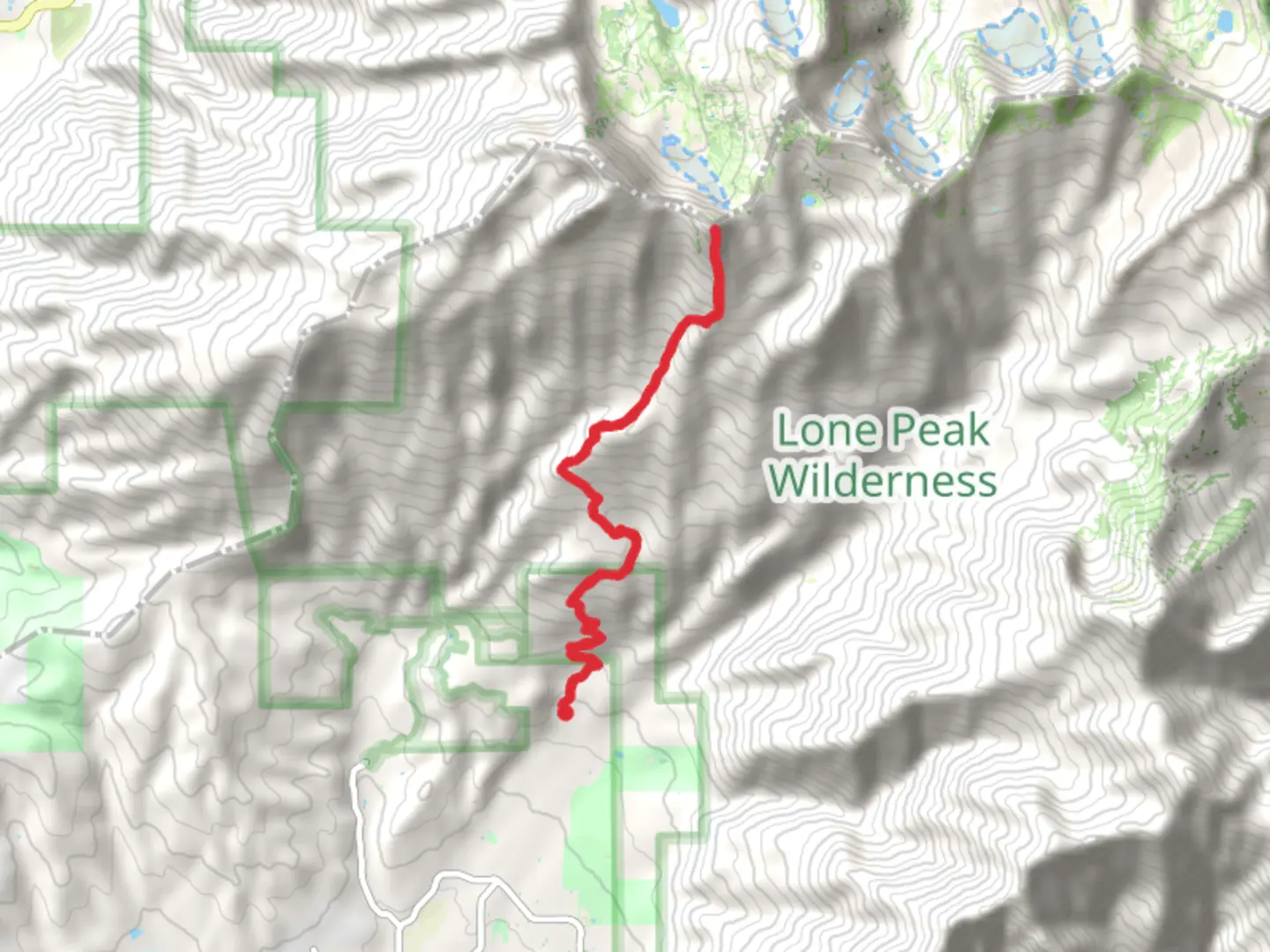
Starting your adventure near Utah County, Utah, the Big Horn Peak via Second Hamongog Trail is a challenging yet rewarding out-and-back hike. The trail spans approximately 16 kilometers (10 miles) with an elevation gain of around 1700 meters (5577 feet), making it a medium difficulty hike suitable for those with some experience.
Getting There
To reach the trailhead, you can drive or use public transport. If driving, head towards the town of Alpine, Utah. The nearest significant landmark is the Alpine City Park, located at 100 S 600 E, Alpine, UT 84004. From there, follow Grove Drive eastward until you reach the trailhead parking area. For those using public transport, the Utah Transit Authority (UTA) offers bus services to Alpine, but you may need to arrange for a taxi or rideshare for the final leg to the trailhead.
Trail Overview
The trail begins with a gentle ascent through a lush forested area, providing ample shade and a serene atmosphere. As you progress, the trail becomes steeper and more rugged, so be prepared for a strenuous climb. The first significant landmark you'll encounter is the First Hamongog, a beautiful meadow located about 3 kilometers (1.9 miles) from the trailhead. This is a great spot to take a short break and enjoy the surrounding wildflowers and the sound of a nearby creek.
Second Hamongog
Continuing onward, you'll reach the Second Hamongog at approximately 5 kilometers (3.1 miles) into the hike. This area is another expansive meadow, offering stunning views of the surrounding peaks and valleys. The elevation gain to this point is around 600 meters (1968 feet), so it's a good place to rest and refuel before tackling the more challenging sections ahead.
Ascending to Big Horn Peak
From the Second Hamongog, the trail becomes steeper and rockier as you make your way towards Big Horn Peak. The final 3 kilometers (1.9 miles) to the summit involve a significant elevation gain of about 1100 meters (3609 feet). The trail can be difficult to follow in some sections, so it's advisable to use a reliable navigation tool like HiiKER to stay on track.
Summit Views and Wildlife
Reaching the summit of Big Horn Peak is a rewarding experience, offering panoramic views of the Wasatch Range and Utah Valley. On a clear day, you can see as far as the Great Salt Lake. Keep an eye out for local wildlife, including mule deer, mountain goats, and various bird species. The area is also known for its diverse plant life, including alpine wildflowers and ancient bristlecone pines.
Historical Significance
The region around Big Horn Peak has a rich history, with evidence of Native American habitation dating back thousands of years. The Ute and Shoshone tribes once roamed these mountains, and you may come across ancient petroglyphs and other artifacts along the way. The area was also explored by early Mormon settlers in the 19th century, who used the meadows for grazing livestock.
Descent
The descent follows the same path back to the trailhead. While descending, take care on the steep and rocky sections, especially if the trail is wet or icy. The return journey offers a different perspective on the landscape, allowing you to appreciate the beauty of the area from a new angle.
Preparation and Safety
Given the trail's length and elevation gain, it's essential to be well-prepared. Bring plenty of water, high-energy snacks, and appropriate clothing for changing weather conditions. A good pair of hiking boots with ankle support is highly recommended. Always check the weather forecast before setting out and let someone know your plans.
This hike offers a blend of natural beauty, challenging terrain, and historical intrigue, making it a must-do for any avid hiker visiting Utah County.

What to expect?
Activity types
Comments and Reviews
User comments, reviews and discussions about the Big Horn Peak via Second Hamongog Trail, Utah.
4.5
average rating out of 5
22 rating(s)