Download
Preview
Add to list
More
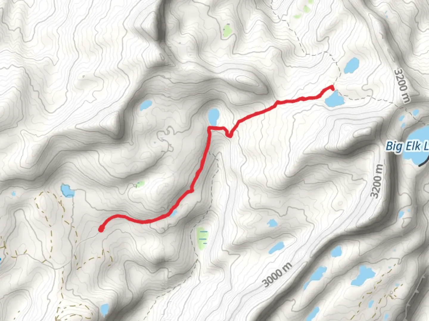
9.2 km
~2 hrs 25 min
349 m
Out and Back
“The Upper Setting Trail to South Erickson Lake offers 9 kilometers of scenic beauty, wildlife, and historical charm.”
Starting near Summit County, Utah, the Upper Setting Trail to South Erickson Lake is a captivating out-and-back hike that spans approximately 9 kilometers (5.6 miles) with an elevation gain of around 300 meters (984 feet). This medium-difficulty trail offers a blend of natural beauty, historical significance, and a moderate challenge suitable for most hikers.
Getting There
To reach the trailhead, you can drive or use public transportation. If driving, head towards the Mirror Lake Highway (UT-150) from Kamas, Utah. The trailhead is located near the Upper Setting Road, which is accessible from the highway. For those using public transport, the nearest significant landmark is the town of Kamas, where you can arrange for a taxi or rideshare service to take you to the trailhead.
Trail Overview
The trail begins with a gentle ascent through a dense forest of aspen and pine trees. Early in the hike, you'll encounter a serene meadow, often filled with wildflowers during the spring and summer months. This section is relatively flat, making it a good warm-up for the more challenging parts ahead.
Key Landmarks and Nature
Around 2 kilometers (1.2 miles) into the hike, you'll come across a small creek. This is a great spot to take a short break and enjoy the sound of flowing water. As you continue, the trail starts to climb more steeply, gaining elevation as you approach the halfway point.
At approximately 4 kilometers (2.5 miles), you'll reach a viewpoint that offers stunning vistas of the surrounding Uinta Mountains. This is one of the most picturesque spots on the trail, perfect for photography or simply soaking in the natural beauty.
Wildlife and Flora
The area is rich in wildlife, including deer, elk, and various bird species. Keep an eye out for the occasional moose, especially near water sources. The flora is equally diverse, with towering pines, vibrant aspens, and a variety of wildflowers depending on the season.
Historical Significance
The region has a rich history, with evidence of Native American presence dating back thousands of years. The Uinta Mountains were also explored by early trappers and settlers in the 19th century. While hiking, you might come across old mining remnants, a testament to the area's historical significance.
Final Stretch to South Erickson Lake
The final 1.5 kilometers (0.9 miles) involve a steeper climb, but the effort is well worth it. As you approach South Erickson Lake, the trail levels out, and you'll be greeted by the pristine waters of the lake, surrounded by rugged mountain peaks. This is an ideal spot for a picnic or a refreshing dip in the lake.
Navigation and Safety
For navigation, it's highly recommended to use the HiiKER app, which provides detailed maps and real-time updates. The trail is well-marked, but having a reliable navigation tool ensures you stay on track.
Return Journey
The return journey follows the same path, offering a different perspective on the landscape as you descend. Be mindful of your footing, especially on the steeper sections, and take your time to enjoy the natural beauty that surrounds you.
This hike offers a rewarding experience with its mix of natural beauty, wildlife, and historical significance. Whether you're a seasoned hiker or someone looking for a moderate challenge, the Upper Setting Trail to South Erickson Lake is a must-visit.

What to expect?
Activity types
Comments and Reviews
User comments, reviews and discussions about the Upper Setting Trail to South Erickson Lake, Utah.
4.27
average rating out of 5
11 rating(s)