Download
Preview
Add to list
More
4.1 km
~1 hrs 18 min
286 m
Out and Back
“The Pioneer Fork Road Walk blends natural beauty and historical intrigue for a rewarding 4-kilometer hike.”
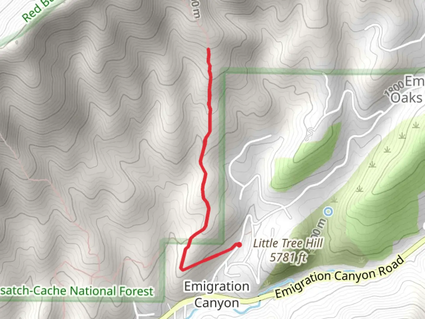
Starting near Salt Lake County, Utah, the Pioneer Fork Road Walk is an out-and-back trail that spans approximately 4 kilometers (2.5 miles) with an elevation gain of around 200 meters (656 feet). This medium-difficulty trail offers a blend of natural beauty and historical significance, making it a rewarding experience for hikers.
Getting There
To reach the trailhead, you can drive or use public transportation. If driving, head towards the nearest known address, which is the intersection of Mill Creek Canyon Road and Big Water Trailhead. From there, follow the signs to the trailhead parking area. For those using public transport, take a bus to the Mill Creek Canyon area and then a short taxi or rideshare to the trailhead.
Trail Overview
The trail begins with a gentle ascent through a mixed forest of aspen and pine trees. The initial section is relatively easy, allowing you to warm up before the steeper sections begin. As you progress, the trail becomes rockier and more challenging, requiring careful footing.
Landmarks and Points of Interest
At approximately 1 kilometer (0.6 miles) into the hike, you'll encounter a small, picturesque stream. This is a great spot to take a short break and enjoy the serene surroundings. Continuing on, the trail starts to climb more steeply, offering increasingly impressive views of the surrounding mountains and valleys.
Flora and Fauna
The area is rich in wildlife, including deer, elk, and various bird species. Keep an eye out for wildflowers such as columbine and Indian paintbrush, especially in the spring and early summer months. The dense forest provides ample shade, making it a pleasant hike even during warmer weather.
Historical Significance
The Pioneer Fork Road Walk is steeped in history. Originally used by early settlers and pioneers, the trail offers a glimpse into the past. Remnants of old cabins and mining equipment can still be seen along the route, providing a tangible connection to the area's rich heritage.
Navigation and Safety
Given the trail's moderate difficulty, it's advisable to use a reliable navigation tool like HiiKER to stay on track. The trail is well-marked, but having a digital map can be invaluable, especially in areas where the path becomes less distinct.
Final Stretch
As you approach the 2-kilometer (1.25-mile) mark, the trail levels out, leading to a scenic overlook. Here, you can take in panoramic views of the surrounding landscape, making the climb well worth the effort. After enjoying the vista, retrace your steps back to the trailhead.
This hike offers a balanced mix of natural beauty, wildlife, and historical intrigue, making it a must-do for anyone visiting the Salt Lake County area.

What to expect?
Activity types
Comments and Reviews
User comments, reviews and discussions about the Pioneer Fork Road Walk, Utah.
4.5
average rating out of 5
16 rating(s)