Download
Preview
Add to list
More
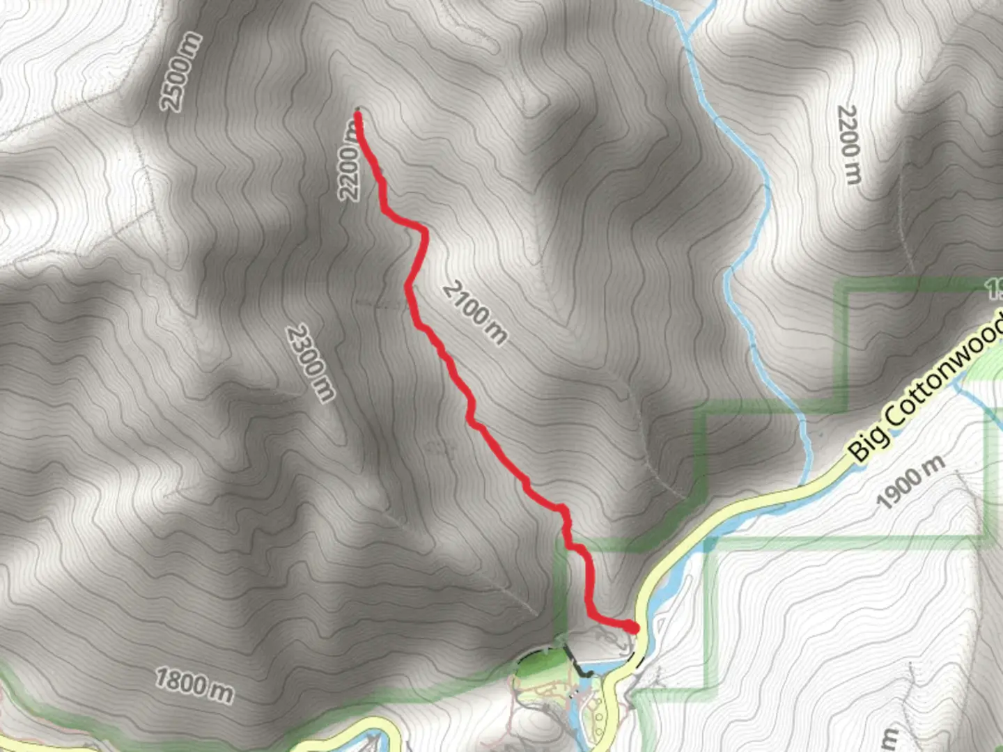
3.9 km
~1 hrs 28 min
418 m
Out and Back
“Experience the Mule Hollow trail's rich history, diverse wildlife, and stunning vistas in a rewarding 4-kilometer hike.”
Starting your hike near Salt Lake County, Utah, the Mule Hollow trail offers a rewarding out-and-back experience. The trailhead is conveniently located near the intersection of Big Cottonwood Canyon Road and Wasatch Boulevard, making it accessible by car. If you're using public transport, the UTA bus service has routes that stop near the base of Big Cottonwood Canyon, from where you can walk to the trailhead.
Trail Overview
The Mule Hollow trail stretches approximately 4 kilometers (2.5 miles) with an elevation gain of around 400 meters (1,312 feet). This medium-difficulty trail is perfect for those looking to challenge themselves without committing to a full-day hike. The trail is well-marked, but it's always a good idea to have a reliable navigation tool like HiiKER to ensure you stay on track.
Initial Ascent
The first section of the trail involves a steady climb through a mixed forest of aspen and pine. This initial ascent covers about 1.5 kilometers (0.9 miles) and gains roughly 150 meters (492 feet) in elevation. The forest canopy provides ample shade, making this part of the hike quite pleasant even on warmer days. Keep an eye out for mule deer and various bird species that inhabit this area.
Mid-Trail Features
As you continue, the trail opens up to a series of meadows around the 2-kilometer (1.2-mile) mark. These meadows are often dotted with wildflowers in the spring and early summer, offering a colorful and picturesque landscape. The elevation gain here is more gradual, adding another 100 meters (328 feet) over the next kilometer (0.6 miles). This section is a great spot to take a break and enjoy the surrounding views.
Historical Significance
The Mule Hollow area has a rich history tied to early settlers and mining activities in the region. Remnants of old mining equipment and cabins can still be found along the trail, particularly near the 3-kilometer (1.8-mile) point. These historical artifacts offer a glimpse into the past and add an educational element to your hike.
Final Stretch
The last kilometer (0.6 miles) of the trail involves a steeper climb, gaining the final 150 meters (492 feet) in elevation. This section can be a bit more challenging, but the effort is well worth it. As you reach the end of the trail, you'll be rewarded with panoramic views of the surrounding canyons and valleys. This is an excellent spot for photography and taking in the natural beauty of the area.
Wildlife and Flora
Throughout the hike, you'll encounter a variety of flora and fauna. The lower elevations are dominated by scrub oak and sagebrush, while higher elevations feature dense forests of pine and fir. Wildlife is abundant, with frequent sightings of mule deer, squirrels, and a variety of bird species. In the spring and summer, the trail is lined with wildflowers, adding vibrant colors to your journey.
Getting There
To reach the trailhead by car, take Big Cottonwood Canyon Road from Salt Lake City and turn onto Wasatch Boulevard. There is a small parking area near the trailhead, but it can fill up quickly, especially on weekends. If you're using public transport, the UTA bus service has routes that stop near the base of Big Cottonwood Canyon. From there, it's a short walk to the trailhead.
Preparation Tips
Given the elevation gain and varying terrain, it's advisable to wear sturdy hiking boots and bring plenty of water. The trail can be rocky in sections, so trekking poles might be helpful for added stability. Weather can change rapidly in this region, so pack layers and be prepared for sudden shifts in temperature.
Using HiiKER for navigation will ensure you stay on the correct path and can help you identify key landmarks along the way. Enjoy your hike and take the time to appreciate the natural and historical elements that make the Mule Hollow trail a unique and rewarding experience.

What to expect?
Activity types
Comments and Reviews
User comments, reviews and discussions about the Mule Hollow, Utah.
4.52
average rating out of 5
23 rating(s)