Download
Preview
Add to list
More
3.8 km
~1 hrs 18 min
333 m
Out and Back
“Mill B North Trail blends natural beauty, historical intrigue, and moderate challenge in Utah's stunning Wasatch Mountains.”
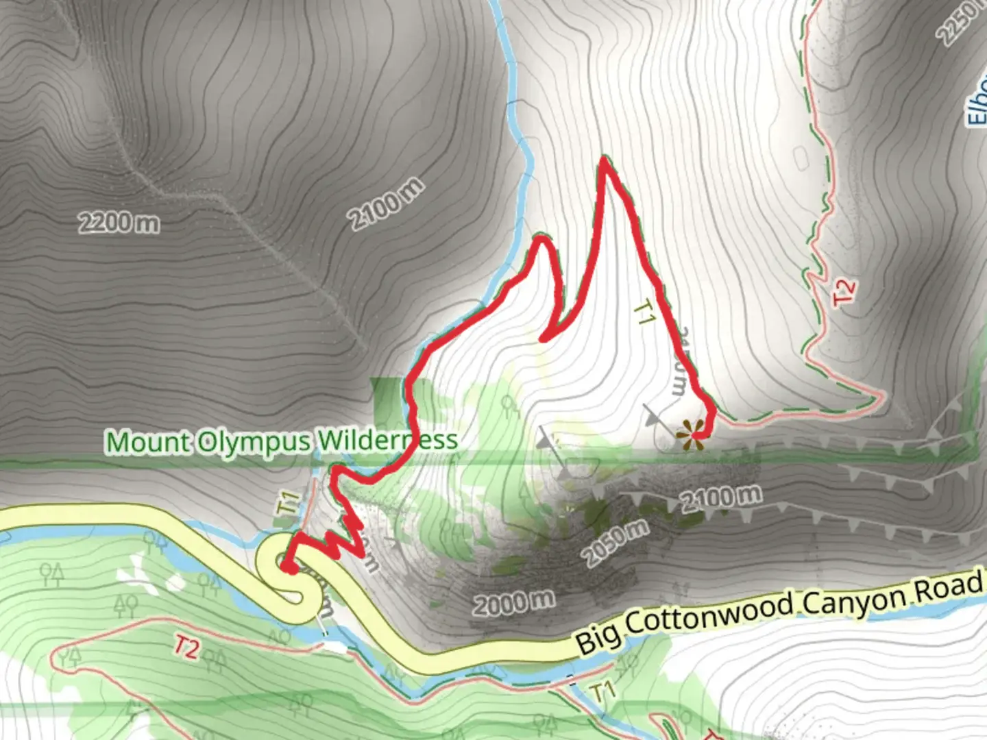
Starting near Salt Lake County, Utah, the Mill B North Trail is an invigorating out-and-back hike that spans approximately 4 kilometers (2.5 miles) with an elevation gain of around 300 meters (984 feet). This trail is rated as medium difficulty, making it suitable for moderately experienced hikers looking for a rewarding challenge.
Getting There
To reach the trailhead, you can drive or use public transportation. If you're driving, head towards Big Cottonwood Canyon Road (UT-190) and look for the Mill B North Fork Trailhead parking area, which is located near the S-Curve in the canyon. For those using public transport, the Utah Transit Authority (UTA) offers bus services that can drop you off near the canyon entrance, from where you can either hike or catch a ride to the trailhead.
Trail Overview
The trail begins with a steady incline, immediately immersing you in the natural beauty of the Wasatch Mountains. The initial section is shaded by a canopy of aspen and pine trees, providing a cool and refreshing start to your hike. As you ascend, you'll encounter a series of switchbacks that offer stunning views of the surrounding canyon and distant peaks.
Significant Landmarks and Nature
At approximately 1 kilometer (0.6 miles) into the hike, you'll come across a small waterfall, a perfect spot for a quick rest and some photos. The sound of cascading water adds a serene ambiance to your journey. Continuing on, the trail opens up to a more exposed area, offering panoramic views of the canyon below.
Around the 2-kilometer (1.2 miles) mark, you'll reach the trail's highest point, where the elevation gain is most noticeable. Here, the landscape transitions to a mix of rocky outcrops and alpine meadows. Keep an eye out for local wildlife such as mule deer, mountain goats, and various bird species that inhabit this region.
Historical Significance
The Mill B North Trail is steeped in history, as it was once a route used by early settlers and miners in the 19th century. The remnants of old mining operations can still be seen along the trail, offering a glimpse into the area's rich past. These historical markers serve as a reminder of the rugged determination of those who once traversed these mountains in search of fortune.
Navigation and Safety
Given the trail's moderate difficulty, it's advisable to use a reliable navigation tool like HiiKER to keep track of your progress and ensure you stay on the correct path. The trail is well-marked, but having a digital map can provide additional peace of mind.
Final Stretch
As you make your way back down, take the time to enjoy the changing perspectives and the natural beauty that surrounds you. The descent offers a different vantage point, allowing you to appreciate the trail from a new angle.
Whether you're a local or a visitor, the Mill B North Trail offers a perfect blend of natural beauty, historical intrigue, and moderate physical challenge. Make sure to bring plenty of water, wear sturdy hiking boots, and prepare for a memorable adventure in the heart of Utah's stunning landscape.

What to expect?
Activity types
Comments and Reviews
User comments, reviews and discussions about the Mill B North Trail, Utah.
4.47
average rating out of 5
19 rating(s)