Download
Preview
Add to list
More
23.4 km
~8 hrs 26 min
2257 m
Out and Back
“Embark on a challenging 23 km adventure with stunning views and rich history on the Lone Peak Trail.”
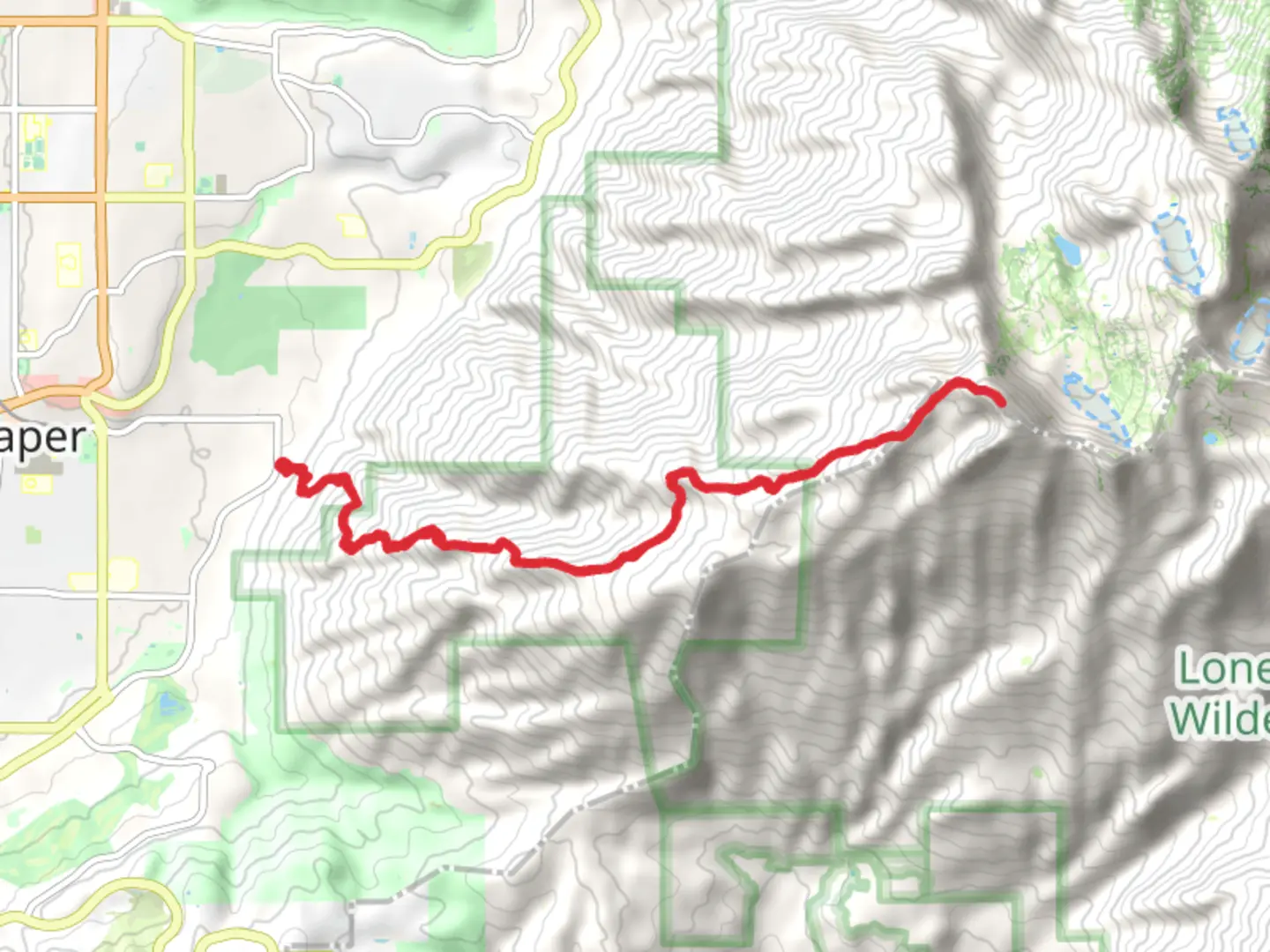
Starting near Salt Lake County, Utah, the Lone Peak via Cherry Canyon Logging Trail is an out-and-back trail that spans approximately 23 kilometers (14.3 miles) with an elevation gain of around 2200 meters (7218 feet). This trail is estimated to be of medium difficulty, making it suitable for experienced hikers looking for a challenging yet rewarding adventure.
Getting There
To reach the trailhead, you can drive or use public transportation. If driving, head towards the Orson Smith Trailhead Park located at 12601 S 2000 E, Draper, UT 84020. There is ample parking available. For those using public transport, take the UTA bus to the Draper Town Center Station, then use a rideshare service or taxi to reach the trailhead, which is about a 10-minute drive away.
Trail Overview
The trail begins with a steady ascent through Cherry Canyon, a lush area filled with diverse flora. Early on, you’ll encounter dense groves of Gambel oak and maple trees, providing ample shade. As you progress, the trail becomes steeper and rockier, transitioning into a more alpine environment.
Significant Landmarks
- Cherry Canyon Logging Road (2 km / 1.2 miles in): This old logging road is a significant marker. It’s wide and relatively flat, making it a good spot to catch your breath before the trail narrows and steepens.
- Jacob’s Ladder (5 km / 3.1 miles in): Named for its steep, switchback nature, this section is one of the most challenging parts of the hike. The elevation gain here is significant, so take your time and enjoy the panoramic views of the Salt Lake Valley.
- Enchanted Forest (8 km / 5 miles in): A beautiful, shaded area filled with towering pines and firs. This section is relatively flat and offers a respite from the strenuous climb.
Wildlife and Nature
The trail is home to a variety of wildlife, including mule deer, mountain goats, and occasionally black bears. Birdwatchers will enjoy spotting species like the American kestrel and the mountain bluebird. The flora changes with elevation, starting with oak and maple at lower elevations and transitioning to pine and fir as you climb higher.
Historical Significance
The Cherry Canyon Logging Trail has historical roots dating back to the late 19th century when it was used for logging. Remnants of old logging equipment and cabins can still be seen along the trail, offering a glimpse into the area’s past.
Final Ascent
The final push to Lone Peak is the most strenuous, with a steep, rocky scramble. The summit offers breathtaking 360-degree views of the Wasatch Range and the Salt Lake Valley. The elevation gain in this section is around 600 meters (1968 feet) over a short distance, so be prepared for a tough climb.
Navigation
Given the trail's complexity and varying terrain, it’s advisable to use a reliable navigation tool like HiiKER to ensure you stay on course. The app provides detailed maps and real-time updates, which are invaluable for a trail of this nature.
Return Journey
The return journey follows the same path back to the trailhead. While descending, take care on the steep sections, especially Jacob’s Ladder, as it can be slippery. The total round trip is approximately 23 kilometers (14.3 miles), so ensure you have enough water and snacks for the entire hike.
This trail offers a mix of natural beauty, challenging terrain, and historical intrigue, making it a must-do for avid hikers in the Salt Lake County area.

What to expect?
Activity types
Comments and Reviews
User comments, reviews and discussions about the Lone Peak via Cherry Canyon Logging Trail, Utah.
4.62
average rating out of 5
13 rating(s)