Download
Preview
Add to list
More
26.4 km
~7 hrs 2 min
1060 m
Point-to-Point
“Explore dramatic canyons and historic landmarks on the captivating 26 km Coyote Gulch Red Well Route.”
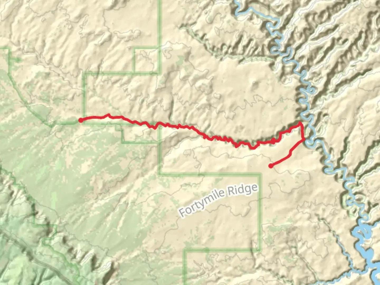
Starting near Kane County, Utah, the Coyote Gulch Red Well Route is a captivating 26 km (16 miles) point-to-point trail with an elevation gain of approximately 1000 meters (3280 feet). This trail is rated as medium difficulty, making it accessible for moderately experienced hikers.
Getting There
To reach the trailhead, you can drive to the Red Well Trailhead, located off Hole-in-the-Rock Road. If you're using public transport, the nearest significant town is Escalante, Utah. From Escalante, you can arrange a shuttle or taxi service to the trailhead, as public transport options are limited in this remote area.
Trail Overview
The trail begins at the Red Well Trailhead and meanders through the stunning landscapes of the Grand Staircase-Escalante National Monument. The initial section of the trail is relatively flat, allowing you to ease into the hike. As you progress, the trail descends into Coyote Gulch, where the scenery transforms into a dramatic canyon landscape.
Key Landmarks and Features
- Jacob Hamblin Arch: Approximately 8 km (5 miles) into the hike, you'll encounter the impressive Jacob Hamblin Arch. This natural sandstone arch is a popular spot for photography and a great place to take a break.
- Coyote Natural Bridge: Around 13 km (8 miles) from the start, you'll come across the Coyote Natural Bridge. This stunning formation is another highlight of the trail and offers a unique perspective on the geological forces at work in the region.
- Water Sources: The trail follows Coyote Creek for much of its length, providing ample opportunities to refill your water supply. However, it's essential to filter or purify the water before drinking.
Flora and Fauna
The trail is home to a diverse range of plant and animal life. You may encounter cottonwood trees, willows, and various desert shrubs along the way. Wildlife sightings can include mule deer, coyotes, and a variety of bird species. Keep an eye out for the elusive desert bighorn sheep, which are occasionally spotted in the area.
Historical Significance
The region holds significant historical importance, with evidence of Native American habitation dating back thousands of years. Petroglyphs and ancient dwellings can be found in the area, offering a glimpse into the lives of the Ancestral Puebloans who once called this place home.
Navigation and Safety
Given the remote nature of the trail, it's crucial to be well-prepared. Download the trail map from HiiKER before setting out, as cell service is unreliable in the area. Carry a GPS device or a compass as a backup. The trail is well-marked, but it's always wise to have multiple navigation tools at your disposal.
Elevation and Terrain
The trail features a mix of sandy washes, rocky terrain, and slickrock sections. The elevation gain is gradual but steady, with the most significant climbs occurring as you descend into and ascend out of the gulch. Proper footwear with good ankle support is recommended to navigate the varied terrain safely.
Weather Considerations
The best times to hike the Coyote Gulch Red Well Route are in the spring and fall when temperatures are moderate. Summer can be extremely hot, with temperatures often exceeding 38°C (100°F), while winter can bring cold temperatures and the possibility of snow. Always check the weather forecast before your hike and be prepared for sudden changes in conditions.
Permits and Regulations
A permit is required to hike in Coyote Gulch, which can be obtained from the Escalante Interagency Visitor Center. Make sure to follow Leave No Trace principles to preserve the natural beauty of the area for future generations.
This trail offers a unique blend of natural beauty, historical significance, and challenging terrain, making it a must-visit for any avid hiker.

What to expect?
Activity types
Comments and Reviews
User comments, reviews and discussions about the Coyote Gulch Red Well Route, Utah.
4.43
average rating out of 5
14 rating(s)