Download
Preview
Add to list
More
22.9 km
~5 hrs 31 min
568 m
Point-to-Point
“Embark on the Porcupine Rim Single Track for breathtaking vistas, diverse landscapes, and historical treasures.”
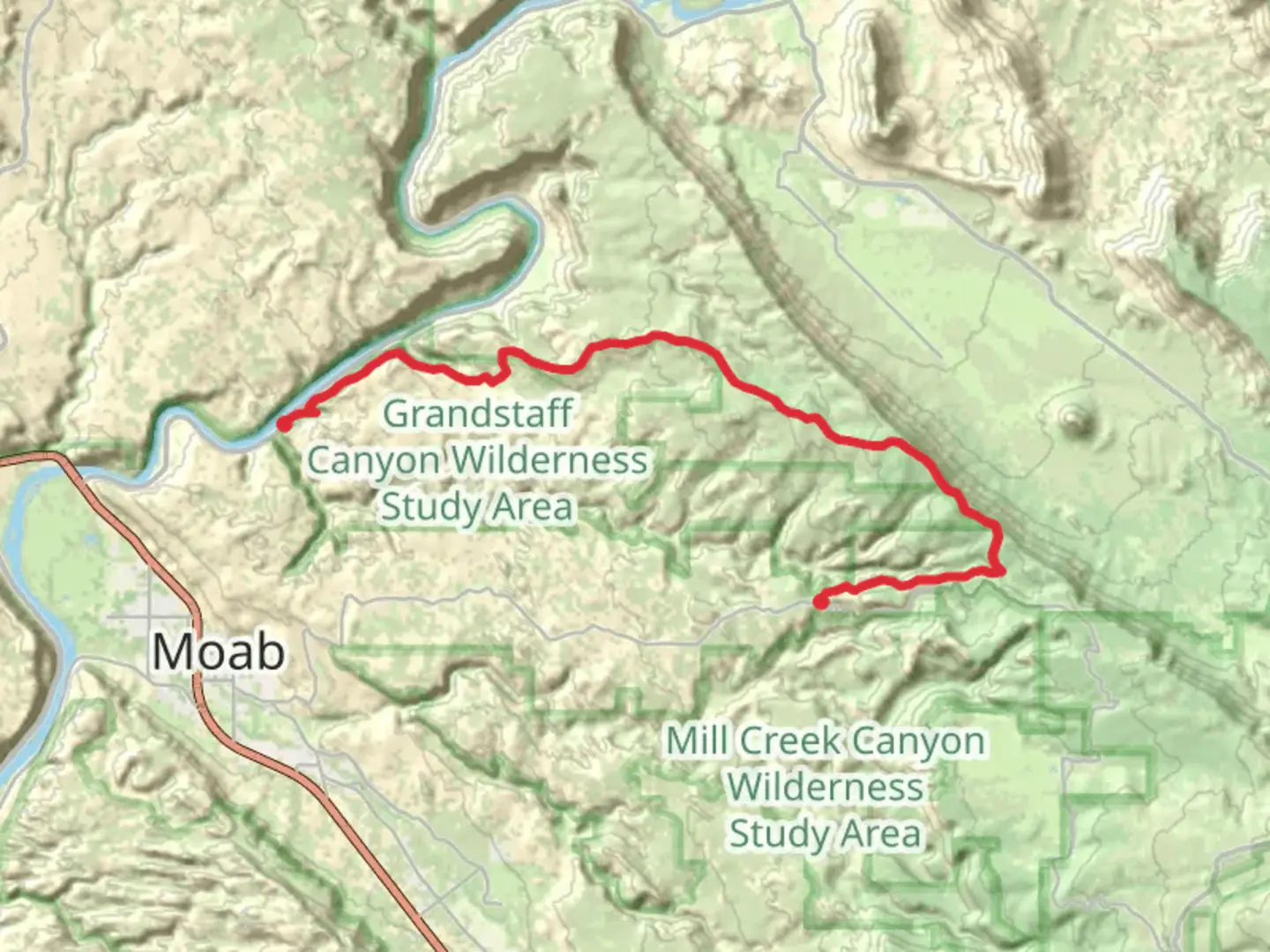
Starting near Grand County, Utah, the Porcupine Rim Single Track is a point-to-point trail that stretches approximately 23 kilometers (around 14.3 miles) with an elevation gain of about 500 meters (1,640 feet). This trail is rated as medium difficulty, making it suitable for moderately experienced hikers looking for a rewarding adventure.
Getting There
To reach the trailhead, you can drive or use public transportation. If you're driving, head towards the Sand Flats Recreation Area, which is the nearest significant landmark. From Moab, Utah, take Sand Flats Road east for about 10 miles (16 kilometers) until you reach the trailhead. For those using public transport, local shuttle services from Moab can drop you off at the Sand Flats Recreation Area.
Trail Overview
The Porcupine Rim Single Track offers a diverse range of landscapes, from rugged rock formations to expansive desert vistas. The trail begins with a steady climb, gaining approximately 300 meters (984 feet) in the first 5 kilometers (3.1 miles). This initial ascent provides panoramic views of the La Sal Mountains and the Colorado River, making it a perfect spot for photography.
Key Landmarks and Sections
Mile 3 (Kilometer 5): As you reach the top of the initial climb, you'll encounter the Porcupine Rim Overlook. This vantage point offers breathtaking views of Castle Valley and the surrounding canyons. It's a great place to take a break and soak in the scenery.
Mile 6 (Kilometer 10): The trail then descends into a series of technical sections with rocky terrain and narrow paths. This part of the trail requires careful navigation, so make sure to have the HiiKER app handy for accurate trail mapping.
Mile 9 (Kilometer 14.5): You'll pass through a lush area known as Jackass Canyon. This section is shaded and features a small creek, providing a refreshing change from the arid landscape. Keep an eye out for local wildlife, including mule deer and various bird species.
Historical Significance
The Porcupine Rim area has a rich history, with evidence of Native American habitation dating back thousands of years. Petroglyphs and ancient artifacts have been found in the region, offering a glimpse into the lives of the indigenous peoples who once roamed these lands. Additionally, the trail was used by early settlers and miners in the 19th century, adding another layer of historical significance.
Final Stretch
The last 5 kilometers (3.1 miles) of the trail are a mix of downhill and flat sections, leading you towards the Colorado River. This part of the trail is less technical but still offers stunning views of the river and surrounding cliffs. The trail ends near the Porcupine Rim Campground, where you can rest and reflect on your journey.
Wildlife and Flora
Throughout the hike, you'll encounter a variety of flora and fauna. The desert landscape is dotted with juniper and pinyon pine trees, as well as various cacti and wildflowers. Wildlife is abundant, with chances to see lizards, snakes, and even the occasional mountain lion.
Preparation Tips
Given the trail's medium difficulty, it's essential to come prepared. Bring plenty of water, as the desert environment can be dehydrating. Wear sturdy hiking boots to navigate the rocky terrain, and consider using trekking poles for added stability. Always check the weather forecast before heading out, as conditions can change rapidly in this region.
By following these guidelines and using the HiiKER app for navigation, you'll be well-prepared to tackle the Porcupine Rim Single Track and enjoy all the natural beauty and historical richness it has to offer.

What to expect?
Activity types
Comments and Reviews
User comments, reviews and discussions about the Porcupine Rim Single Track, Utah.
4.46
average rating out of 5
13 rating(s)