Download
Preview
Add to list
More
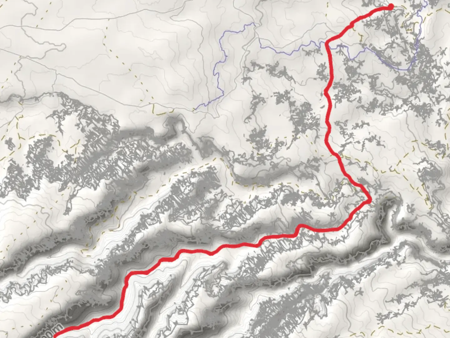
17.5 km
~4 hrs 9 min
389 m
Out and Back
“Explore the vibrant landscapes and ancient petroglyphs of the moderately challenging Dry Fork Bull Canyon Trail.”
Starting near Grand County, Utah, the Dry Fork Bull Canyon Trail is an 18 km (approximately 11.2 miles) out-and-back adventure with an elevation gain of around 300 meters (about 984 feet). This medium-difficulty trail offers a blend of natural beauty, historical significance, and a moderate challenge for hikers.
Getting There
To reach the trailhead, you can drive or use public transport. If driving, head towards Grand County, Utah, and look for signs directing you to the Dry Fork Bull Canyon area. The nearest significant landmark is the town of Moab, which is well-known for its outdoor activities and serves as a good base for your hike. From Moab, it's a short drive to the trailhead. Public transport options are limited, so renting a car or using a shuttle service from Moab is recommended.
Trail Overview
The trail begins with a gentle ascent, allowing you to ease into the hike. As you progress, the terrain becomes more varied, featuring rocky paths and sandy stretches. The initial 3 km (1.9 miles) are relatively easy, with an elevation gain of about 50 meters (164 feet), making it a good warm-up for the more challenging sections ahead.
Significant Landmarks and Nature
Around the 5 km (3.1 miles) mark, you'll encounter the first significant landmark: a series of ancient petroglyphs etched into the canyon walls. These petroglyphs offer a glimpse into the history of the indigenous peoples who once inhabited this region. Take a moment to appreciate these historical artifacts, but remember to respect and preserve them for future generations.
Continuing on, the trail meanders through a series of stunning red rock formations. The colors are particularly vibrant during sunrise and sunset, so plan your hike accordingly if you want to capture some breathtaking photos. At approximately 8 km (5 miles), you'll reach a natural arch, a perfect spot for a short break and some exploration.
Wildlife and Flora
The Dry Fork Bull Canyon area is home to a variety of wildlife. Keep an eye out for mule deer, coyotes, and a variety of bird species. The flora is equally diverse, with juniper trees, sagebrush, and various wildflowers dotting the landscape. Spring and early summer are the best times to see the wildflowers in full bloom.
Navigation and Safety
Given the trail's moderate difficulty, it's advisable to use a reliable navigation tool like HiiKER to keep track of your progress and ensure you stay on the right path. The trail is well-marked, but having a digital map can provide extra peace of mind.
Final Stretch
The final 3 km (1.9 miles) of the trail involve a steeper ascent, with an elevation gain of about 100 meters (328 feet). This section can be a bit challenging, especially if you're hiking during the hotter months. Make sure to carry plenty of water and take breaks as needed.
Upon reaching the end of the trail, you'll be rewarded with panoramic views of the surrounding canyonlands. It's a perfect spot to rest, take in the scenery, and perhaps enjoy a packed lunch before heading back the way you came.
Historical Significance
The Dry Fork Bull Canyon area is rich in history. The petroglyphs you encounter along the way are believed to be created by the Fremont people, who lived in the region over a thousand years ago. These ancient artworks provide valuable insights into the lives and cultures of the early inhabitants of this area.
Practical Tips
- Water: Carry at least 2-3 liters of water per person, especially during the hotter months.
- Footwear: Sturdy hiking boots are recommended due to the rocky and uneven terrain.
- Weather: Check the weather forecast before you go. The trail can be extremely hot in summer and may have snow in winter.
- Permits: No permits are required for this trail, but always check for any updates or changes in regulations.
By following these guidelines and being well-prepared, you'll have a rewarding and memorable experience on the Dry Fork Bull Canyon Trail.

What to expect?
Activity types
Comments and Reviews
User comments, reviews and discussions about the Dry Fork Bull Canyon Trail, Utah.
4.5
average rating out of 5
14 rating(s)