Download
Preview
Add to list
More
4.5 km
~1 hrs 5 min
123 m
Loop
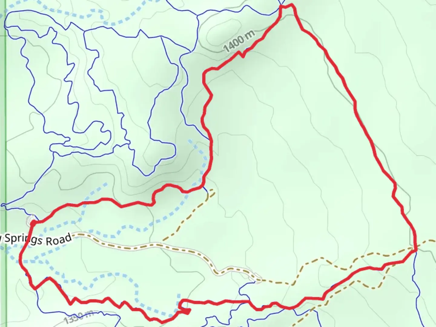
“Explore the scenic, historical, and moderately challenging Borderline, Zoltar, and Hotdog Loop in Grand County, Utah.”
Starting near Grand County, Utah, the Borderline, Zoltar, and Hotdog Loop is a captivating 4 km (2.5 miles) loop trail with an elevation gain of approximately 100 meters (328 feet). This medium-difficulty trail offers a blend of scenic beauty, geological wonders, and a touch of history, making it a must-visit for hikers of all levels.
Getting There
To reach the trailhead, you can drive or use public transport. If driving, head towards Grand County, Utah, and look for parking near the nearest known landmark, the Grand County Public Library. From there, it's a short drive to the trailhead. For those using public transport, the nearest bus stop is at the Grand County Public Library, from where you can either walk or take a short taxi ride to the trailhead.
Trail Navigation
For navigation, it's highly recommended to use HiiKER, which provides detailed maps and real-time updates to ensure you stay on track.
Trail Highlights
As you embark on the trail, you'll first encounter the Borderline section, which is relatively flat and easy-going. This part of the trail is perfect for warming up and getting a feel for the terrain. The path is well-marked and surrounded by native flora, including sagebrush and juniper trees.
Zoltar Section
Approximately 1.5 km (0.9 miles) into the hike, you'll transition into the Zoltar section. This part of the trail starts to ascend gradually, offering panoramic views of the surrounding landscape. Keep an eye out for unique rock formations that are characteristic of the Utah desert. The elevation gain here is about 50 meters (164 feet), making it a bit more challenging but still manageable for most hikers.
Hotdog Loop
The final section, known as the Hotdog Loop, is where the trail reaches its highest point. The elevation gain here is another 50 meters (164 feet), bringing the total to around 100 meters (328 feet). This part of the trail is more rugged, with some rocky patches that require careful footing. The effort is well worth it, as you'll be rewarded with stunning views of the Grand County landscape. Look out for local wildlife such as lizards, hawks, and occasionally, mule deer.
Historical Significance
The region around Grand County has a rich history, with evidence of Native American habitation dating back thousands of years. Petroglyphs and ancient artifacts have been found in the area, adding a layer of historical intrigue to your hike. The trail itself passes near some of these historical sites, so take a moment to appreciate the ancient cultures that once thrived here.
Final Stretch
As you complete the loop and head back towards the trailhead, the path descends gently, allowing you to cool down and reflect on the diverse landscapes and historical richness you've just experienced. The entire loop takes about 1.5 to 2 hours to complete, depending on your pace and how often you stop to take in the views.
Preparation Tips
- Wear sturdy hiking boots, as the trail can be rocky in sections.
- Bring plenty of water, especially during the hotter months.
- Use HiiKER for navigation to ensure you stay on the correct path.
- Be mindful of the local wildlife and maintain a respectful distance.
This trail offers a perfect blend of natural beauty, moderate challenge, and historical significance, making it an enriching experience for any hiker.

What to expect?
Activity types
Comments and Reviews
User comments, reviews and discussions about the Borderline, Zoltar and Hotdog Loop, Utah.
4.55
average rating out of 5
11 rating(s)