Download
Preview
Add to list
More
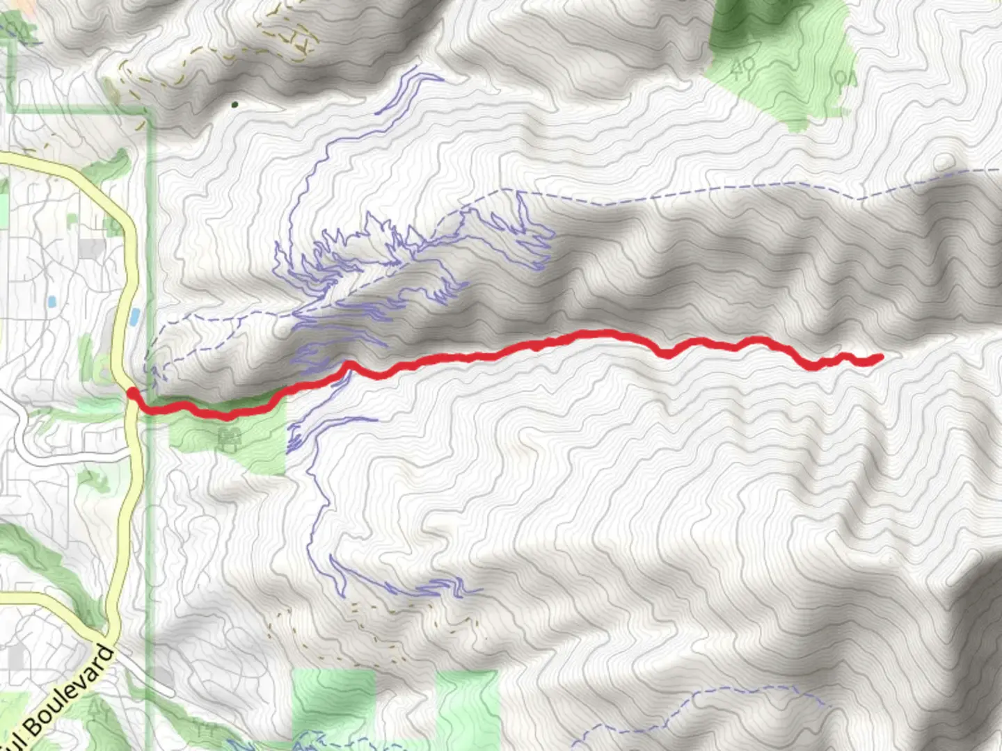
10.0 km
~3 hrs 9 min
693 m
Out and Back
“Holbrook Canyon Trail offers a scenic, moderately challenging hike with rich history and stunning views.”
Starting near Davis County, Utah, the Holbrook Canyon Trail is an invigorating out-and-back hike that spans approximately 10 kilometers (6.2 miles) with an elevation gain of around 600 meters (1,968 feet). This trail is rated as medium difficulty, making it suitable for moderately experienced hikers.
Getting There
To reach the trailhead, you can drive or use public transportation. If you're driving, head towards Bountiful, Utah, and look for the Holbrook Canyon Trailhead near the intersection of Canyon Creek Drive and Bountiful Boulevard. For those using public transport, the nearest major transit hub is the Bountiful Main Street Station. From there, you can take a local taxi or rideshare service to the trailhead.
Trail Overview
The trail begins with a gentle ascent through a shaded forest of oak and maple trees. As you progress, the path becomes steeper, offering a good workout for your legs. The first significant landmark you'll encounter is a small wooden bridge about 1.5 kilometers (0.9 miles) in, crossing a bubbling creek. This is a great spot to take a short break and enjoy the serene surroundings.
Flora and Fauna
Holbrook Canyon is rich in biodiversity. Keep an eye out for mule deer, wild turkeys, and various bird species such as the American kestrel and red-tailed hawk. The trail is particularly beautiful in the fall when the foliage turns vibrant shades of red, orange, and yellow.
Mid-Trail Highlights
Around the 3-kilometer (1.9-mile) mark, you'll come across a series of switchbacks that offer panoramic views of the canyon and the Great Salt Lake in the distance. This section is more exposed, so make sure to wear sunscreen and bring plenty of water.
Historical Significance
Holbrook Canyon has a rich history dating back to the early settlers of Utah. The area was once used for logging and grazing, and remnants of old cabins and logging equipment can still be found along the trail. These historical artifacts offer a glimpse into the rugged life of the pioneers who once inhabited this region.
Final Stretch
The last 2 kilometers (1.2 miles) of the trail are the most challenging, with a steep ascent leading to a scenic overlook. From this vantage point, you can see the entire canyon and even spot the distant peaks of the Wasatch Range. The elevation gain in this section is about 200 meters (656 feet), so take your time and enjoy the climb.
Navigation and Safety
For navigation, it's highly recommended to use the HiiKER app, which provides detailed maps and real-time updates. The trail is well-marked, but having a reliable navigation tool can help you stay on track and avoid any potential detours.
Return Journey
Once you've soaked in the views, retrace your steps back to the trailhead. The descent is much easier, but still requires caution, especially on the steeper sections.
This trail offers a perfect blend of natural beauty, moderate challenge, and historical intrigue, making it a rewarding experience for any hiker.

What to expect?
Activity types
Comments and Reviews
User comments, reviews and discussions about the Holbrook Canyon Trail, Utah.
4.42
average rating out of 5
19 rating(s)