Download
Preview
Add to list
More
13.1 km
~3 hrs 56 min
329 m
Loop
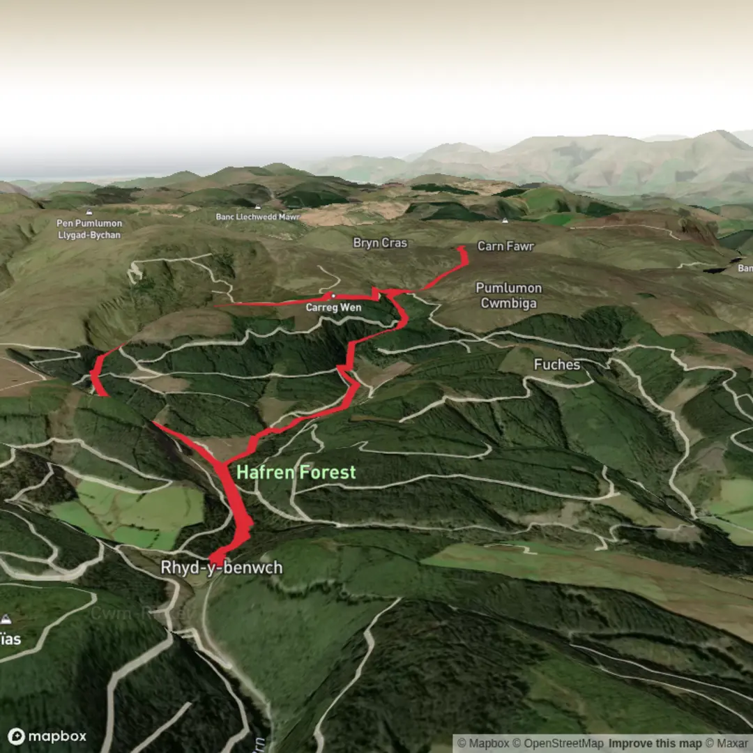
The first of the Upper Limits UK walking group routes in Mid Wales / Southern Snowdonia started with an 8 mile partial circular out of the #Harfen Forest, taking in the Source of the River Severn before topping out at the Boundary Stone at 618m.
Parking is free at Rhyd y Benwch and this area has good, clean toilet facilities too.
From here there are a few route options of varying length depending on your ability. All routes / paths are good, clearly marked and colour coded.
Our choice was to head up to the source of the Severn (white route) and possibly take in the Wye too. However, once out of the relative shelter of the forest, conditions deteriorated with low laying cloud, heavy drizzle and a biting breeze.
We took in the source of the Severn, which is marked with a large wooden post on slabbed rock. From here we moved on up to the two small llyns and the Boundry Stone at 618m.
With visibility restricted and the chance of any views lost, rather than handrailing the boundry fence across to the source of the Wye, we decided on a slightly shorter circular taking in the standing stone near Carreg Wen, then heading down to the disused 19th century mine at Nant yr Eira before meeting up with the main path back to the car park.
We had been really exposed to the conditions on the open ground after the standing stone so it was good to lose height and get some shelter from the trees on the last section. choosing the shorter route option also meant we had time to head over to Llyn Clywedog Reservoir, the main dam and the CADW managed Bryntail lead mine.


Comments and Reviews
User comments, reviews and discussions about the Hafron Forest & the Source of the Severn - Upper Limits UK, Wales.
average rating out of 5
0 rating(s)