Download
Preview
Add to list
More
12.5 km
~4 hrs 8 min
510 m
Loop
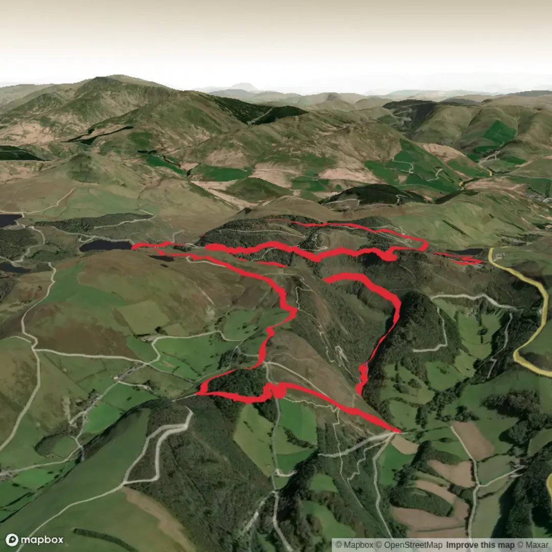
Todays route was a huge variation on a route we did last year around Bwlch Nant yr Arian. The Visitor Centre is currently closed (as is Coed y Brenin & Ynyslas) On a positive, the car park was free but port a loos replace the now closed toilet block - this was the same at Hafren Forest Yesterday.
Not sure what NRW are playing at, but they need to get a grip! From the car park we dropped down to take in the lake near the Kite Feeding area before climbing back up to meet the byway open to all traffic. Heading NE toward Esgair Gorlan then NW on a good track toward 387m.
Continue on a good footpath past the standing Stone to pick up the road around to Llyn Blaenmelindwr.then onto Llyn Rhosgoch.
We cam off the path just after this to head up onto the windy summit @370m. then rejoined the path off the back of this small peak which actually offered some fantastic views.
After crossing the road at SN701 822, because of storm damage you will need to do your best Tarzan interpretation as there are plenty of trees to swing off and round until picking up the road again. The footpath here has now been changed to a mountain bike trail so head left up the road and pick up a rough track SE to meet up with the main track that leads steeply down hill to the lowest section of the walk.
After Contouring around to Esgair Nantyrarian its of course back up from here! the upper sections of this path offer fantastic views down to the coast, as does the Borth to Devils Bridge Trail once you join it at SN717 830.
Now back up high and on a small wide ridge, the views off both sides are stunning. Here is todays route fly through: Bwlch Nant yr Arian Loop! https://www.relive.com/view/vDqg2MMg4G6


Comments and Reviews
User comments, reviews and discussions about the Bwlch Nant yr Arian Loop - Upper Limits UK, Wales.
average rating out of 5
0 rating(s)