Download
Preview
Add to list
More
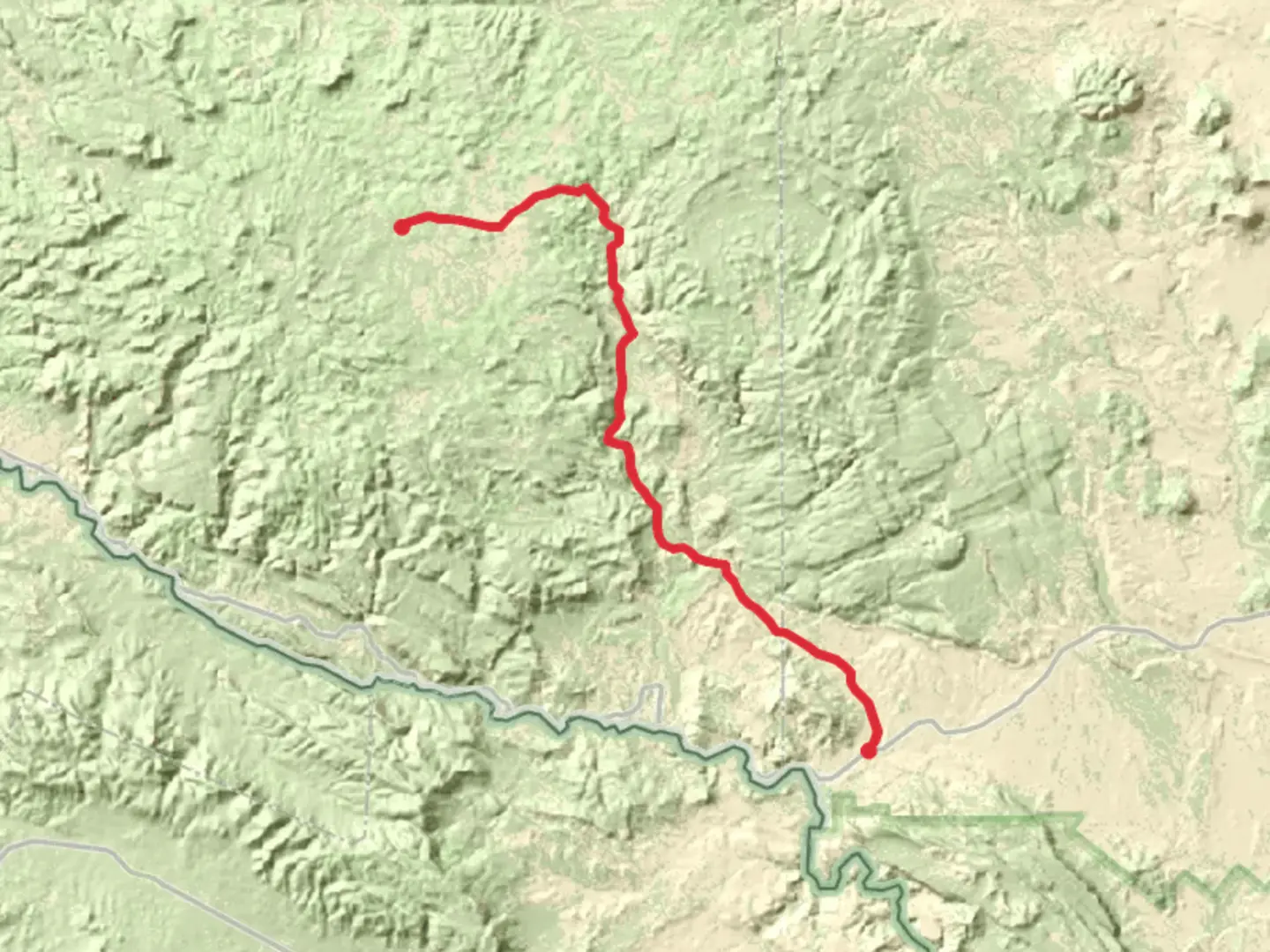
41.8 km
~1 day 4 hrs
912 m
Point-to-Point
“Explore Texas's Chihuahuan Desert with a challenging trek through stunning landscapes and historical sites.”
Nestled in the rugged terrain of Brewster County, Texas, the trail from Buena Suerte to Main Park Road offers an invigorating journey through the heart of the Chihuahuan Desert. Spanning approximately 42 kilometers (about 26 miles) with an elevation gain of around 900 meters (approximately 2,950 feet), this point-to-point trail is a medium-difficulty adventure that promises both challenge and reward.### Getting ThereTo reach the trailhead near Brewster County, travelers can opt for a scenic drive or utilize public transportation options. If driving, head towards the town of Terlingua, a gateway to the Big Bend region, and follow the signs to Buena Suerte. For those relying on public transport, the nearest major hub is Alpine, Texas, where you can catch a bus or arrange a shuttle service to Terlingua. From there, local transport services can take you to the trailhead.### Trail HighlightsAs you embark on this journey, the trail unfolds through a landscape rich in natural beauty and historical significance. The Chihuahuan Desert is renowned for its diverse flora and fauna, and hikers will encounter a variety of cacti, yucca, and desert wildflowers, especially vibrant in the spring months. Keep an eye out for wildlife such as roadrunners, jackrabbits, and the occasional javelina.### Historical SignificanceThe region is steeped in history, with remnants of early Native American settlements and artifacts occasionally visible along the trail. The area was once traversed by Spanish explorers and later by pioneers heading west. The trail itself offers a glimpse into the past, with old mining sites and ghost towns like Terlingua providing a haunting reminder of the area's boom-and-bust mining history.### Navigation and LandmarksNavigating the trail is straightforward, but it's advisable to use the HiiKER app for detailed maps and real-time updates. Significant landmarks include the striking vistas of the Chisos Mountains to the east and the expansive views of the desert plains. At approximately 21 kilometers (13 miles) in, you'll encounter a natural rock formation known locally as "The Sentinel," a perfect spot for a rest and photo opportunity.### Preparing for the HikeGiven the trail's medium difficulty, hikers should be prepared for a full day of trekking. The desert climate can be harsh, with temperatures soaring during the day and dropping at night, so pack plenty of water, sun protection, and layers for warmth. The trail is well-marked, but sections can be remote, so ensure you have a reliable navigation tool like HiiKER and inform someone of your plans before setting out.This trail offers a unique blend of natural beauty, historical intrigue, and physical challenge, making it a must-experience for those seeking adventure in the vast landscapes of Texas.

What to expect?
Activity types
Comments and Reviews
User comments, reviews and discussions about the Buena Suerte to Main Park Road, Texas.
average rating out of 5
0 rating(s)