Download
Preview
Add to list
More
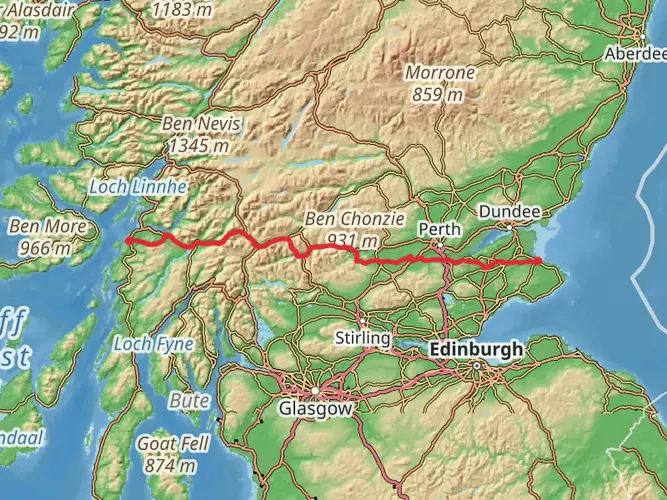
14.6 km
~4 hrs 10 min
749 m
Out and Back
“Embark on Sgiath Chùil's scenic 15-km highland hike, rich with history, wildlife, and breathtaking Scottish vistas.”
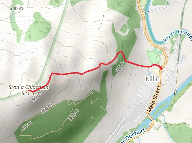
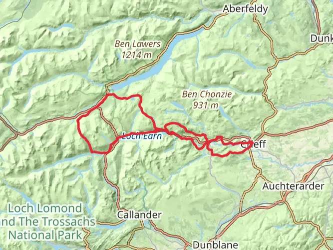
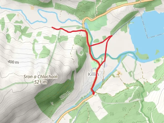
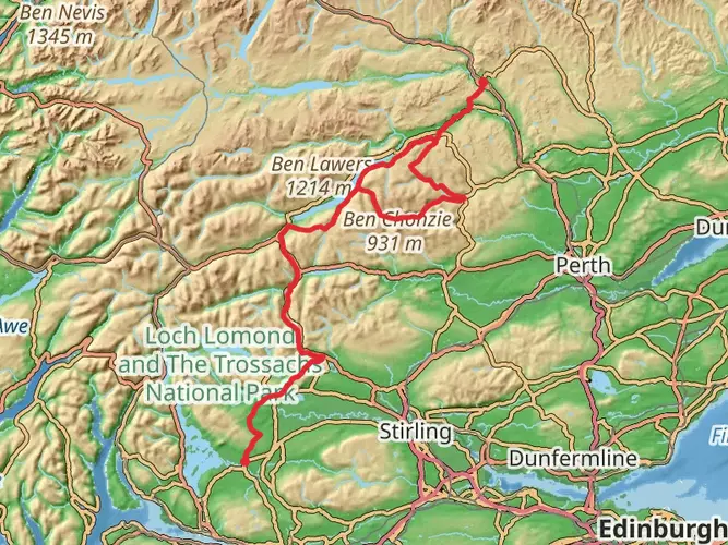
Sgiath Chùil, a mountain in the southern part of the Scottish Highlands, offers a moderately challenging hike that spans approximately 15 kilometers (around 9.3 miles) with an elevation gain of roughly 700 meters (about 2297 feet). The trailhead is conveniently located near Stirling, Scotland, making it accessible for those seeking a day hike immersed in the beauty of the Scottish landscape.
Getting to the Trailhead
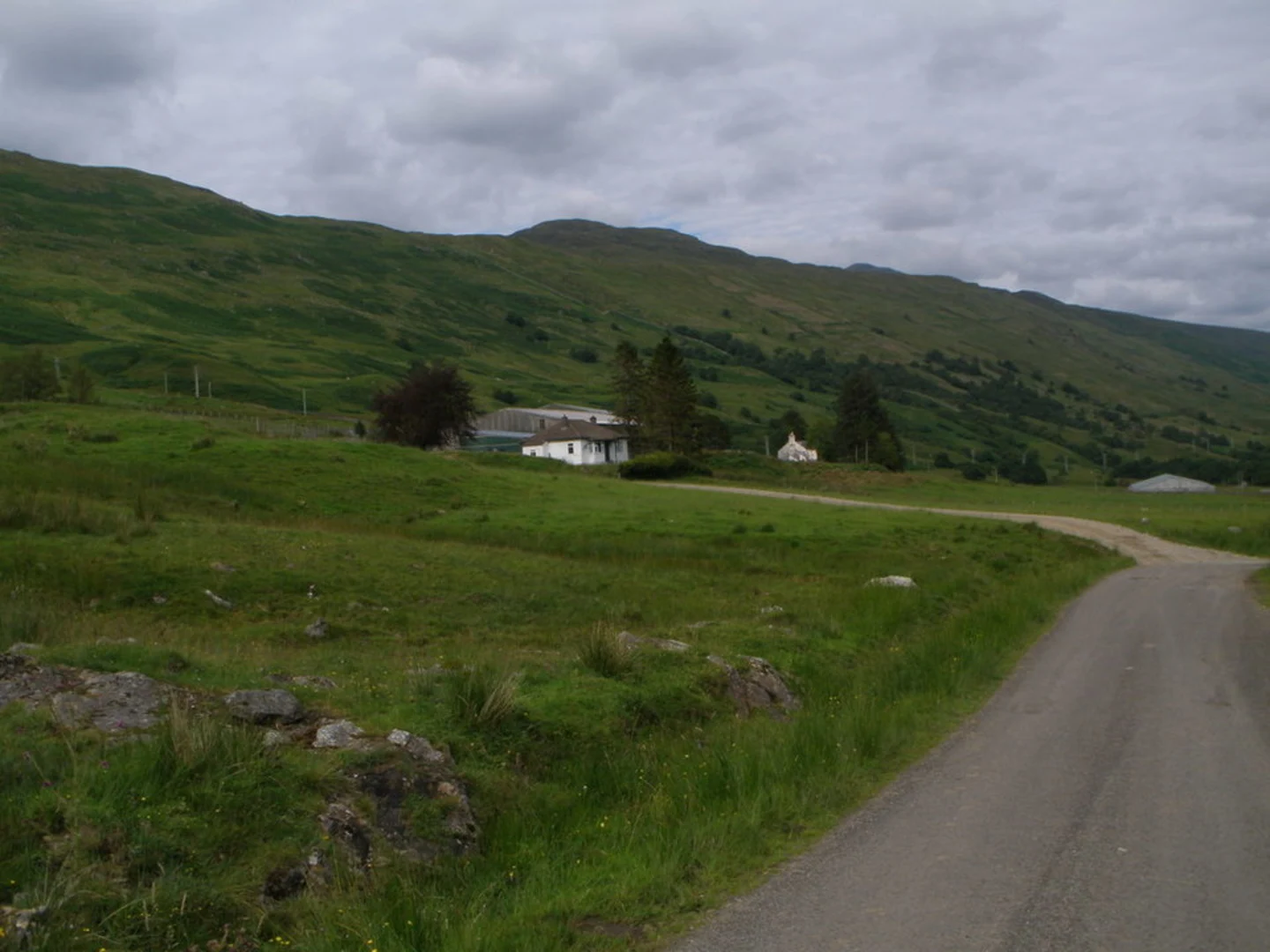
To reach the starting point of the Sgiath Chùil hike, you can drive or take public transport. If driving, you'll head towards the small village of Killin, which is situated at the western end of Loch Tay. From Killin, take the local roads heading north towards Glen Lochay. There is a small parking area near Kenknock, which serves as the informal trailhead for the hike.
For those relying on public transport, buses run from Stirling to Killin. From there, you might need to arrange a taxi to the trailhead, as public transport options into Glen Lochay are limited.
Navigating the Trail
Once you're at the trailhead, the path begins by following the Glen Lochay road before veering off onto a more rugged track. The route can be boggy and indistinct in places, so having a reliable navigation tool like HiiKER is essential to keep you on track. The initial section of the hike is relatively gentle, but as you progress, the incline increases, offering a more strenuous workout.
Landmarks and Scenery
As you ascend, you'll be treated to stunning views of the surrounding mountains and the valley below. The landscape is a patchwork of heather, bracken, and grass, with the occasional rocky outcrop adding to the rugged terrain. Keep an eye out for the ruins of old shielings – small, rough stone huts that were used by herdsmen in the past.
Wildlife and Nature
The area is rich in wildlife, and you may spot red deer, golden eagles, and various species of grouse. The plant life is also diverse, with a range of wildflowers and mosses that add color to the green expanse.
Historical Significance
The region is steeped in history, with Glen Lochay itself having been an important route for cattle drovers. The mountains and valleys have witnessed centuries of clan history, and the sense of the past is palpable as you hike through this ancient landscape.
Preparation and Safety
Given the Scottish weather's unpredictability, it's crucial to be well-prepared with waterproof clothing and good hiking boots. The trail can be wet and slippery, especially after rain. Also, ensure you have enough food and water, as there are no facilities once you leave the trailhead.
Remember to respect the natural environment by following the Leave No Trace principles, ensuring that this beautiful area remains unspoiled for future generations to enjoy.
Conclusion
By the time you reach the summit of Sgiath Chùil, you will have climbed roughly 2297 feet, and the panoramic views from the top are a fitting reward for your efforts. The descent follows the same path back to the trailhead, allowing you to experience the stunning scenery from a new perspective.

Comments and Reviews
User comments, reviews and discussions about the Sgiath Chùil, Scotland.
4.52
average rating out of 5
21 rating(s)