Download
3D Flyover
Add to list
More
2.5 km
~33 min
30 m
Out and Back
“Wander the old narrow‑gauge corridor—straight, serene, and bird‑lively—for an easy, low‑effort leg‑stretcher.”
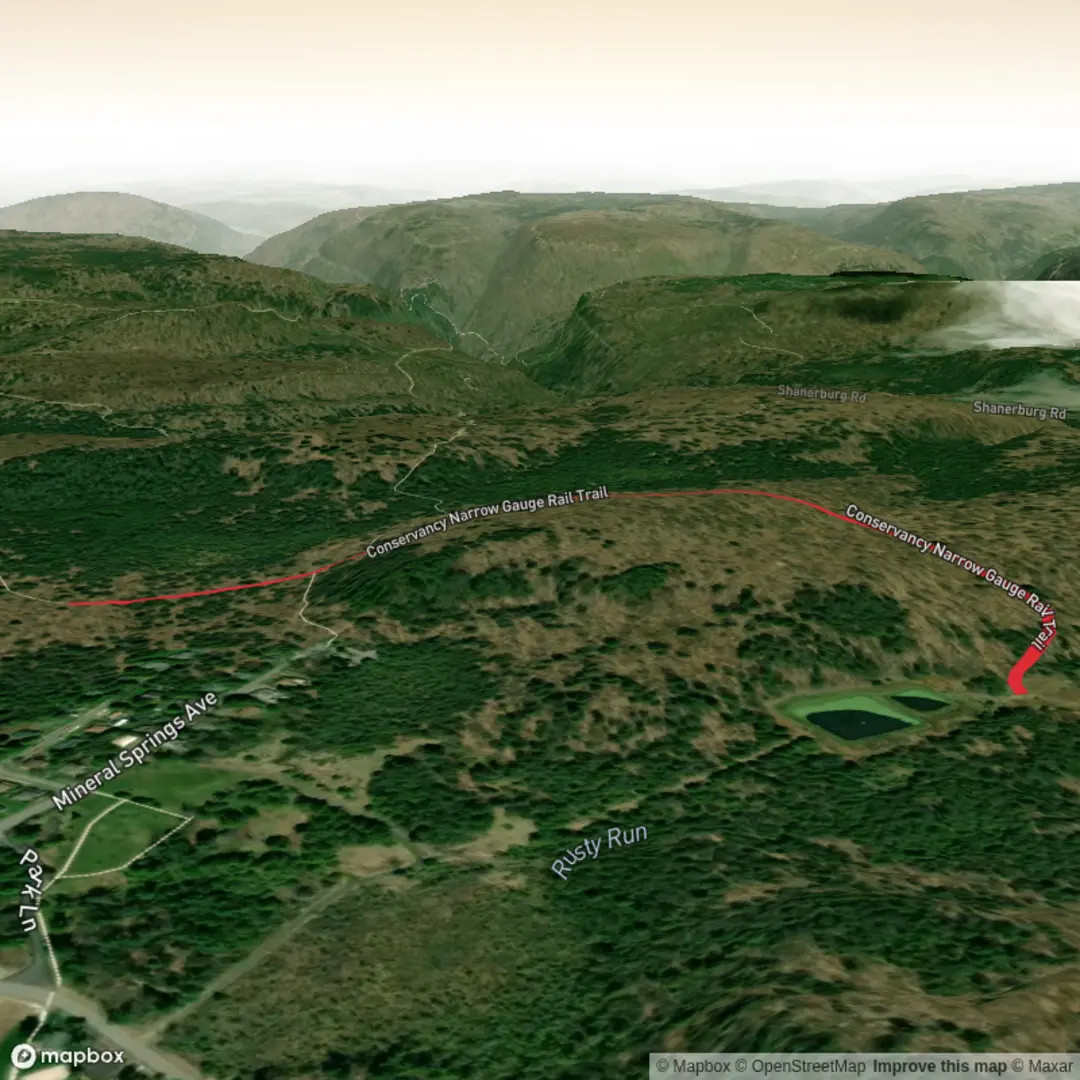
A gentle, mostly level out-and-back or short point-to-point stroll on a former narrow-gauge rail corridor, this walk suits families, casual walkers, and anyone wanting an easy leg-stretcher with minimal elevation change (about 3 km / 1.9 mi total, with roughly 0 m / 0 ft of climbing). Expect a firm, rail-trail style surface and a corridor-like feel—straight stretches, gradual curves, and wide sightlines that make it relaxing and straightforward to follow.
Getting to the start (car + public transport)
Because the hike head is listed only as “near” (with no coordinates or place name), I can’t reliably convert the start location to a nearest address or landmark yet. If you share a lon/lat (even just one point) or the nearest town/park/road name, I’ll pin it to the closest known address or significant landmark and tailor directions precisely.
In the meantime, here’s how these Conservancy-style rail trails are typically accessed: - By car: Look for a signed trailhead/parking pull-in where the rail corridor crosses a main road (often the easiest legal access). If there’s a “Conservancy” reserve or trail signboard, that’s usually the best place to start because it has the clearest entry and any posted rules. - By public transport: The most practical approach is usually to ride transit to the nearest town center (bus or rail station), then walk or rideshare to the closest road crossing of the rail trail. Once you tell me the nearest town, I can suggest the most sensible stop and walking link.
What the trail is like underfoot
With essentially no elevation gain, the effort is dictated more by surface and weather than by fitness: - Surface: Typically compacted gravel or fine crushed stone, sometimes with short paved sections near road crossings. After rain, expect damp patches and occasional puddles in low spots. - Width & grade: Rail corridors are engineered for gentle grades, so you’ll likely have a consistently easy pitch and a path wide enough for two people to walk side-by-side in many sections. - Accessibility: Often suitable for strollers and many mobility devices when dry, though any gates, bollards, or short rough patches at crossings can be the limiting factor.
Navigation and wayfinding
This is usually a “follow-the-corridor” walk, but it’s still worth loading the route in HiiKER so you can: - confirm the exact 3 km / 1.9 mi segment you intend to do, - identify road crossings and any parallel side paths, - and keep an eye on distance so you can turn around at the right point if you’re doing an out-and-back.
Landmarks and points of interest (what to watch for)
Even on a short rail-trail, there are a few features that tend to stand out. Over 3 km / 1.9 mi, you’ll commonly encounter: - Old rail formation details: low embankments, shallow cuttings, and the telltale straightness of the corridor. If any original infrastructure remains, it’s often subtle—stone culverts, drainage channels, or remnants of sleepers/ties (usually removed, but sometimes visible off to the side). - Culverts and small bridges: these are often the most “historic-feeling” structures on short rail trails. They can also be the slickest spots in wet weather—watch footing on shaded approaches where moss and algae can build up. - Road crossings: the main hazard on easy rail trails. Expect at least one crossing; treat every crossing as active traffic, even if sightlines look good.
Nature, habitat, and wildlife
Rail corridors create long, narrow habitat strips that can be surprisingly lively: - Birdlife: You’ll often see small woodland and edge-habitat birds moving along the corridor, especially early morning. Listen for calls from shrubs and low trees bordering the trail. - Insects and pollinators: In warmer months, flowering verge plants can attract bees and butterflies. If you’re sensitive to stings, keep an eye on flowering clusters near the trail edge. - Mammals: Depending on the region, you may spot rabbits/hares, small rodents, or signs like tracks and scat along the softer margins. - Plants: Expect a mix of native regrowth and hardy corridor species. In some areas, invasive plants can be present along disturbed rail beds—stay on the main tread to avoid brushing through seed heads or thorny growth.
Historical significance (why a “narrow gauge” matters)
A narrow-gauge railway was often chosen because it was cheaper and quicker to build, especially through rolling terrain or where budgets were tight. These lines commonly served: - timber and forestry operations, - mining or quarrying, - agricultural freight, - or linking small settlements to larger rail networks.
Walking the corridor today, the “rail logic” is still visible: gentle grades, broad curves, and engineered drainage. Even if the rails are long gone, the route reflects the industrial and settlement history of the area—how goods and people once moved through the landscape.
Practical prep for an easy 3 km / 1.9 mi outing
- Time: Most hikers will take 40–60 minutes at a relaxed pace, longer with kids, photos, or birdwatching.
- Footwear: Light hikers or sneakers are usually fine; choose something with grip if it’s been wet.
- Water: A small bottle is enough for most people, but bring more on hot days—rail corridors can be exposed.
- Sun/wind: If the corridor is open, sun protection matters even on a short

Surfaces
Unknown
Dirt
Comments and Reviews
User comments, reviews and discussions about the Conservancy Narrow Gauge Rail Trail, Pennsylvania.
average rating out of 5
0 rating(s)