Download
3D Flyover
Add to list
More
28.0 km
~6 hrs 15 min
390 m
Loop
“Hemlock-shadowed creeks, breezy high meadows, and a swaying bridge—an all-day plateau ramble.”
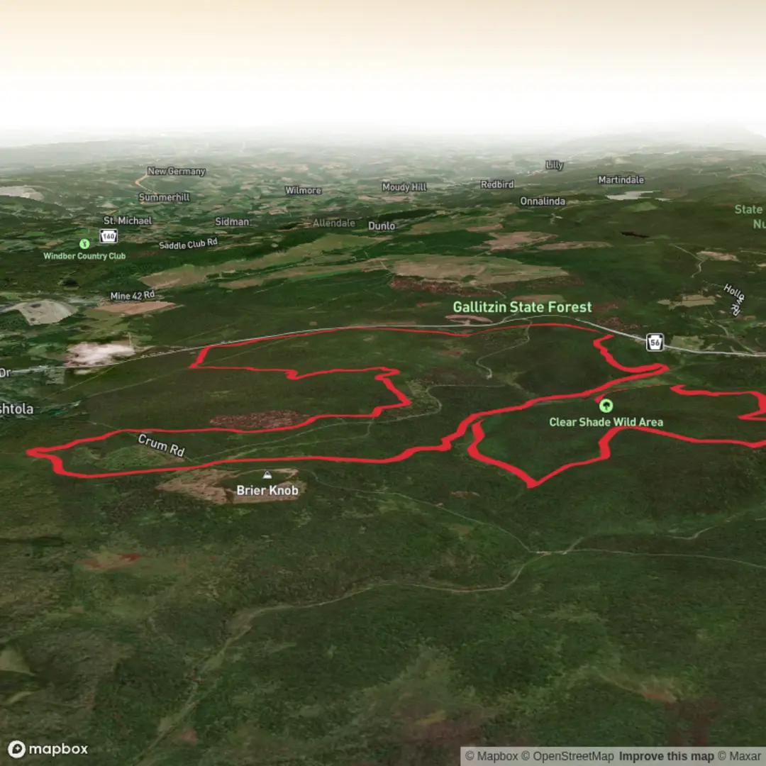
A gently rolling, two-loop walk through the high plateau of the Allegheny Front in Gallitzin State Forest (Babcock Division), this route is best planned as a full circuit of roughly 28 km / 17.5 mi with about 400 m / 1,300 ft of total climbing. The grades are mostly mild, but the distance makes it an all-day outing for many hikers. The trail is well-known for its mix of shady hemlock creek corridors, open “high meadow” stretches, and a handful of historic logging-era remnants—plus a signature swinging suspension bridge over Clear Shade Creek that links the two main loops. (en.wikipedia.org)
Getting to the start (car + public transport)
Primary start point: the Babcock State Forest Picnic Area on Pennsylvania Route 56, about 4 miles (6.4 km) east of Windber, PA. This picnic area is the traditional trailhead for the system and is easy to find right along PA-56. (pa.gov)
- By car: From the US-219 & PA-56 area east of Johnstown, follow PA-56 East toward Windber; directions commonly reference continuing several miles to the signed picnic area. Parking is typically at/near the picnic area, with additional parking sometimes noted across the highway depending on conditions and signage. (wpoc.org)
- By public transport: There isn’t reliable, close-in public transit directly to the picnic area. The most workable approach is to get to Johnstown (regional bus/rail options) or Windber (limited service), then use a taxi/rideshare for the last rural stretch along PA-56 to the picnic area.
For navigation, load the full loop in HiiKER before you arrive—cell coverage can be inconsistent on the plateau and down in the creek hollows.
What the hike feels like underfoot
Expect a mostly forested tread with frequent stretches that “roll” rather than climb—short rises and dips that add up gradually to the total gain. The trail system is commonly described as two loops connected by a short connector, so you’ll often be choosing whether to commit to the full figure-eight style outing or shorten the day by focusing on one loop. (en.wikipedia.org)
Even with an “Easy” rating, plan for: - Long distance fatigue: 28 km / 17.5 mi is the main challenge here. - Seasonal wet spots: low areas and boggier ground can linger after rain or snowmelt. - A rougher zone near Wolf Rocks: footing and trail wear can be noticeably worse around the rock formations, and the area has a reputation for heavy visitation impacts. (mrhyker.tripod.com)
Landmarks you’ll actually notice (with planning distances)
Starting from Babcock Picnic Area, the early miles ease you into the terrain—mixed hardwoods with conifers in cooler pockets. Within the broader loop system you’ll encounter several standout features that make good “checkpoints” for pacing:
- High-elevation meadows (openings on the plateau): These breaks in the forest are a hallmark of the route and can feel surprisingly expansive compared to the surrounding woods. They’re also where wind and weather are most noticeable—carry a layer even on mild days. (kta-hike.org)
- Clear Shade Creek corridor: Portions of the trail drop into a darker, cooler creekside environment—often with dense hemlock and a more enclosed feel. This is where you’ll want to watch for slick rocks, roots, and muddy edges after rain. (mrhyker.tripod.com)
- Swinging suspension bridge over Clear Shade Creek: This is the iconic crossing and a natural mid-hike milestone. If you’re doing the full system, it effectively marks the transition between the two loops. The bridge can sway, and the approaches can be slick—cross one at a time if your group is large, and keep trekking poles shortened or stowed so tips don’t catch.

Comments and Reviews
User comments, reviews and discussions about the John P. Saylor Trail, Pennsylvania.
average rating out of 5
0 rating(s)