Download
Preview
Add to list
More
5.3 km
~1 hrs 23 min
206 m
Loop
“Embark on the Iris Ridge Loop for a floral spectacle and sweeping vistas amidst historical Oregon woodlands.”
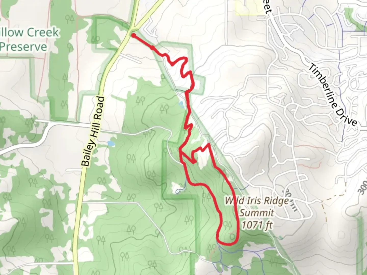
Nestled in the scenic region near Lane County, Oregon, the Iris Ridge Loop is a moderately challenging trail that spans approximately 5 kilometers (3.1 miles) and features an elevation gain of around 200 meters (656 feet). This loop trail is a favorite among locals and visitors alike for its beautiful wildflowers, particularly irises, and the panoramic views it offers.
Getting to the Trailhead
To reach the trailhead, you can drive to the designated parking area located just off a local road near Lane County. If you're using public transportation, check the local bus schedules as services may vary, and you might need to walk a short distance from the nearest bus stop to the trailhead.
Trail Experience
As you embark on the Iris Ridge Loop, you'll be greeted by a well-marked path that meanders through a lush forested area. The initial segment of the trail is relatively flat, allowing hikers to warm up before the ascent begins. The path is lined with a variety of ferns and towering trees, providing a cool, shaded environment.
After about 1 kilometer (0.6 miles), the trail starts to ascend, and you'll encounter a series of switchbacks. These switchbacks make the climb more manageable, but you'll still want to pace yourself and take breaks as needed. As you gain elevation, the forest canopy occasionally opens up to reveal stunning views of the surrounding landscape.
Flora and Fauna
The Iris Ridge Loop is particularly renowned for its springtime display of wild irises, which blanket the area in a sea of purple and blue. The best time to witness this natural spectacle is from late spring to early summer. In addition to irises, you'll likely spot other wildflowers, adding splashes of color to your hike.
Wildlife is abundant in this area, so keep an eye out for deer, birds, and perhaps even the occasional fox. Remember to respect the wildlife by observing from a distance and not feeding any animals you encounter.
Historical Significance
The region around the Iris Ridge Loop is steeped in history, with the land having been inhabited by indigenous peoples long before European settlers arrived. As you hike, consider the centuries of history that have unfolded in these forests and valleys.
Navigating the Trail
For navigation, HiiKER is an excellent tool to keep you on track. The app will help you follow the loop without missing any important turns or landmarks. As you approach the highest point of the trail, approximately 2.5 kilometers (1.55 miles) in, you'll be rewarded with a breathtaking vista. Here, you can take a moment to enjoy the panoramic view before continuing on the loop.
The descent is gentler than the ascent and winds through a different part of the forest, offering new scenery and perspectives. As you complete the loop and return to the trailhead, you'll have experienced a diverse range of environments, from dense woodlands to open ridgelines.
Preparing for the Hike
Before setting out on the Iris Ridge Loop, ensure you have adequate water, snacks, and layers of clothing to adjust for changing weather conditions. The trail is rated as medium difficulty, so it's suitable for hikers with some experience. Always let someone know your hiking plans and expected return time for safety.
Remember to leave no trace, pack out all your trash, and enjoy the natural beauty of the Iris Ridge Loop responsibly.

What to expect?
Activity types
Comments and Reviews
User comments, reviews and discussions about the Iris Ridge Loop, Oregon.
4.5
average rating out of 5
18 rating(s)