Download
Preview
Add to list
More
102.4 km
~4 day
193 m
Point-to-Point
“Journey through southern Oregon's scenic landscapes and history on the accessible OC and E Woods Line Trail.”
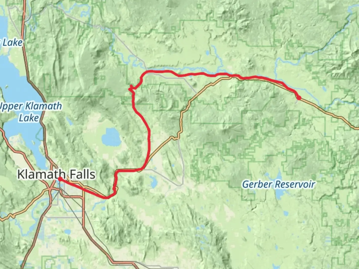
The OC and E Woods Line State Trail stretches approximately 102 kilometers (about 63 miles) from Klamath County, Oregon, offering a leisurely point-to-point journey with an elevation gain of around 100 meters (328 feet). This trail is ideal for hikers seeking an easy, scenic adventure through the diverse landscapes of southern Oregon.### Getting ThereThe trailhead is conveniently located near Klamath Falls, Oregon. If you're traveling by car, you can reach Klamath Falls via U.S. Route 97. For those using public transportation, the Klamath Falls Amtrak Station is a viable option, with connections to various bus services that can bring you closer to the trailhead.### Trail OverviewThe OC and E Woods Line State Trail is a converted rail trail, which means it follows the path of the former Oregon, California, and Eastern Railroad. This historical significance adds a unique charm to the hike, as you traverse through areas that once echoed with the sounds of steam engines. The trail is predominantly flat, making it accessible for hikers of all skill levels, including families and those looking for a gentle walk or bike ride.### Natural Beauty and WildlifeAs you embark on this journey, you'll be treated to a variety of landscapes, from open meadows to dense forests. The trail is lined with wildflowers in the spring and summer, providing a colorful backdrop to your hike. Keep an eye out for local wildlife, including deer, rabbits, and a variety of bird species. The trail also offers several opportunities to spot the majestic bald eagle, especially near water bodies.### Significant LandmarksOne of the highlights along the trail is the Olene Gap, located approximately 16 kilometers (10 miles) from the trailhead. This natural feature offers stunning views of the surrounding countryside and is a perfect spot for a rest or picnic. Further along, at about 48 kilometers (30 miles) in, you'll encounter the Sprague River, a serene location ideal for bird watching and photography.### Navigation and PlanningFor navigation, the HiiKER app is an excellent tool to help you stay on track and explore the trail's features. The app provides detailed maps and information about the trail, ensuring you have a safe and enjoyable experience.### Historical ContextThe OC and E Woods Line State Trail is steeped in history, as it follows the route of a railway that played a crucial role in the development of the region. The railroad was instrumental in transporting timber and other goods, contributing to the economic growth of southern Oregon in the early 20th century. As you hike, you'll pass remnants of this bygone era, including old trestles and railway artifacts, offering a glimpse into the past.Whether you're a history enthusiast, nature lover, or simply looking for a peaceful hike, the OC and E Woods Line State Trail provides a unique and enriching experience.

What to expect?
Activity types
Comments and Reviews
User comments, reviews and discussions about the OC and E Woods Line State Trail, Oregon.
average rating out of 5
0 rating(s)