Download
3D Flyover
Add to list
More
892.6 km
~32 days
7876 m
Multi-Day
“Embark on the Bruce Trail for a historic hike through Ontario's scenic wonders and diverse wildlife.”
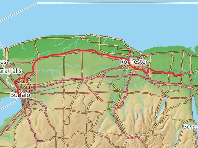
Spanning approximately 893 kilometers (555 miles) and boasting an elevation gain of around 7800 meters (25,590 feet), the Bruce Trail offers an immersive experience through Ontario's picturesque landscapes. Beginning near Niagara, close to the iconic Niagara Falls, the trailhead is accessible from Queenston Heights Park, which is a short drive from the town of Niagara-on-the-Lake. For those relying on public transportation, regional buses serve the area, and the nearest significant landmark is the Brock Monument at Queenston Heights.
Getting to the Trailhead
To reach the starting point by car, take the Queen Elizabeth Way (QEW) to the Niagara Townline Road exit and follow the signs to Niagara Parkway and Queenston Heights Park. Parking is available at the park, which is a convenient place to begin your journey.
Navigating the Trail
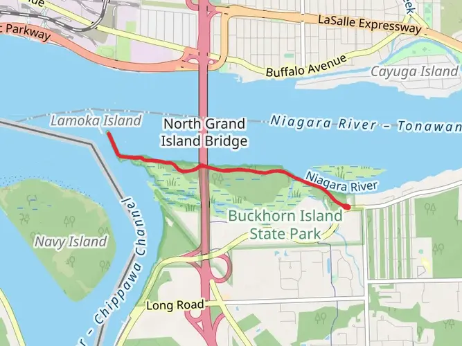
The Bruce Trail is a point-to-point hike, meaning it starts and ends at different locations. It is well-marked with white blazes, and hikers can use the HiiKER app for detailed maps and navigation assistance. The trail winds its way north to Tobermory, located at the tip of the Bruce Peninsula.
Landmarks and Scenery
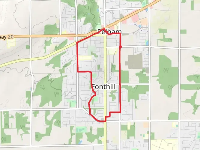
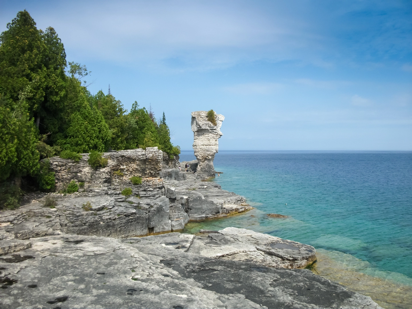
As you embark on the trail, you'll traverse the Niagara Escarpment, a UNESCO World Biosphere Reserve. The path leads through lush forests, past streams and waterfalls, and offers stunning views of the escarpment's cliffs. Notable landmarks include the Devil's Punchbowl, a dramatic ribbon waterfall, and the scenic lookouts at Rattlesnake Point and Lion's Head.
Wildlife and Nature
The Bruce Trail is a haven for nature enthusiasts, with a diverse range of flora and fauna. Hikers may encounter white-tailed deer, raccoons, and a variety of bird species. The trail also passes through several conservation areas, where you can observe unique geological features and wildflowers, especially trilliums in the spring.
Historical Significance
The region is steeped in history, with the trail itself following paths used by First Nations people and later by European settlers. The Bruce Peninsula is named after James Bruce, a colonial governor of Canada. Along the route, you'll find historical sites such as old mills and remnants of early settlements.
Preparation and Planning
Given the trail's difficulty rating and length, it's essential to plan accordingly. Hikers should be prepared for challenging sections, particularly where the trail ascends or descends steeply. It's advisable to carry a reliable source of water, food, and a first-aid kit. Weather can be unpredictable, so pack appropriate clothing and check forecasts regularly.
Access Points and Distances
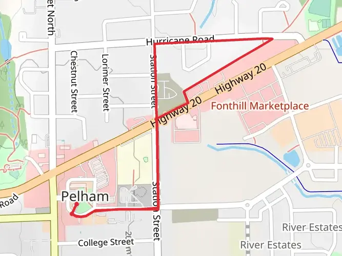
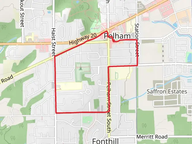
The Bruce Trail offers multiple access points, allowing for shorter hikes or resupply opportunities. The trail is divided into nine sections, each managed by a local Bruce Trail club. These sections vary in length and difficulty, so hikers can choose segments that match their skill level and time constraints.
Conclusion
The Bruce Trail provides a unique and rewarding experience for those seeking adventure amidst Ontario's natural beauty. With careful preparation and respect for the environment, hikers can enjoy one of Canada's premier long-distance trails and the rich heritage it traverses.

What to expect?
Activity types
Frequently asked questions
How long does it take to hike the Bruce Trail end to end from Niagara to Tobermory?
The Bruce Trail is 892.63 km long, so it is usually completed as a multi-day trek in sections rather than in one continuous push. Organized end-to-end events on individual sections often break the route into day hikes of roughly 9 to 23 km, which shows the full trail is a substantial long-distance project rather than a weekend hike.
Where is the southern trailhead for the Bruce Trail in Niagara?
The southern terminus of the Bruce Trail is at the stone cairn in Queenston Heights Park in Queenston, near Niagara-on-the-Lake. This is the recognized starting point for the trail before it follows the Niagara Escarpment north all the way to Tobermory on the Bruce Peninsula.
Where can you park to start the Bruce Trail at Queenston Heights Park?
A common place to start the Bruce Trail is the parking area at Queenston Heights Park, beside the Niagara Parkway entrance and close to the southern terminus cairn. Niagara Parks lists Queenston Heights Park, 14184 Niagara Parkway, as a year-round pay-and-display lot, with parking posted at 8 Canadian dollars per hour and no overnight parking.
Is the Bruce Trail well marked for navigation?
The Bruce Trail is waymarked with white blazes on the main trail and blue blazes on side trails. On a route that runs nearly 893 km from Queenston to Tobermory, those blaze colors are the key on-the-ground markers for staying on the main line versus taking a side trail to a lookout, waterfall, or access point.
Are dogs allowed on the Bruce Trail in Ontario?
Dogs are allowed on much of the Bruce Trail, but they must be kept on a leash, and there are some sections where dogs are not permitted. The Bruce Trail Conservancy also notes a specific no-dog stretch on the main trail between Firemen’s Park and Concession 6/Mewburn Road in the Niagara area, so rules can vary by section.
Is the Bruce Trail a difficult hike?
The Bruce Trail is generally rated medium, but that rating covers a very long point-to-point route with 7,876 m of total elevation gain. In practice, difficulty depends on the section: a short Niagara day hike can feel moderate, while a full end-to-end itinerary demands strong endurance, repeated climbs, and careful logistics over many days.
Comments and Reviews
User comments, reviews and discussions about the The Bruce Trail, Ontario.
4.69
average rating out of 5
13 rating(s)