Download
Preview
Add to list
More
22.3 km
~2 days
1114 m
Multi-Day
“Trek the Aotea Track's scenic loop to witness Great Barrier Island's geological wonders and rich Maori heritage.”
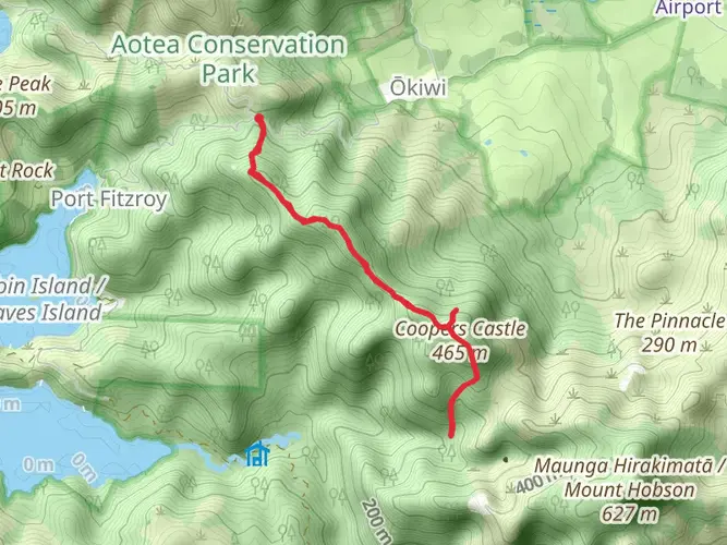
Embarking on the Aotea Track, hikers will traverse a diverse landscape on Great Barrier Island, not far from Auckland, New Zealand. This loop trail, approximately 22 kilometers (13.7 miles) in length with an elevation gain of around 1100 meters (3608 feet), offers a medium difficulty rating and is a true showcase of the island's natural beauty.
Getting to the Trailhead
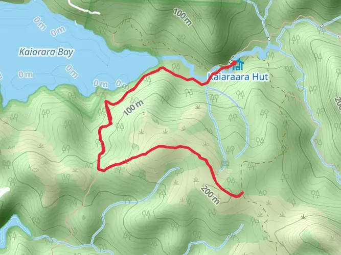
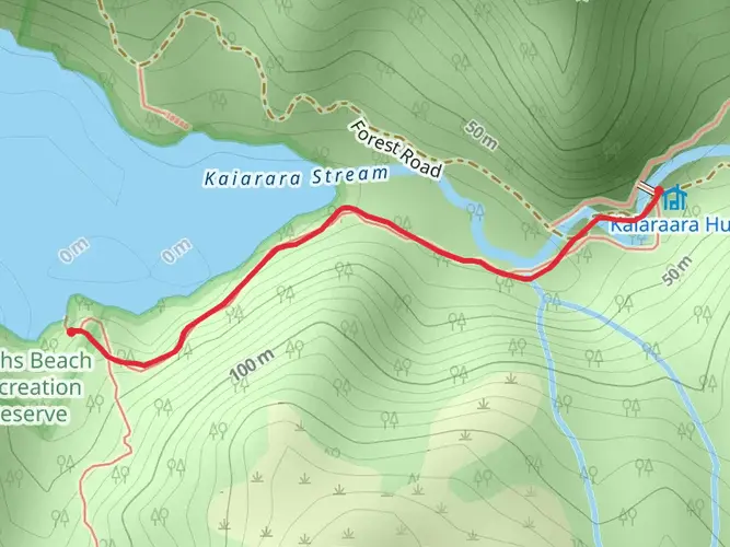
To reach the trailhead, visitors can take a ferry from Auckland to Great Barrier Island, followed by a local shuttle service or a rented car to the trail's starting point. The Aotea Track begins near the end of Whangaparapara Road, close to the Aotea Conservation Park.
Navigating the Trail
Hikers can rely on HiiKER for detailed maps and navigation assistance throughout their journey. The loop can be completed in either direction, but many choose to start with the climb towards Windy Canyon, which offers breathtaking views as a reward for the early effort.
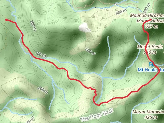
Windy Canyon to Mt. Hobson/Hirakimata
The ascent through Windy Canyon is a geological marvel, with sculpted rock formations and lush native bush. After approximately 5 kilometers (3.1 miles), hikers reach the summit of Mt. Hobson/Hirakimata, the island's highest point at 621 meters (2037 feet). This peak holds cultural significance to the local Māori and provides panoramic views of the island and surrounding ocean.
Palmers Track to South Fork Hut
Descending from Mt. Hobson, the trail continues along Palmers Track, leading through kauri forests and past remnants of the island's logging history. After about 8 kilometers (5 miles), hikers arrive at South Fork Hut, a convenient spot for an overnight stay. The hut is situated near the tranquil Kaitoke Hot Springs, which are perfect for a relaxing soak.
Forest Flora and Fauna
Throughout the hike, the trail meanders through native forest, home to a variety of bird species such as kaka, kereru, and tui. The dense canopy is composed of nikau palms, kauri, and rimu trees, creating a habitat rich in biodiversity. Hikers should be mindful of the conservation efforts to protect the kauri trees from kauri dieback disease by cleaning their footwear at designated stations.
Historical Significance
Great Barrier Island has a rich history, with the Aotea Track crossing areas that were once bustling with kauri logging and mining activities. The remnants of these industries can still be seen along the trail, providing a glimpse into the island's past.
Completing the Loop
The final stretch of the Aotea Track leads back towards the trailhead, completing the loop. This section offers a gentler descent and the opportunity to reflect on the diverse landscapes encountered along the way.
Preparation and Safety
Hikers should prepare for variable weather conditions and carry sufficient water, food, and safety gear. It's also advisable to inform someone of your hiking plans and expected return time. The Aotea Track can be hiked year-round, but the best conditions are typically from late spring to early autumn.
By following these guidelines and respecting the natural environment, visitors to the Aotea Track will have an unforgettable experience exploring one of New Zealand's hidden gems.

What to expect?
Activity types
Comments and Reviews
User comments, reviews and discussions about the Aotea Track, New Zealand.
3.63
average rating out of 5
8 rating(s)