Download
Preview
Add to list
More
62.7 km
~3 day
3978 m
Point-to-Point
“Embark on a historic 39-mile trek through the White Mountains' majesty, teeming with wildlife and awe-inspiring vistas.”
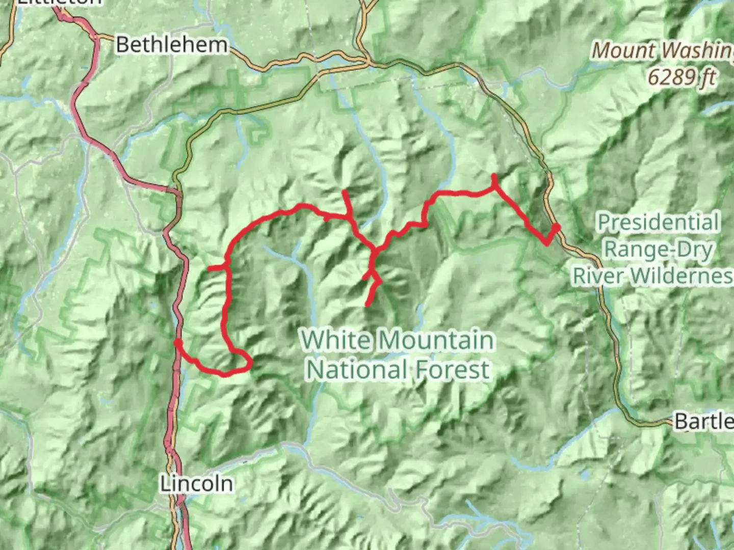
The Basin to Wiliey Pond trail is a captivating journey through the heart of the White Mountains, offering hikers a chance to immerse themselves in the rugged beauty of Grafton County, New Hampshire. Spanning approximately 63 kilometers (about 39 miles) with an elevation gain of roughly 3900 meters (close to 12,800 feet), this point-to-point trail is a medium-difficulty hike that promises a blend of scenic vistas, challenging terrain, and a rich tapestry of flora and fauna.
Getting to the Trailhead To embark on this adventure, hikers can reach the trailhead near Grafton County by car, parking at the designated area close to The Basin off I-93 North. For those relying on public transport, options may be limited, but regional bus services can get you close to the area, and from there, a taxi or ride-sharing service can complete the journey to the trailhead.
Navigating the Trail As you set out from The Basin, a natural granite pothole formed by the falling waters of the Pemigewasset River, the trail will take you through a diverse landscape of dense forests, clear streams, and alpine ridges. Hikers should be prepared for the initial ascent, which can be quite steep, and it's advisable to use a reliable navigation tool like HiiKER to track your progress and ensure you're on the right path.
Landmarks and Scenery The trail offers a variety of landmarks that are not only visually stunning but also steeped in history. One of the early highlights is the Franconia Ridge, a section of the Appalachian Trail that provides panoramic views of the surrounding peaks and valleys. As you traverse this ridge, you'll be walking a path that has been trodden by countless hikers before you, each with their own stories and experiences.
Further along, the trail descends into the Pemigewasset Wilderness, where the silence of the forest is punctuated by the calls of native birds. This area is a haven for wildlife, and it's not uncommon to spot deer, moose, and even black bears, so hikers should be knowledgeable about wildlife safety precautions.
Historical Significance The White Mountains region is rich in history, with the trail itself passing through areas that were once important to the indigenous Abenaki people. European settlers later used these lands for logging, and remnants of old logging railroads can still be seen along certain parts of the trail.
Preparation and Planning Given the trail's length and elevation gain, hikers should be well-prepared with adequate supplies, including water, food, and layers of clothing to adapt to the unpredictable mountain weather. It's also wise to plan for overnight stays, either in tents or at the Appalachian Mountain Club huts scattered along the route, which offer a place to rest and refuel.
End of the Trail As you approach the end of the trail near Wiliey Pond, the terrain becomes less demanding, allowing for a peaceful conclusion to the hike. The pond itself is a serene spot, perfect for reflection and a well-deserved rest before arranging transportation back to civilization.
Remember, while the journey from The Basin to Wiliey Pond is a rewarding one, it requires respect for the natural environment and preparation for the challenges it presents. With each step, you'll be following in the footsteps of history and creating your own story in the timeless landscape of the White Mountains.

What to expect?
Activity types
Comments and Reviews
User comments, reviews and discussions about the The Basin to Wiliey Pond, New Hampshire.
average rating out of 5
0 rating(s)