Download
3D Flyover
Add to list
More
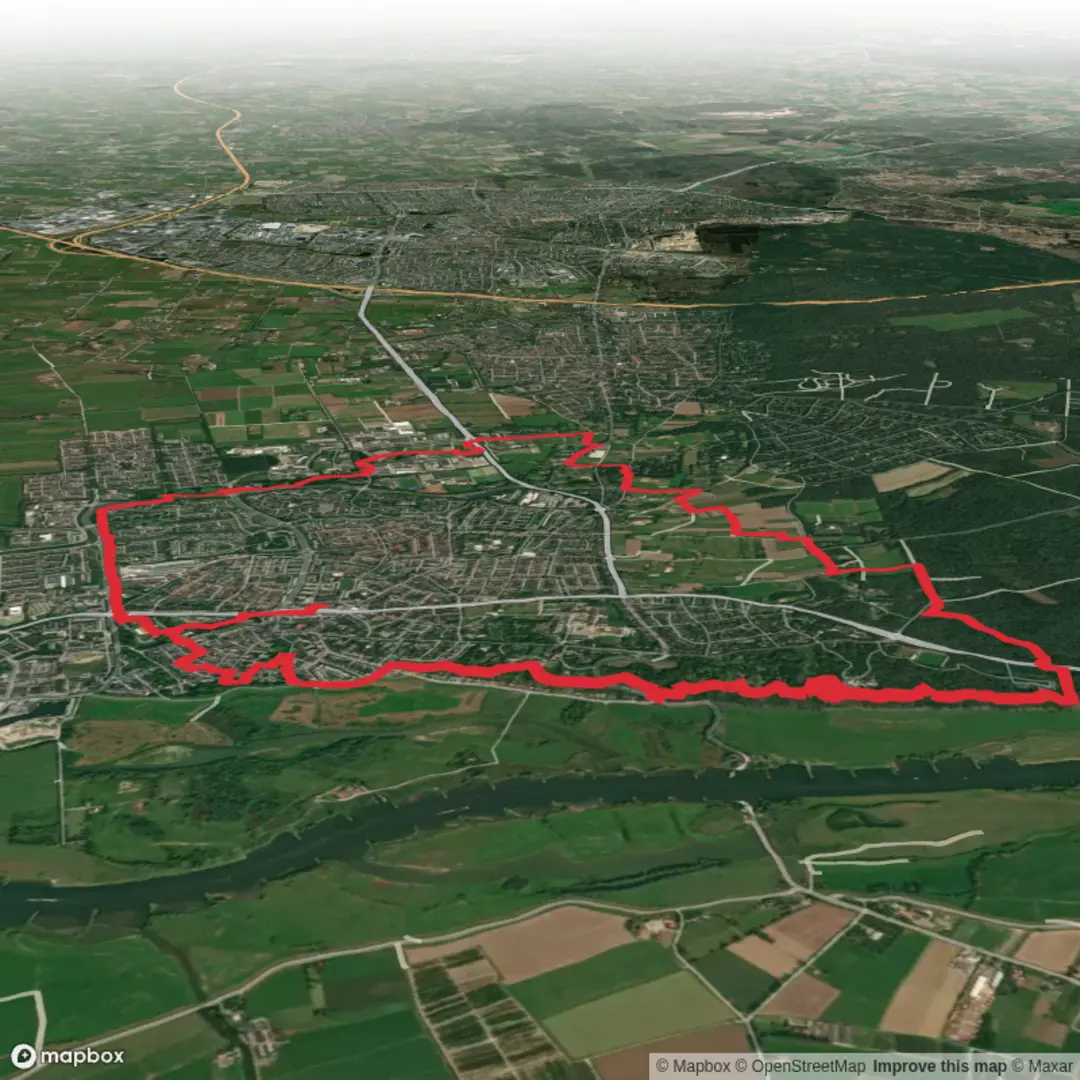
14.6 km
~3 hrs 1 min
64 m
Loop
“Wander through blossoming orchards, ancient farmland, and wooded ridges, where history and nature gently entwine.”
Starting from the outskirts of Wageningen, a university town in the Gelderland province, this 15 km (about 9.3 miles) loop trail offers a gentle introduction to the rolling landscapes of the Veluwe and the fertile Wageningse Eng. The trailhead is conveniently located near the Wageningen bus station, which is easily accessible by direct bus from Ede-Wageningen train station—a major rail hub. For those arriving by car, parking is available near the Wageningen University campus, close to the Arboretum Belmonte, a well-known botanical garden and a suitable landmark for navigation.
Route Overview and Terrain
The loop meanders through a patchwork of open fields, wooded slopes, and historic farmland, with a total elevation gain of around 100 metres (328 feet). The route is mostly flat, with a few gentle ascents as you climb the Bergpad, a sandy ridge that offers panoramic views over the Rhine valley and the Betuwe region. The Wageningse Eng, a centuries-old agricultural area, is characterized by its traditional strip fields and hedgerows, remnants of medieval land use that are still visible today.
Landmarks and Points of Interest
- Arboretum Belmonte (Start/Finish, 0 km/0 miles): The trail begins near this renowned botanical garden, home to a vast collection of trees and rhododendrons. It’s worth a short detour to explore the gardens before or after your hike.
- Bergpad Ridge (2 km/1.2 miles): As you ascend the Bergpad, the path winds through mixed woodland, with occasional clearings that provide sweeping views. Look out for information panels detailing the area’s glacial history—these hills were formed during the last Ice Age.
- Wageningse Eng (5 km/3.1 miles): The trail descends into the Eng, where you’ll walk alongside fields that have been cultivated for centuries. In spring and summer, wildflowers and butterflies are abundant, and you may spot kestrels hunting over the meadows.
- Historic Farmsteads (7–10 km/4.3–6.2 miles): Several traditional Dutch farmhouses dot the landscape, some dating back to the 18th century. Many are still in use, and the area’s agricultural heritage is evident in the well-maintained fields and orchards.
- Rhine River Views (12 km/7.5 miles): The route skirts the edge of the Wageningse Berg, offering glimpses of the Rhine River below. On clear days, you can see across to the Betuwe, a region famous for its fruit orchards.
- Return to Wageningen (15 km/9.3 miles): The final stretch brings you back through quiet residential streets and leafy parks, ending near the Arboretum.
Nature and Wildlife
The varied habitats along the loop support a rich diversity of flora and fauna. Woodpeckers, nuthatches, and tawny owls are common in the forests, while the open fields attract hares and roe deer. In the wetter areas, you might encounter frogs and dragonflies, especially after rain. The Wageningse Eng is also known for its old fruit trees, which blossom spectacularly in spring.
Navigation and Trail Conditions
Waymarking is generally good, but carrying a digital map on HiiKER is recommended for precise navigation, especially at junctions where multiple trails intersect. The paths are mostly unpaved but well-maintained, suitable for sturdy walking shoes or lightweight hiking boots. After heavy rain, some sections can become muddy, particularly in the lower-lying fields.
Getting There
From Ede-Wageningen train station, frequent buses run to Wageningen bus station, which is a short walk from the trailhead near Arboretum Belmonte. If driving, follow signs to Wageningen University and park near the arboretum or university sports centre. Both options provide easy access to the start of the loop.
Historical Significance
Wageningen is known as the “City of Liberation,” as the German surrender in the Netherlands was signed here in May 1945. The surrounding landscape bears traces of its strategic importance, with wartime bunkers and memorials scattered along the route. The agricultural fields of the Eng have been continuously farmed since medieval times, and the area’s layered history is reflected in its field patterns, hedgerows, and historic buildings.

Surfaces
Unknown
Asphalt
Dirt
Sand
Gravel
Wood
Paved
Unpaved
Comments and Reviews
User comments, reviews and discussions about the Bergpad and Wageningse Engpad Loop, Netherlands.
average rating out of 5
0 rating(s)