Download
3D Flyover
Add to list
More
16.9 km
~3 hrs 38 min
167 m
Loop
“Windswept sand flats, wildflowers, and echoes of history create an unforgettable journey across Vlieland’s west.”
Starting from the western edge of Vlieland, the Vliehors Range Loop offers a unique 17 km (about 10.5 miles) circuit with a gentle elevation gain of around 200 metres (650 feet). The trailhead is located near Posthuys, a historic inn and café that serves as a gateway to the vast Vliehors sand flats, often referred to as the “Sahara of the North.” This area is accessible by bus from the ferry terminal at Oost-Vlieland, with regular services connecting visitors to Posthuys. For those arriving by car, parking is available near the ferry terminal on the mainland at Harlingen, as private vehicles are not permitted on Vlieland itself.
The Vliehors Experience
The route quickly immerses hikers in the expansive, windswept landscape of the Vliehors, a tidal sandflat stretching for kilometers along the island’s western tip. The terrain is mostly flat, with only minor undulations as you traverse sandy tracks and occasional grassy dunes. The openness of the area means weather conditions can change rapidly, so windproof clothing is recommended. Navigation is straightforward, but due to the vastness and lack of distinct features, using HiiKER for GPS guidance is highly advisable.
Landmarks and Natural Highlights
At approximately 4 km (2.5 miles) into the loop, you’ll encounter the Vliehors Expres shelter, a quirky wooden structure used by the local sand train tours. Continuing west, the trail skirts the edge of the military training range—marked by clear signage and off-limits during exercises, so always check local notices before setting out. The area is rich in birdlife, especially during migration seasons, with oystercatchers, curlews, and terns commonly seen. Seals are often spotted basking on the sandbanks at low tide.
Around the halfway point, near the 8.5 km (5.3 miles) mark, the trail passes the Drenkelingenhuisje, a historic rescue hut once used to shelter shipwreck survivors. This whitewashed building stands as a poignant reminder of Vlieland’s maritime history and the treacherous waters that have claimed many vessels over the centuries.
Flora, Fauna, and Coastal Views
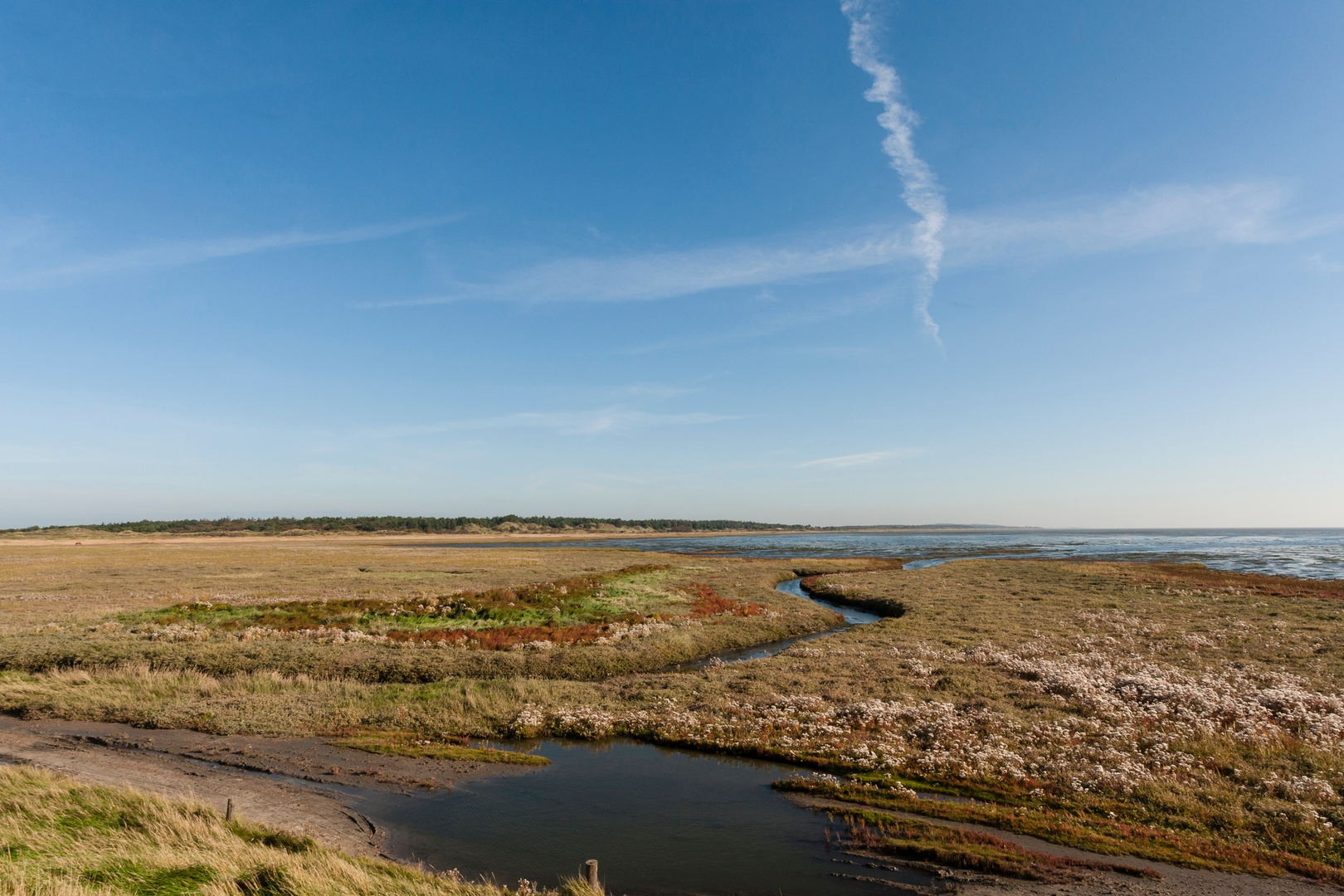
The return leg of the loop leads you along the northern edge of the Vliehors, where the sand gives way to salt marshes and dune grasses. In spring and summer, wildflowers dot the landscape, and the air is filled with the calls of nesting birds. The views northward across the Wadden Sea are expansive, with Texel visible on clear days.
Practical Considerations
The entire loop is exposed, with little shelter from sun or wind, so bring adequate water, sun protection, and snacks. There are no facilities along the route except at Posthuys, so plan accordingly. The sandy surface can be challenging for bicycles or strollers, and sturdy footwear is recommended. Tides can affect access to certain sections, so consult local tide tables and HiiKER’s trail updates before departure.
This loop is suitable for most fitness levels due to its easy rating and minimal elevation, but the distance and exposure require preparation. The combination of natural beauty, wildlife, and historical landmarks makes this a memorable walk on one of the Netherlands’ most unique islands.

Surfaces
Unknown
Asphalt
Comments and Reviews
User comments, reviews and discussions about the Vliehors Range Loop, Netherlands.
average rating out of 5
0 rating(s)