Download
3D Flyover
Add to list
More
17.0 km
~3 hrs 27 min
31 m
Loop
“Drift through Vasserheide’s sandy pines and open heath to the mesmerizing Jannink circles—gently undulating, unhurried.”
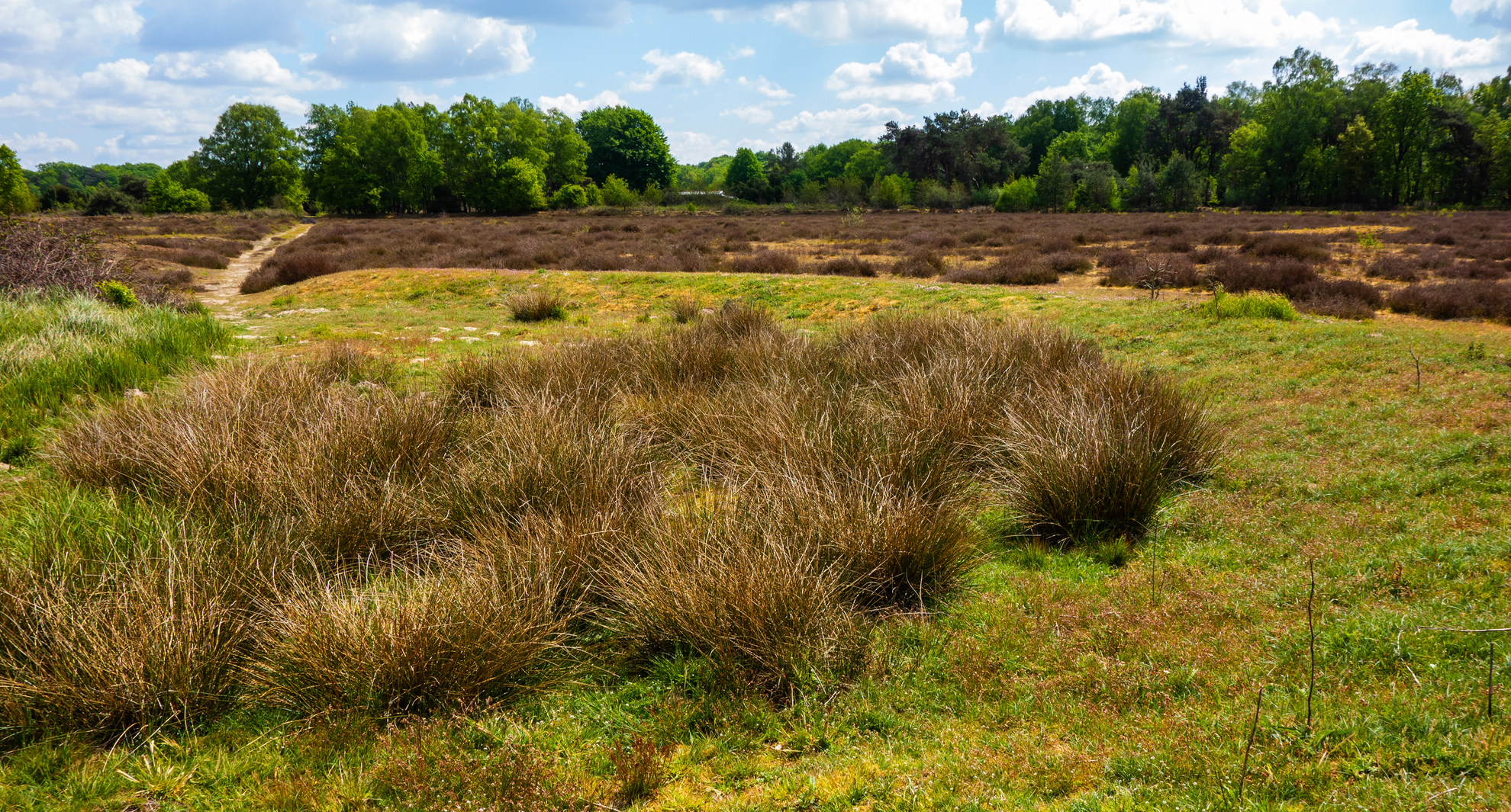
You’ll be walking a classic slice of Noordoost-Twente (Overijssel): sandy forest tracks, quiet heathland, and open “essen” farmland on gently rolling ground. Even though the overall elevation gain is close to 0 m (0 ft), expect constant small rises and dips—more “soft undulation” than true climbing—so it stays easy but never boring.
Plan on ~17 km / ~10.6 mi. At an easy pace with stops for viewpoints and landmarks, most hikers take 4–5 hours.
Getting to the start (and what “near” means here)
This loop is typically started from the Vasserheide trailhead (Startpunt Vasserheide, keuzepunt D71) on the edge of the Vasserheide area. The nearest usable “address-style” reference is the junction area of Beekzijdeweg / Lädderken near Mander/Vasse (municipality of Tubbergen), which is the signed startpoint used by local route networks. (wandeleninoverijssel.nl)
By car - Aim for Startpunt Vasserheide (D71) near the Beekzijdeweg/Lädderken junction; parking is typically informal/small and can fill on sunny weekends. Arrive early if you want a quiet start.
By public transport
- The most practical approach is usually via Vasse and then a short taxi/bike ride or a longer walk-in. For example, Landschap Overijssel notes a bus stop at Vasse (RK kerk) for routes in this area, with a walk-in option from there to nearby starts. (landschapoverijssel.nl)
- If you’re building the day around buses, use HiiKER to pin the exact startpoint and check the walk-in distance from the nearest stop you choose.
What the route feels like underfoot
Most of the loop is on wide sandy forest roads, narrower pine-and-oak singletrack, and heathland paths that can be soft and springy. After rain, the low spots can hold water and the sand can turn into a slow, sticky paste; in dry spells, the sand gets loose and energy-sapping. Footwear with decent tread is enough—no special kit required.
Because the terrain is flat-to-gently-rolling, the main “difficulty” factors are: - Distance (17 km / 10.6 mi) - Surface drag (sand) - Exposure on open heath/farmland edges (wind/sun)
Landmarks and nature you’ll pass
Early on, you’ll settle into the Vasserheide character: a mix of woodland and heath that feels surprisingly spacious for the Netherlands. This area is often described as an “outstretched forest-and-heath” landscape, and it’s a good place to watch the scenery shift quickly from darker conifer stands to brighter open patches. (wandelroutesoverijssel.fandom.com)
As you arc toward Braamberg, you’re moving through a landscape shaped by Ice Age processes, which is why you get these subtle height differences and a patchwork of fields, hedgerows, and small woods. Braamberg itself is a modest hill (by Dutch standards) and part of a cluster of local rises between Vasse and Hezingen; the area is managed with a mix of farmland and woodland, including varied deciduous forest. (visittubbergen.nl)
On the Manderheide side, the feel becomes more open again—heath, scattered shrubs, and nature “fields” managed to keep the heath from turning back into forest. The Manderheide is explicitly being managed/restored as an open heath habitat (a Natura 2000 context), which is why you may notice active management such as clearing or changes in vegetation structure. (projectspringendal.nl)
The “Cirkels van Jannink” (Mandercirkels): the standout cultural landmark
One of the most distinctive features you can encounter in this wider area is the Cirkels van Jannink: two large, perfectly round fields laid out as an agricultural experiment inspired by North American practices. They’re widely regarded as a major Dutch landscape-art/cultural-landscape feature and are often described as the largest landscape art project in the Netherlands. (projectspringendal.nl

Surfaces
Unknown
Sand
Ground
Concrete
Asphalt
Dirt
Grass
Cobblestone
Comments and Reviews
User comments, reviews and discussions about the Vasserheide, Braamberg and Manderheide Loop, Netherlands.
average rating out of 5
0 rating(s)