Download
3D Flyover
Add to list
More
14.6 km
~3 hrs 1 min
63 m
Loop
“A gentle Springendal loop of woods, springs and meadow edges, crowned by a sky-high tower view.”
This easy loop is a gentle, mostly level wander through the Springendal estate landscape—wooded lanes, small streams, heath and meadow edges—punctuated by a viewpoint tower that gives you a quick “big picture” of the surrounding Twente countryside. Expect around 15 km / 9.3 miles with roughly 100 m / 330 ft of total ascent, spread out in small, barely-noticeable rises rather than any sustained climbing.
Where the hike starts (nearest landmark/address) The start is best treated as Landgoed Springendal (Springendal Nature Reserve) near Ootmarsum, Overijssel, Netherlands, with the most practical “pin” being the main visitor access/parking area commonly signed as Springendal / Bronnen van de Springendalse Beek (the Springendal brook sources) on local approach roads. If you share a lon/lat point for your exact trailhead, I can convert it to the nearest named place/parking area more precisely.
Getting to the start
By car - Navigate to Landgoed Springendal (near Ootmarsum) and follow brown/green nature signage for “Springendal” and/or “Bronnen” (springs). Parking is typically at signed nature reserve lots near the main access points. - Roads are narrow and rural; drive slowly—cyclists and farm traffic are common, and visibility can be limited by hedgerows and bends.
By public transport - The nearest hub is usually Ootmarsum (a small town with regional bus connections). From there, you’ll typically need a bus + short taxi or a longer walk/cycle to reach the Springendal access points, depending on the day/time and the specific stop served. - Plan your connection before you go and build in buffer time; rural services can be infrequent. Once you’re on the trail, keep your route loaded in HiiKER so you can confidently link paths if you start from a slightly different access point.
What the route feels like underfoot
Most of the loop is on well-made estate tracks, forest paths, and grassy field-edge trails. After wet weather, expect: - Soft, muddy patches in shaded woodland sections - Slippery roots on narrower singletrack - Occasional standing water where paths dip near streams and springs
Because the elevation gain is modest (~100 m / 330 ft total), the main “effort” comes from distance rather than steepness. Comfortable walking shoes can be enough in dry spells, but light hiking boots are a safer bet year-round for traction in mud.
Landmarks and scenery you’ll notice
0–3 km / 0–1.9 mi: Settling into the estate landscape You’ll ease in on quiet tracks that quickly trade town-edge feel for a more enclosed, green corridor. This early section is a good warm-up: gentle gradients, easy navigation, and frequent junctions where estate paths intersect—keep an eye on your HiiKER line so you don’t accidentally take a parallel track.
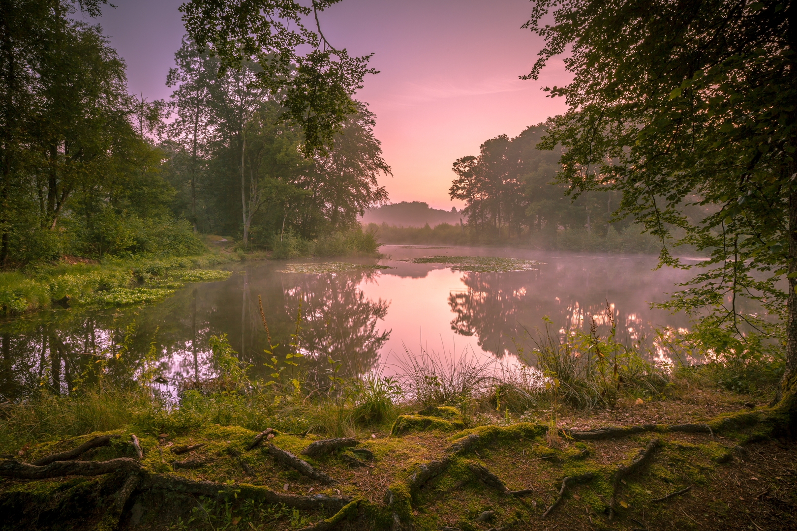
3–7 km / 1.9–4.3 mi: Springs, brooks, and shaded woodland Springendal is known for its water—small springs and clear brooks that thread through the reserve. You’ll likely pass close to the spring-fed headwaters area (often signed locally), where the ground can be noticeably wetter and the vegetation lusher. Listen for birdsong and the subtle sound of running water; the route often follows the easiest natural corridors through the woods.
7–10 km / 4.3–6.2 mi: Uitzichttoren (viewpoint tower) The viewpoint tower is the “punctuation mark” of the loop. The climb up the tower is short but can feel airy if you’re not fond of heights. On clear days, you’ll get a broad look over patchwork fields, woodland blocks, and the gently rolling Twente landscape. The tower area is also a natural place for a snack break—just be mindful of wind exposure if it’s breezy.
10–15 km / 6.2–9.3 mi: Open edges, meadows, and the return The back half typically alternates between more open estate edges and returning woodland, with long, easy-going stretches where you can settle into a steady pace. If you’ve had rain, this is where you may encounter the day’s muddiest sections—sun-exposed tracks dry faster, but shaded hollows can stay slick.
Nature and wildlife to look out for
This part of Overijssel is a classic mix of deciduous woodland, conifer stands, heath-like patches, and agricultural margins, which supports a lot of everyday Dutch wildlife.
- Birdlife: woodpeckers in mature trees, songbirds along hedgerows, and raptors occasionally circling over open fields.
- Mammals: roe deer are possible at quieter times; you may also see signs of foxes and small mammals along path edges.
- Amphibians/insects: near springs and wetter ground, watch for frogs/newts (seasonal) and plenty of insect activity in warmer months.
Stay on established paths around sensitive wet areas—spring zones can be fragile, and detours widen trails quickly.
Historical and cultural context
Springendal sits within the Twente region, an area shaped by centuries of estate management, farming, and woodland use. The “landgoed” (estate) character you’ll feel on this walk—straight tracks, managed woods, and field boundaries—reflects long-term human stewardship layered over older natural features

Surfaces
Unknown
Sand
Asphalt
Dirt
Ground
Concrete
Paved
Comments and Reviews
User comments, reviews and discussions about the Uitzichttoren and Landgoed Springendal Loop, Netherlands.
average rating out of 5
0 rating(s)