Download
3D Flyover
Add to list
More
20.0 km
~4 hrs
6 m
Loop
“A gentle, level wander through pine-scented tracks and shimmering peatlands, with occasional soggy patches.”
A flat, low-effort loop of roughly 20 km (12.4 mi) with about 0 m (0 ft) of climbing, this walk is all about quiet heath-and-wetland scenery, straight sandy tracks through pine and mixed woodland, and long, open views across restored peat and “veen” landscapes. Expect easy footing most of the way, with a few short sections where the path can be soft, muddy, or waterlogged after rain—especially near the veen edges and any boardwalked crossings.
Getting to the start (car + public transport)
Because the start point is listed only as “near,” the most reliable way to pin it down is to use the trail’s GPX/route page in HiiKER and match the first waypoint to the nearest road access/parking area. In this region, trailheads for “veen” loops are commonly signed near small parking pull-ins by forest roads and nature reserve entrances.
- By car: Plan for a small nature-area car park or roadside pull-in near the reserve boundary. Arrive early on weekends—these flat reserve loops are popular with walkers and birders.
- By public transport: The usual pattern is train to a nearby town station, then a local bus toward the reserve-side villages, finishing with a short walk (often 1–3 km / 0.6–1.9 mi) to the signed entrance. Use HiiKER’s start-point coordinates to choose the closest stop and to avoid guessing which entrance is intended.
If you share the start coordinates (or a HiiKER link), I can convert them to the nearest named car park, road, or landmark and give a precise “get-off-here” plan.
What the route feels like underfoot and on the map
You’ll be moving through classic lowland terrain: wide forestry tracks, narrower footpaths skirting wetland margins, and occasional boardwalk or reinforced sections where the ground stays saturated. With essentially no elevation change, pacing is straightforward: most hikers finish in 4.5–6 hours depending on stops for wildlife viewing.
- Surface: firm sand/gravel in the woods; softer peat-edge paths near the veen.
- Wet spots: after rain, expect puddling and slick mud where water drains slowly.
- Exposure: open stretches across heath/veen edges can feel windy and cooler than the forest.
Landmarks, nature, and wildlife to watch for
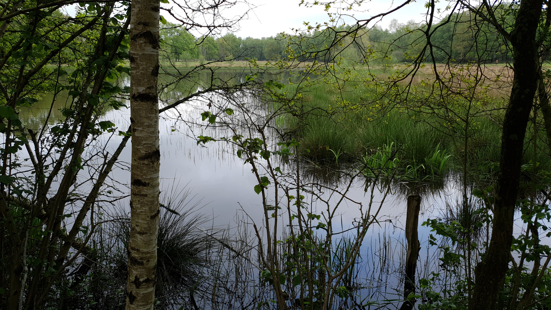
The names “Zandveen,” “Witte Veen,” and “Westenenk” strongly suggest a landscape shaped by sand (zand) and peat/wetland (veen)—a mosaic that often includes heath, boggy pools, and managed woodland.
- Veen margins and pools: These are the most atmospheric parts of the loop—dark water, reedbeds, and spongy ground. Look for dragonflies and damselflies in warmer months and listen for reedbed birds.
- Heath and open clearings: In late summer, heathland can show purple blooms; in cooler seasons it’s more about big skies and long sightlines. Open areas are also where you’re most likely to spot deer at dawn/dusk.
- Woodland blocks: Pine and mixed woodland provide shelter and easy walking. Edges between forest and open wetland are prime for wildlife activity.
Wildlife expectations (seasonal, typical for lowland heath/veen country): - Birdlife: waterfowl on pools, small woodland birds in the trees, and raptors cruising over open ground. Bring binoculars if you enjoy birding. - Mammals: deer are the most likely larger sighting; smaller mammals are usually heard rather than seen. - Insects: ticks can be present in grassy/heathy areas in warmer months—long socks and a quick post-hike check help.
Historical and landscape context
“Veen” landscapes across this part of northwestern Europe are often tied to peat formation and historic peat cutting, followed by later drainage, forestry planting, and modern restoration to re-wet areas for biodiversity and carbon storage. Even when you don’t see obvious “history boards,” the straight tracks, drainage lines, and the sharp transitions between wetland and plantation-style woodland can reflect that long land-use story. If the loop passes any information panels, they’re usually placed at reserve entrances or viewpoints and are worth a pause—they often explain how water levels are managed and why certain areas are kept open rather than allowed to revert to forest.
Practical planning: what to bring and what to look out for
- Footwear: light hiking shoes are fine in dry spells; after rain, water-resistant trail shoes or boots are more comfortable near the veen.
- Clothing: windproof layer for open sections; the forest can feel still, but the wetland edges can be breezy.
- Navigation: the trail network can include many intersecting forestry tracks that look similar—keep HiiKER handy and confirm junctions before committing.
- Food/water: for a 20 km (12.4 mi) easy loop, carry enough for half a day; services are often limited once you leave the nearest village edge.
- Trail etiquette: these reserves frequently have shared use with cyclists on wider tracks—listen for bikes approaching from behind and step aside at safe, wide points.
If you provide the start location (lat/long) or the HiiKER route link, I’ll pinpoint the nearest address/parking area/landmark, estimate time splits by kilometre/mile, and call out the most likely wettest sections and best viewpoints along the exact line of travel.

Surfaces
Sand
Unknown
Asphalt
Concrete
Dirt
Grass
Ground
Unpaved
Paved
Comments and Reviews
User comments, reviews and discussions about the Zandveen, Witte Veen and Westenenk Loop, Netherlands.
average rating out of 5
0 rating(s)