Download
3D Flyover
Add to list
More
18.4 km
~3 hrs 41 min
0 m
Loop
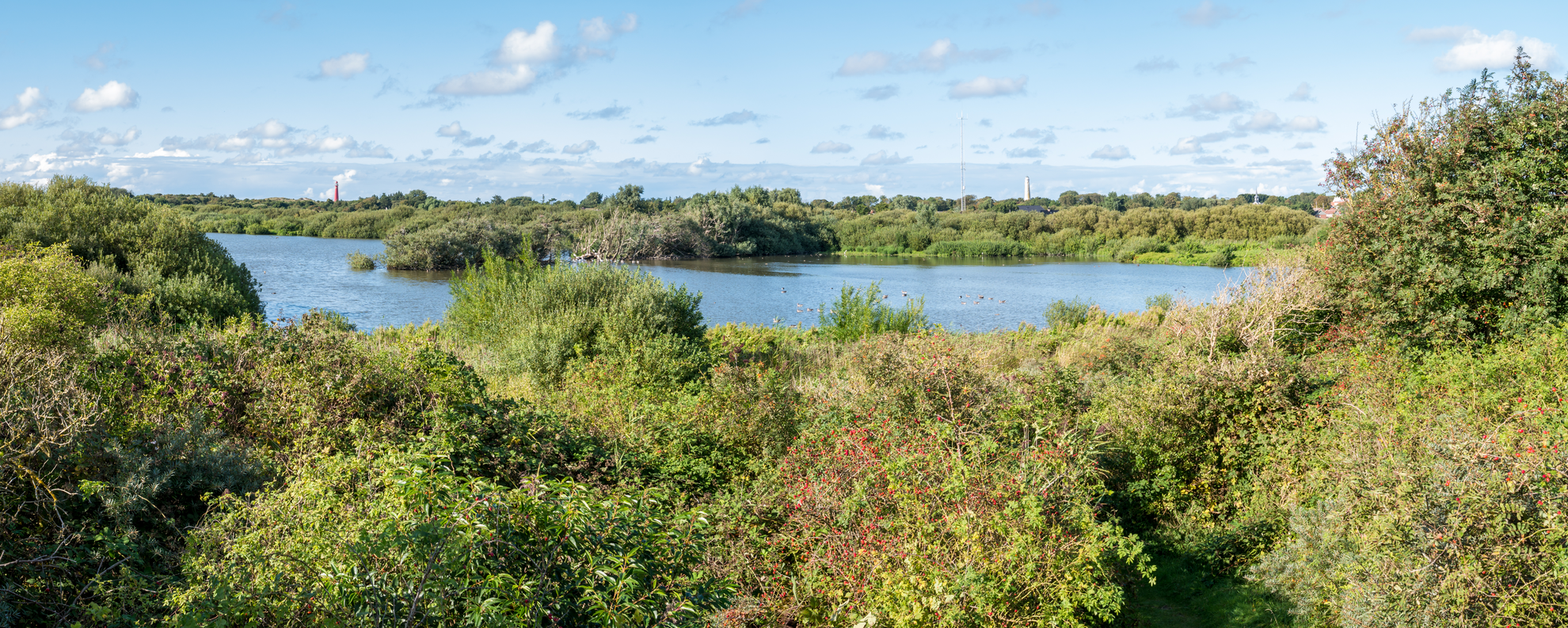
“A breezy, mostly level loop of sky, reeds and shimmering water through the Dutch polder’s quiet geometry.”
An easy, mostly level loop of about 18 km (11.2 mi) with essentially 0 m (0 ft) of climbing, this walk is all about big skies, water, and wide-open Dutch landscape. Expect a mix of paved paths, compact gravel, and short stretches of grass or earth track—generally comfortable in trail shoes, with waterproof footwear helpful after rain where paths can hold shallow water.
Getting to the start (public transport + car)
Because the start point is only listed as “near” (no town, coordinates, or trailhead provided), the most reliable way to pinpoint the exact trailhead is to open the route in HiiKER and use the “navigate to start” function. If you share the lon/lat (or a HiiKER link), I can convert it to the nearest street address or recognizable landmark and tailor the transport directions precisely.
In the meantime, here’s how this kind of loop is typically accessed in the Netherlands: - By public transport: aim for the nearest railway station to the Westerplas area, then connect via local bus and finish with a short walk (often 10–30 minutes) to the trailhead. In many Dutch lake-and-polder areas, the last mile is easiest on foot or by bike. - By car: look for signed parking near the main recreation access points around the water (often marked as P near beaches, marinas, bird hides, or day-use areas). Arrive earlier on weekends—lakeside lots can fill quickly in fair weather.
What the route feels like underfoot
With negligible elevation change, the effort comes from distance and wind exposure, not hills. You’ll likely be walking on: - Dike-top paths (often paved or hard-packed): smooth, fast walking, but can be breezy. - Lakeside promenades / recreation paths: wider, shared-use surfaces—watch for cyclists. - Polder-edge tracks: narrower, sometimes soft or muddy after rain; occasional farm access lanes.
Plan for 3.5–5 hours of moving time depending on pace and stops.
Landmarks, scenery, and the “shape” of the day
The loop’s character is typically defined by two anchors:
- Johannes de Jongpad: commonly a named footpath segment that threads through local green space and waterside edges. These named pads often pass small bridges, reedbeds, and viewpoints where the landscape opens up.
- Westerplas: “plas” indicates a lake/pond—often a former peat excavation, sand extraction, or managed water body now used for recreation and nature. Expect long, open sightlines across water, with reed fringes and pockets of willow/alder scrub.
You’ll likely alternate between open water views and polder geometry—straight drainage canals, grazing fields, and lines of trees acting as windbreaks. If the loop includes any dike sections, those are usually the most panoramic parts of the walk.
Nature and wildlife to look out for
Even in heavily managed Dutch lowlands, wildlife can be excellent—especially around reedbeds and shallow margins.
Birdlife (most noticeable year-round): - Waterfowl such as mallard, coot, moorhen, and geese are common on lakes and canals. - Reedbed birds (seasonal) may include reed warblers and other small passerines—more often heard than seen in spring/summer. - Raptors like kestrel or buzzard may be seen hunting over open fields. - In migration periods, scan shorelines and shallows for waders.
Mammals and amphibians: - Along calm banks and ditches, you may spot signs of muskrat/nutria activity in some regions (burrows, grazed vegetation), and frogs are common near wet margins in warmer months.
Plants and habitats: - Expect reeds (Phragmites), sedges, and wet meadow plants near the water, with willow and alder in damper pockets. In summer, lakeside paths can have tall vegetation brushing the trail edges.
Practical hazards and what to watch for
- Wind exposure: With flat terrain and open water, wind can be the biggest factor. A calm forecast can still feel chilly near the lake.
- Shared paths: Many Dutch waterside routes are multi-use. Stay alert for fast cyclists, especially on blind bends and narrow bridges.
- Slippery edges: Canal and lake banks can be steep or undercut. Keep a safe distance from the edge, particularly on narrow grassy verges.
- Seasonal mud / standing water: After rain, low points can puddle. Waterproof shoes help; gaiters are optional but useful in wet grass.
- Sun exposure: With few hills, there can also be few trees—bring sun protection on bright days.
Navigation and services
This is the kind of loop where intersections can look similar—straight tracks, repeated bridges, and parallel canals—so it’s worth having the route loaded in HiiKER for turn-by-turn confidence.
For water and rest stops: - Lakeside areas often have benches, picnic spots, and occasional cafés near main access points, but quieter stretches may have no services for long intervals. Carry enough water for the full distance, especially on warm days.
Historical context of the landscape
A flat, near-zero-elevation-gain route around a “plas” and along polder edges is typically walking through a landscape shaped by centuries of Dutch water management:
- Polders, dikes, and drainage canals reflect land reclaimed or stabilized for agriculture and settlement.

Surfaces
Unknown
Asphalt
Sand
Grass
Concrete
Cobblestone
Wood
Comments and Reviews
User comments, reviews and discussions about the Johannes de Jongpad and Westerplas Loop, Netherlands.
average rating out of 5
0 rating(s)