Download
3D Flyover
Add to list
More
8.0 km
~1 hrs 41 min
55 m
Loop
“A gentle woodland loop near Rozendaal—beeches, oaks, sandy paths, and softly rolling “high points.””
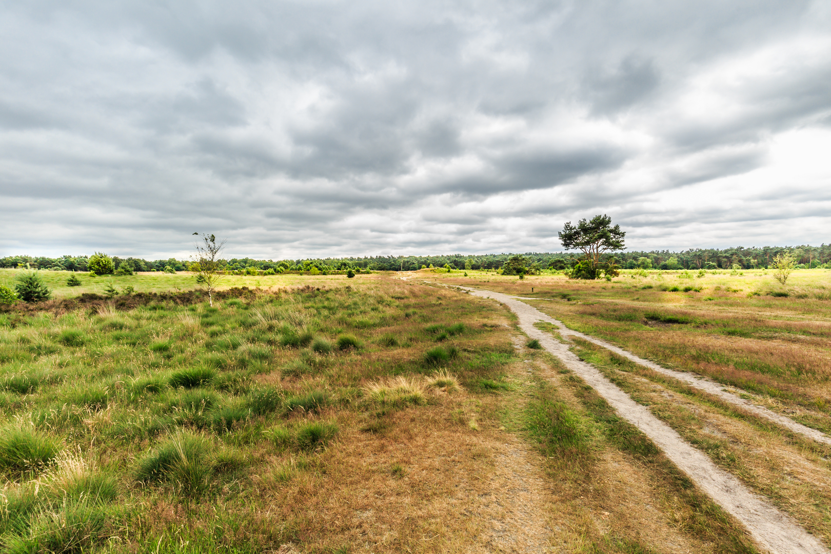
This easy loop is a gentle, mostly wooded walk of about 8 km (5.0 mi) with roughly 100 m (330 ft) of total climbing—ideal for a half-day outing with plenty of variety: beech and oak forest, sandy paths, small heath-like clearings, and a couple of subtle “high points” (the Zwarte Bulten area) that give the route its rolling feel without ever becoming strenuous.
Getting to the start (and where “near” usually means here)
Because the hike head location is incomplete (“near …”), the most practical and common start for this loop is by the Rozendaalse Bos / Veluwezoom access points on the edge of Rozendaal (near Arnhem, Gelderland)—typically around the forest entrances close to Kasteel Rosendael (Rosendael Castle) and the village edge where signed walking routes begin.
- By car: Aim for parking near Kasteel Rosendael (Rosendael Castle), Rozendaal, which is a well-known landmark and a frequent gateway into Rozendaalse Bos. From there, you can pick up forest tracks immediately without road-walking.
- By public transport: The nearest major rail hub is Arnhem. From Arnhem, local buses commonly serve Rozendaal and stops near the village/estate area; from the stop it’s usually a short walk to the forest edge and the castle/estate approaches. Check the day’s bus routing and walking approach in HiiKER so you start on the correct side of the estate/forest boundary.
If you share the missing start coordinates (lon/lat), I can pin it to the nearest address or named landmark precisely and tailor the approach directions to the exact trailhead.
You’ll begin on broad, well-used forest paths—often compacted sand or fine gravel—under tall deciduous canopy. The first kilometer or so is typically the “settling in” section: gentle gradients, easy footing, and a clear sense of being in managed woodland rather than deep wilderness. Expect occasional cyclists on wider tracks; keep right and listen for bells on blind corners.
As you arc away from the village edge, the route becomes quieter and more immersive. The forest here is part of the greater Veluwe landscape—one of the Netherlands’ most significant natural regions—shaped by ancient river systems and Ice Age processes that left behind sandy soils and low ridges. Those subtle rises are what you’ll feel as the loop accumulates its modest ~100 m (330 ft) of gain in small increments rather than one big climb.
Through Rozendaalse Bos: terrain, landmarks, and what to watch for
Between roughly 1.5–4 km (0.9–2.5 mi) you’ll usually be in the heart of the woods. The character alternates between: - Beech stands with smooth trunks and a more open understory (often leaf-littered and tidy), - Mixed oak and pine sections where the ground can be sandier and the trail may braid into parallel lines.
Footing: Mostly straightforward, but after rain the sandy base can turn into soft patches and shallow puddling in low spots. In drier weather, sand can feel slightly “draggy,” especially if you’re in lighter shoes—still easy, just a bit more effort.
Navigation: Intersections can come quickly in managed forests where multiple tracks meet. Use HiiKER to confirm you’re taking the correct branch, especially where a wide track splits into two equally inviting options.
Wildlife: This area is known for roe deer and, in the broader Veluwe region, red deer and wild boar. You’re most likely to spot deer at quieter times of day near edges of clearings. Wild boar are typically shy; if you do encounter them, give them space, keep calm, and avoid getting between an adult and any young. Birdlife is often the most visible: woodpeckers, jays, and small songbirds in the canopy.
Zwarte Bulten: the “high points” and the most scenic feel
Around 4–6.5 km (2.5–4.0 mi) you’ll reach the Zwarte Bulten portion—“bulten” referring to low hills or mounds. This is where the loop tends to feel the most undulating, with short rises and dips that account for much of the day’s elevation gain. None of these climbs are long; think brief 10–30 m (30–100 ft) pushes that end as soon as they begin.
You may notice: - Slightly more open patches where light reaches the ground, - A change in vegetation—more heather-like textures or scrubby edges in places, - Occasional viewpoints through the trees rather than big panoramas (this is a forest walk, not a ridge hike).
What to look out for: Some of the smaller paths here can be narrower and more rooty. Roots can be slick in wet conditions and are the most common “trip hazard” on an otherwise easy route. If it’s been windy, keep an eye out for small fallen branches and, rarely, partially downed trees across minor tracks.
Historical and cultural context
Rozendaal and the surrounding woods are closely tied to estate landscapes—a hallmark of this part of Gelderland—where forests were historically managed for timber, hunting, and as designed scenery around country houses. Kasteel Rosendael is a key cultural landmark in the area, and the surrounding woodland has long been part of the “green buffer” between Arnhem and the Veluwe’s larger natural expanses. Even when you’re deep among trees, the straightness of some tracks

Surfaces
Dirt
Unknown
Ground
Sand
Gravel
Comments and Reviews
User comments, reviews and discussions about the Rozendaalse Bos and Zwarte Bulten Loop, Netherlands.
average rating out of 5
0 rating(s)