Download
3D Flyover
Add to list
More
12.1 km
~2 hrs 25 min
0 m
Point-to-Point
“Begin your journey on the Pieterpad with wide skies, village charm, and tranquil fields unfolding before you.”
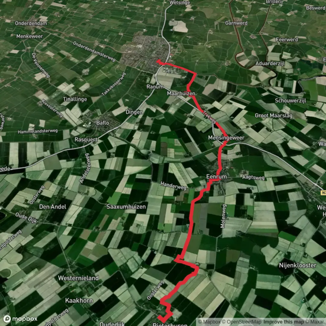
Starting from the northern village of Pieterburen, this first stage of the Pieterpad covers approximately 12 km (7.5 miles) with virtually no elevation gain, making it an accessible and gentle introduction to the Netherlands’ most famous long-distance trail. The route begins near the Seal Rehabilitation and Research Centre (Zeehondencentrum Pieterburen), a well-known local landmark, and heads south through the open, flat landscapes of Groningen province.
Getting There
Pieterburen is accessible by public transport from Groningen city. Take a train to Winsum, then transfer to a local bus (line 68) that stops in Pieterburen, just a short walk from the trailhead. For those arriving by car, parking is available near the Seal Centre. Winsum, the endpoint, is served by regular trains back to Groningen, making logistics straightforward for a point-to-point hike.
Trail Experience and Navigation
The trail follows quiet country roads, grassy dikes, and farm tracks, passing through a patchwork of meadows, canals, and small villages. Navigation is straightforward, with the Pieterpad’s distinctive red-and-white waymarks guiding the way. For added confidence, use HiiKER to track your progress and access detailed maps.
Landmarks and Points of Interest
- Pieterburen: The starting village is famous for its seal sanctuary, which is worth a visit before or after your hike. The village itself is charming, with traditional brick houses and a peaceful rural atmosphere.
- Hogeland Landscape: The route traverses the Hogeland, a region characterized by its wide, open skies, fertile fields, and ancient terps (man-made dwelling mounds). The flatness of the land offers unobstructed views and a sense of tranquility.
- Wierhuizen: Around 4 km (2.5 miles) into the hike, you’ll pass the hamlet of Wierhuizen, notable for its historic church ruins and terp. This area is rich in birdlife, especially waders and waterfowl, thanks to the surrounding wetlands.
- Canals and Bridges: The trail crosses several picturesque canals, including the Mensingeweersterloopdiep. Watch for traditional Dutch drawbridges and the occasional passing boat.
- Winsum: The endpoint is one of the prettiest villages in the Netherlands, with its twin churches, historic windmills, and waterside cafés. Winsum’s old center is a protected heritage site, and the village has twice been voted the most beautiful village in the country.
Nature and Wildlife
Expect to see a variety of farmland birds, including lapwings, oystercatchers, and starlings. The ditches and ponds along the route are home to frogs and dragonflies in summer. The open fields may also reveal hares and, in spring, the vibrant colors of wildflowers.
Historical Significance
This region of Groningen has been inhabited for centuries, with evidence of early settlements on the terps. The landscape tells the story of Dutch water management, with its network of dikes, canals, and reclaimed land. Many of the small villages along the route have medieval churches and remnants of ancient farmsteads, reflecting the area’s long agricultural history.
Practical Tips
The route is exposed, with little shelter from wind or sun, so bring appropriate clothing and sun protection. There are limited facilities between Pieterburen and Winsum, so carry water and snacks. Both villages offer cafés and shops for refreshments at the start and finish. The flat, well-marked path is suitable for all fitness levels and ideal for a relaxed day’s walk through classic Dutch countryside.

Surfaces
Asphalt
Unknown
Concrete
Grass
Paved
Wood
Comments and Reviews
User comments, reviews and discussions about the Pieterburen to Winsum via Pieterpad deel 1, Netherlands.
average rating out of 5
0 rating(s)