Download
Preview
Add to list
More
10.7 km
~2 hrs 8 min
0 m
Loop
“A big-sky polder loop from Kieldrecht’s church, where reeds, creeks, and port horizons mingle.”
Expect an almost perfectly flat polder loop of about 11 km / 6.8 mi with essentially 0 m / 0 ft of climbing—more “big-sky walking” than “hiking,” with long sightlines, wide dikes, and a constant presence of water. Underfoot is typically a mix of quiet village streets, farm lanes, dike-top paths, and some softer track sections that can turn slick or muddy after rain.
Getting to the start (nearest clear landmark/address) The most reliable startpoint for this loop is by the church in Kieldrecht (Sint-Michielskerk area), 9130 Kieldrecht, Beveren, Belgium—a common trailhead for the Kieldrecht kreek/dike walks. (routen.be)
- By car: Navigate to Kieldrecht church (Kerk, 9130 Kieldrecht) and use nearby street parking in the village center. (wandelknooppunt.be)
- By public transport: Regional buses serve Kieldrecht; plan the last-mile details with current schedules and stops (they can change seasonally). From the village center, it’s a short walk to the church area where the loop is easiest to pick up. (If you share your departure city, I can outline a practical connection.)
Route flow and what you’ll see (with approximate distances)
0.0–1.7 km (0.0–1.1 mi): Village edge → first open polder views
From the church area, you quickly leave the tighter village streets and step into open country. The landscape flattens out into fields and drainage channels, and you’ll start to feel the “dike rhythm”: straight lines, wind exposure, and wide horizons.
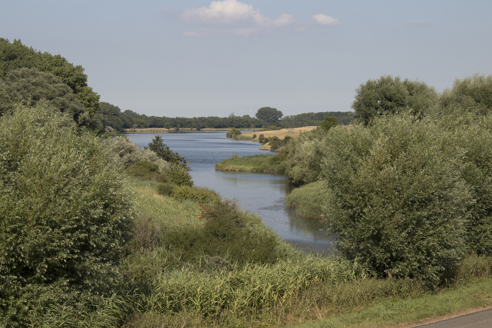
1.7–3.5 km (1.1–2.2 mi): Along the kreek—reedbeds and waterbird territory
This is where “De Kreekoever” makes sense as a name: you’re walking near the Grote Geule / Kieldrechtse Kreek, an old watercourse with broad reed margins. It’s a strong birding section—scan the water and reed edges for ducks and other wetland species, and listen for constant movement in the reeds. (routen.be)
What to look out for here:
- Wind: dikes offer little shelter; a mild forecast can still feel sharp.
- Soft verges: the grassy edge can be saturated; stay on the firmer line to avoid sliding into muddy ruts.
Nature & wildlife (best practices for spotting)
The loop passes a mosaic of polders, creeks, and managed wetland pockets, which makes it productive for wildlife even on a short, easy walk. Rietkragen (reedbeds) and shallow water attract wintering and migrating birds; bring binoculars if you have them. (routen.be)
Etiquette that matters here: keep voices low near reedbeds, pause at dike benches/viewpoints rather than approaching the waterline, and give grazing animals a wide berth.
3.5–6.5 km (2.2–4.0 mi): Wetland reserve feel—Drijdijck area and “polder meets port” contrast
A standout middle section is near Drijdijck, described as a plas-dras (shallow wet) habitat created by raising water levels—excellent for water and marsh birds, especially in winter when parts can be inundated. (routen.be)
This is also where the region’s character really shows: tranquil wetland foreground with major port/industrial infrastructure visible across the way, a striking contrast that’s typical around the Antwerp port fringe. (routen.be)
Practical note: if water is high, expect damp air, slick boards/edges, and occasional puddling on low points.
**6.5–9.0 km (4.0–5.6

Surfaces
Unknown
Asphalt
Unpaved
Grass
Dirt
Comments and Reviews
User comments, reviews and discussions about the De Kreekoever and Braamsweg Loop, Netherlands.
average rating out of 5
0 rating(s)