Download
3D Flyover
Add to list
More
8.9 km
~1 hrs 47 min
7 m
Loop
“Wander from pine-shadowed tracks onto Otterlose Zand’s inland dunes—breezy, sandy, and wildlife-watchful.”
This easy loop is a classic Veluwe-style wander: wide sandy tracks, pockets of heath and pine, and open “zand” (drift-sand) where the landscape feels almost dune-like despite being inland. At roughly 9 km / 5.6 mi with essentially 0 m / 0 ft of sustained climbing, it’s well-suited to a relaxed half-day outing—more about scenery, textures underfoot, and wildlife spotting than elevation.
Where the hike starts (nearest landmark) The route name points strongly to the Otterlose Zand area on the Veluwe, near the village of Otterlo (Gelderland, Netherlands). A practical, well-known place to anchor your start is around Otterlo village / the Kröller-Müller Museum & De Hoge Veluwe National Park entrances—both are prominent, easy-to-find landmarks used by hikers and visitors as meeting points. If you share the exact lon/lat (or a map), I can pin it to the nearest specific parking area, bus stop, or trailhead landmark.
Getting to the start (car + public transport)
By car - Aim for Otterlo and follow signs for Nationaal Park De Hoge Veluwe or Kröller-Müller Museum. In and around Otterlo you’ll typically find signed parking areas serving the park approaches and local trail networks. - Expect busier parking on weekends and school holidays; arriving earlier helps if you want a quieter start.
By public transport - The usual approach is train to Ede-Wageningen (major rail station for the region), then a bus toward Otterlo. From Otterlo village, you can walk to the trail network leading toward the drift-sand and forest blocks. - Check the day’s bus frequency before committing—service can be less frequent outside peak hours.
What the terrain feels like (and what that means for planning)
Even with negligible elevation gain, this loop can feel “worky” in places because of soft sand: - Surface: a mix of compact forest paths, sandy double-tracks, and open drift-sand sections. Soft sand increases effort and can slow pace. - Footwear: trail shoes are fine in dry conditions; after rain, some forest sections can be damp but generally not muddy like clay soils. - Wind exposure: the open sand/heath areas can be breezy and feel cooler than the forest—bring a light layer even on mild days. - Navigation: the Veluwe has many intersecting tracks; load the route in HiiKER and keep an eye on junction density, especially where multiple sandy lanes braid together.
Route flow and key landmarks (approximate distances)
0.0–2.0 km (0.0–1.2 mi): Forest approach You’ll typically begin on easy, level tracks through pine and mixed woodland. The forest here is managed but still atmospheric—straight trunks, filtered light, and a soft understory of mosses and low shrubs. This early section is ideal for settling into a steady pace and checking your HiiKER track at the first few junctions.
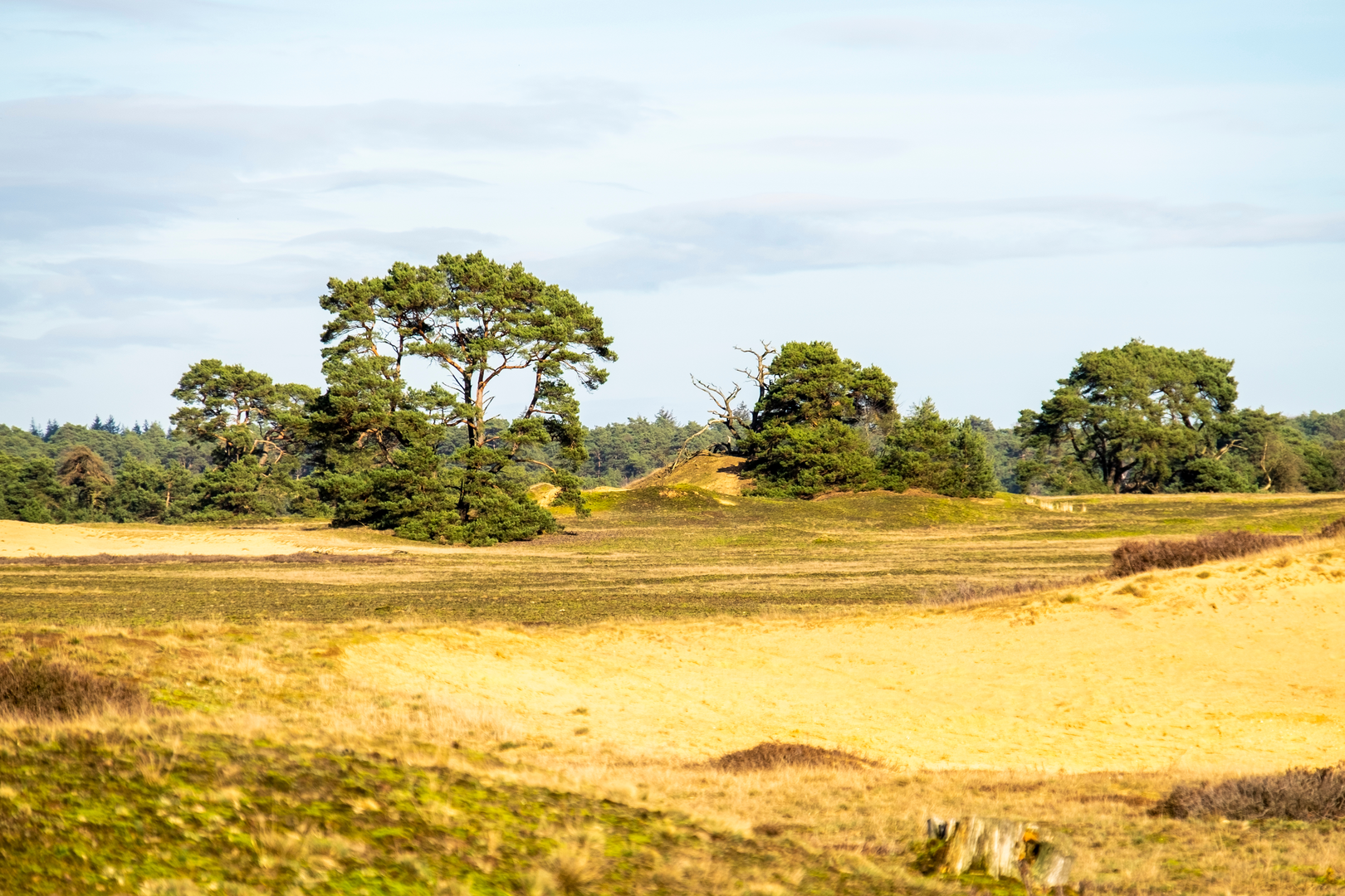
2.0–5.5 km (1.2–3.4 mi): Otterlose Zand—open drift-sand and heath This is the signature middle of the loop. The Otterlose Zand is part of the Veluwe’s inland drift-sand landscapes—areas where wind-blown sand historically expanded due to grazing, sod-cutting, and land use that reduced vegetation cover. Modern conservation often aims to keep some sand active (open) because it supports specialized species and preserves the rare “desert-like” habitat mosaic.
What to look for: - Shifting sand patches with sparse pioneer plants (grasses, lichens). - Heath edges (often heather and low shrubs) transitioning into forest. - Big-sky views and long sightlines—great for spotting wildlife at a distance.
Underfoot, this is where you may hit the deepest sand. If you want to keep it easy, choose the firmer margins of tracks where possible and keep your stride shorter.
5.5–7.5 km (3.4–4.7 mi): Return through woodland and quieter tracks You’ll re-enter forest where the footing firms up. This section often feels cooler and calmer after the openness of the sand. It’s also where wildlife encounters can happen suddenly—animals move along the cover of tree lines and cross tracks quickly.
7.5–9.0 km (4.7–5.6 mi): Final leg back toward the start The last stretch is typically straightforward, following broader paths back toward the trailhead area. If you’re finishing near Otterlo or a park approach, you may notice more day visitors and cyclists on shared-use tracks—stay alert at bends and junctions.
Nature and wildlife you may encounter
The Veluwe is one of the Netherlands’ best-known wildlife regions. While sightings are never guaranteed, this landscape is good habitat for: - Red deer and roe deer (most active at dawn/dusk; look along forest edges near open sand). - Wild boar (often heard before seen; watch for rooting signs in softer ground). - Foxes and small mustelids (quick, low movement along edges). - Birdlife: woodpeckers in forest, and open-area species around heath/sand.
Practical wildlife etiquette: - Keep voices low in the open sand/heath—sound carries. - Give animals space; don’t follow them into vegetation. - If you see fresh boar rooting or tracks, stay aware and keep dogs close

Surfaces
Unknown
Gravel
Sand
Asphalt
Comments and Reviews
User comments, reviews and discussions about the Franse Berg, t Rieselo and Otterlose Zand Loop, Netherlands.
average rating out of 5
0 rating(s)