Download
3D Flyover
Add to list
More
17.3 km
~3 hrs 27 min
0 m
Loop
“A long, level wander through wind-brushed heath and quiet pines, where distance becomes meditation.”
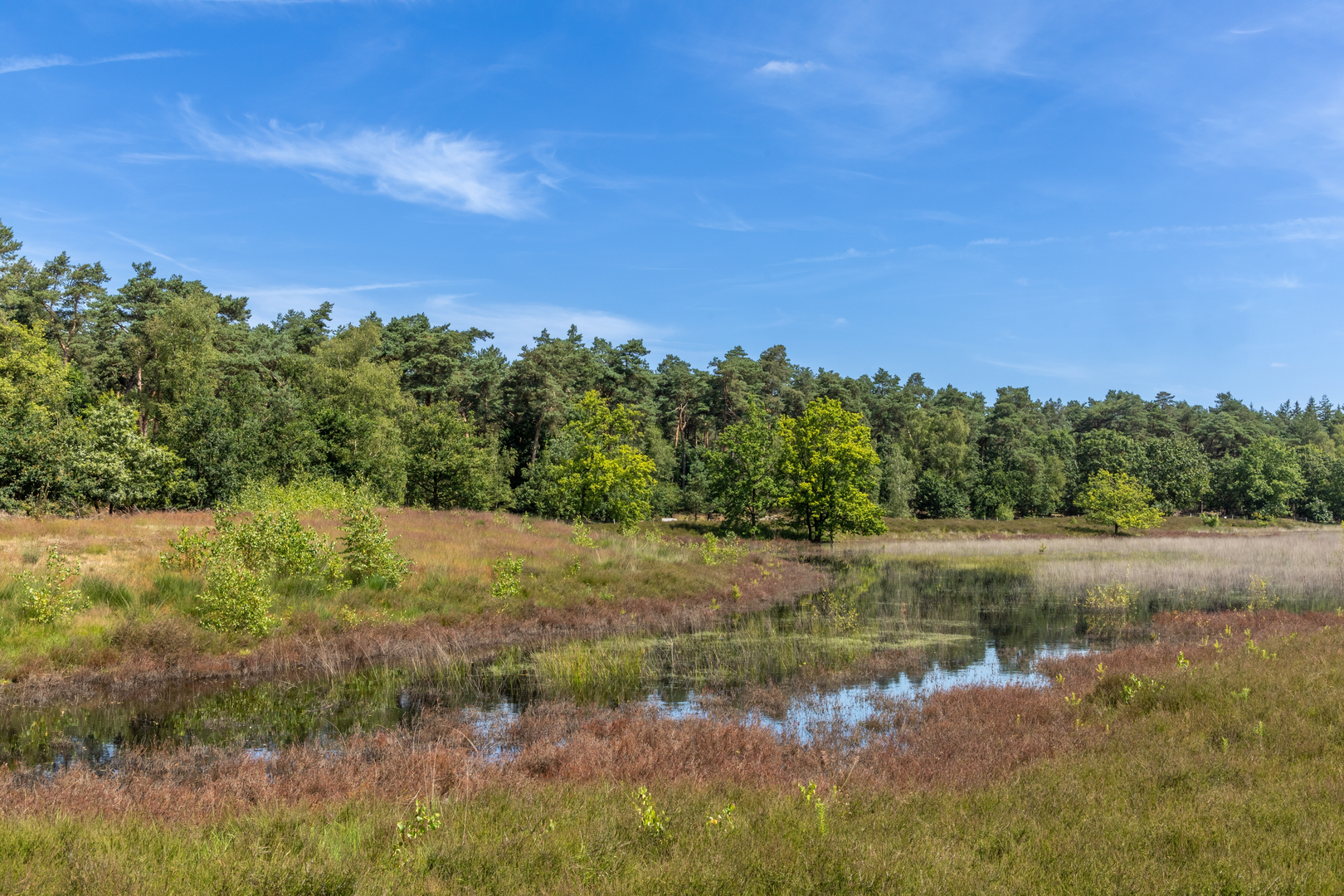
A flat, lowland loop of roughly 17 km / 10.6 mi with essentially 0 m / 0 ft of climbing, this walk is all about easy-going mileage through open heath, sandy tracks, and quiet woodland edges. Expect long, level stretches where your pace stays steady, plus a few short, gentle undulations that won’t register much as “elevation gain” but can feel slightly softer underfoot in sandy sections.
Because your start point is listed only as “near” (with no coordinates), I can’t reliably convert a lon/lat to a nearby address or landmark yet. If you share the start coordinates (or the nearest town/village name), I’ll pin it to the closest recognizable place (e.g., a trailhead parking area, church square, or transit stop) and tailor the access directions precisely.
Getting to the start (car + public transport)
By car: In this part of the Low Countries, heathland loops like Luchensche Heide/Molenheide typically begin near a small parking pull-in or signed nature-area car park at the edge of the heath. Plan for narrow local roads and limited shoulder space; arrive earlier on weekends if the area is popular with dog walkers and cyclists.
By public transport: The most common pattern is train to the nearest larger town, then a local bus toward the heath/forest edge, finishing with a 1–3 km (0.6–1.9 mi) walk-in on quiet lanes or cycle paths. Once you provide the nearest town or coordinates, I’ll identify the most sensible station/bus stop pairing and the shortest walk-in.
What the route feels like underfoot
You’ll likely alternate between: - Wide, compacted gravel or sandy forestry tracks (easy navigation, can be soft after dry spells) - Heathland paths (narrower, sometimes sandy; can be muddy in wet periods) - Short paved connectors near farms or small settlements (quick, straightforward transitions)
With the route being essentially flat, the main “effort” factor is distance, not climbing. Footwear-wise, light hikers or trail shoes are usually enough; after rain, choose something with decent tread for sandy-muddy mixes.
Heathland and woodland: landmarks, nature, and what to look for
The “heide” landscape is a classic cultural-nature mosaic: open heath maintained historically by grazing, turf cutting, and later conservation management. Depending on season and management, you may see: - Heather and acid grassland (late summer often brings the most color where heather is present) - Pine and mixed woodland edges that shelter the paths from wind - Small drainage ditches, ponds, or wet hollows typical of lowland heaths—watch for slick plank crossings or muddy pinch points
Wildlife is often subtle but rewarding if you slow down: - Heathland birds (listen for calls over open ground; early morning is best) - Roe deer at woodland margins, especially at dawn/dusk - Reptiles such as lizards in sunny sandy patches (they’re shy—look for quick movement near path edges) - Insects: dragonflies near wet spots; butterflies along sunny verges in warmer months
If the loop passes any managed grazing areas, you may encounter sheep or cattle used to keep the heath open. Give animals space, keep dogs controlled, and don’t assume electric fencing is inactive.
Navigation and pacing
This is the kind of loop where it’s easy to drift onto the “wrong but plausible” forestry track because everything looks similarly straight and level. Use HiiKER to: - Confirm you’re taking the correct branch at multi-track junctions - Check distance-to-go so you can plan breaks (a good rhythm is a short stop every 4–6 km / 2.5–3.7 mi) - Reassure yourself on long straightaways where landmarks are sparse
Signal is usually decent in lowland areas, but wooded pockets can be patchy—download the route in HiiKER before you set off.
Weather, exposure, and comfort
Even without hills, this terrain can feel surprisingly “big”: - Wind exposure on open heath can make it feel colder than expected; pack a light shell even on mild days. - Sun exposure can be significant with little shade—bring water and sun protection. - After wet weather, expect muddy sections where heath meets woodland and where drainage collects.
For an easy 17 km / 10.6 mi day, many hikers carry 1–1.5 L of water (more in warm weather) and a snack/lunch; facilities are often limited once you leave the nearest village edge.
Historical context of heathlands in the region
Heathlands across this part of northwestern Europe are often semi-natural: shaped by centuries of human land use—grazing, cutting heather for bedding, and harvesting turf/peat in wetter areas. Modern conservation typically aims to prevent the heath from turning into closed forest, so you may notice: - Cutting or mowing strips - Young pine removal - Grazing programs These management signs are part of keeping the landscape open and biodiverse rather than “abandoned.”
If you share the start location (coordinates or nearest town) and, if possible, the hike type (loop confirmed, but whether it’s primarily heath/forest/boardwalk), I’ll tighten this into a turn-by-turn style overview with key junctions, likely landmark points, and the nearest known address/landmark for the trailhead.

Surfaces
Ground
Sand
Unpaved
Asphalt
Unknown
Concrete
Comments and Reviews
User comments, reviews and discussions about the Luchensche Heide and Molenheide Loop, Netherlands.
average rating out of 5
0 rating(s)