Download
3D Flyover
Add to list
More
20.4 km
~4 hrs 4 min
0 m
Loop
“A flat, horizon-wide loop through reedbed wetlands, peat-heath mosaics and quiet farm tracks—sometimes soggy, often windswept.”
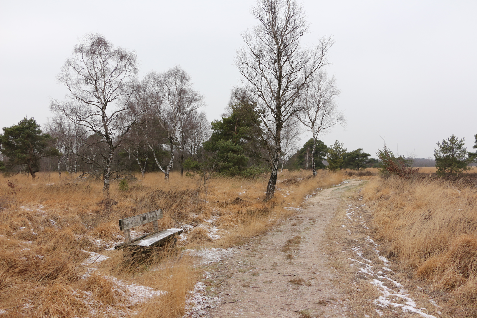
This is a mostly level, lowland loop of about 20 km (12.4 mi) with essentially 0 m (0 ft) of climbing, linking three very different-feeling sections: open “bodden”/wetland edges, the peat-and-heath landscapes associated with De Groote Peel, and a quieter rural stretch often marked by drainage ditches, small woods, and farm tracks. Expect easy walking fitness-wise, but plan for soft ground, wind exposure, and wet feet risk depending on season and recent rain.
Getting to the start (car + public transport)
Because the start point is listed only as “near” (no coordinates provided), the most practical way to plan is to anchor your start at a well-known access point on the edge of De Groote Peel. Common, easy-to-navigate trailheads in this area are around the Buitencentrum De Pelen (visitor center) near Ospel (Limburg, NL) and the main parking areas by the reserve entrances.
- By car: Aim for the main visitor center/primary reserve parking for De Groote Peel (often signed locally as the visitor center for “De Pelen/De Groote Peel”). From there, you can stitch together the loop using HiiKER and local waymarking. Parking is typically straightforward at reserve entrances, but arrive earlier on weekends/holidays.
- By public transport: The nearest larger rail hubs are typically Weert and Deurne (depending on which side you start). From there, you’re usually looking at a bus toward Ospel/Meijel plus a short walk to the reserve edge. Check the day-of schedule carefully—rural services can be infrequent, especially Sundays.
If you share the lon/lat for “Hike head,” I can convert it to the nearest recognizable address/landmark and tailor the approach directions precisely.
What the terrain is like (and what to wear) - Surface: A mix of compacted paths, boardwalk-like sections in wetter areas, sandy/gravel farm tracks, and occasional narrow singletrack along ditches or reed margins. - Footwear: Even on an “easy” profile, this is a place where waterproof trail shoes or light boots can be the difference between comfortable and miserable. After rain, peat edges and shaded tracks can stay wet for days. - Wind & exposure: Much of the Peel landscape is open. Bring a wind layer even when it’s mild. - Navigation: Waymarking can be good, but intersections of farm tracks and reserve paths can be confusing. Load the route in HiiKER and keep an eye on turns where paths run parallel to drainage lines.
Route flow and key sections (approximate)
0–4 km (0–2.5 mi): Wetland edge and “bodden” character You’ll likely begin on broad, easy paths with long sightlines across low vegetation and reedbeds. The “bodden” feel here is about flat horizons, waterlogged ground, and seasonal pools. In cooler months, expect muddy pinch points; in summer, the same areas can firm up but may bring insects—pack repellent if you’re sensitive.
4–11 km (2.5–6.8 mi): De Groote Peel—peatland, heath, and water This is the heart of the walk: a landscape shaped by peat formation and historic peat extraction. The Peel region is famous for its raised bog history—centuries of cutting and drainage altered the hydrology, and modern conservation focuses on re-wetting and habitat recovery. You’ll notice: - Straight drainage ditches/canals and geometric water bodies that hint at past industrial-scale work. - Heath and bog vegetation: heather, sedges, cotton-grass in season, and scrubby birch/pine on drier margins. - Birdlife: This is prime territory for wetland and heath birds. Bring binoculars if you have them—open water and reed edges often hold the most activity. Keep voices low near reedbeds, especially in spring/early summer.
Practical note: even though elevation gain is near zero, this section can feel “slower” if you hit soft peat, puddled trail, or narrow passing points.
11–16 km (6.8–10 mi): Aan’t Elfde Loop—quiet rural connectors This portion typically transitions to calmer, more sheltered walking: field edges, small woods, and long straight tracks. It’s easy underfoot and a good place to settle into a steady pace. Watch for: - Cyclists and local farm traffic on shared tracks. - Livestock fencing and gates—close anything you open. - Drainage-side paths: the edge can be undercut or slick; give the ditch a little extra berth.
16–20 km (10–12.4 mi): Return along reserve margins The final stretch often brings you back toward reserve signage and more frequent walkers. If you started near a visitor center/primary car park, you’ll likely rejoin wider paths and clearer wayfinding.
Landmarks, nature, and what to look out for
- Peatland hydrology features: straight canals/ditches, small sluices, and re-wetted pools—these are the “infrastructure” of both the extraction era and modern restoration.
- Heath and bog flora: heather and cotton-grass (when in season) are standout visuals; in wetter pockets, sedges and reeds dominate.
- Wildlife: Expect a strong chance of waterfowl and marsh birds; raptors may patrol open areas. Larger mammals are usually shy—more often you’ll see tracks and movement

Surfaces
Unknown
Unpaved
Asphalt
Dirt
Concrete
Comments and Reviews
User comments, reviews and discussions about the Eeuwselse Bodden, De Groote Peel and Aan't Elfde Loop, Netherlands.
average rating out of 5
0 rating(s)