Download
3D Flyover
Add to list
More
6.7 km
~1 hrs 20 min
0 m
Loop
“A breezy dike loop through reed-fringed lakes, big skies, and birdwatching—weather and cyclists permitting.”
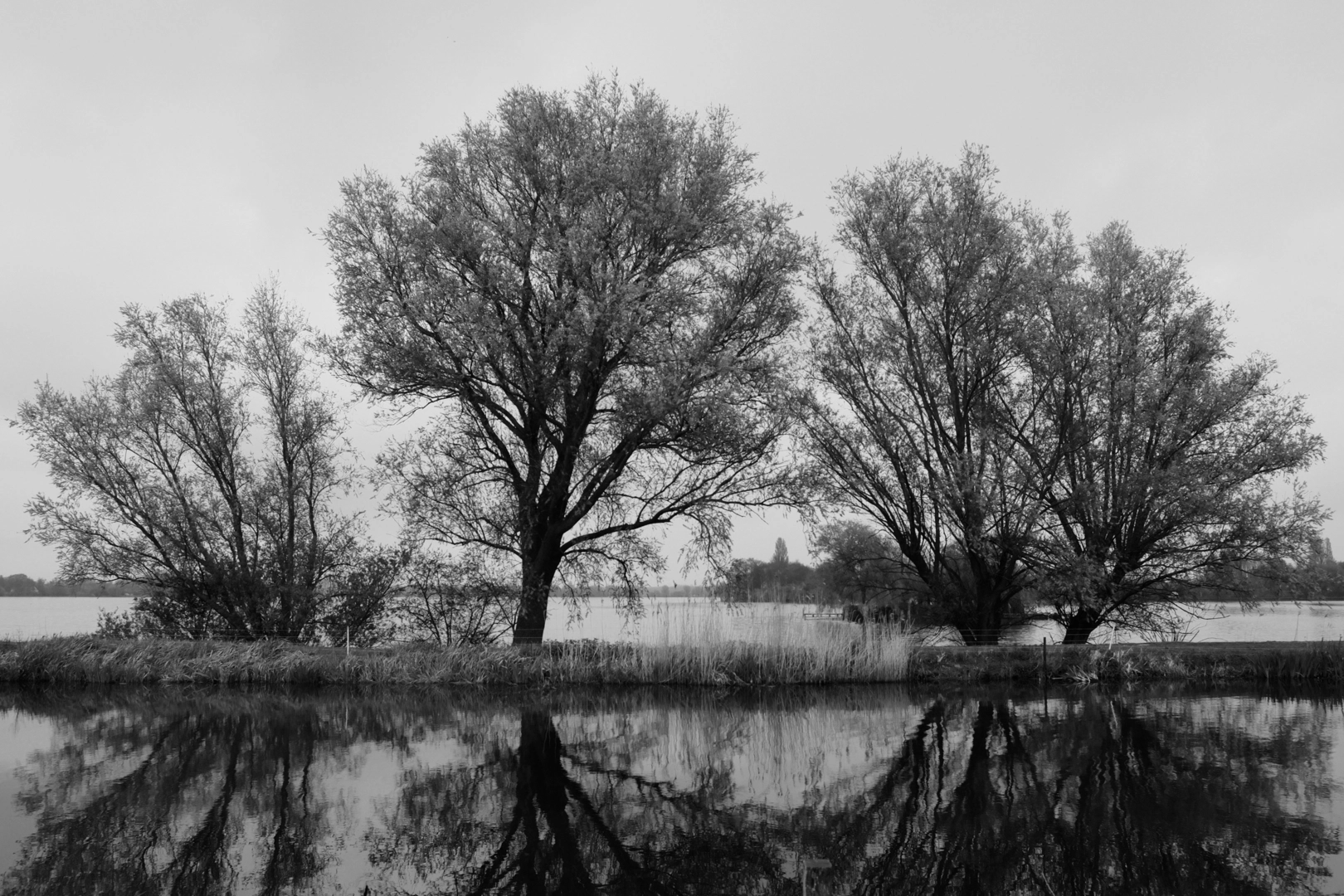
This easy, mostly level loop of about 7 km (4.3 mi) traces the edges of the Langeraarsche Plassen and the adjoining waters often referred to locally as the Noordplas/Zuidplas—a classic “Groene Hart” waterscape of reedbeds, open water, and narrow dikes. Expect negligible elevation gain (roughly 0 m / 0 ft overall), with the only “ups and downs” coming from small bridge ramps and dike undulations.
Getting to the start (car + public transport)
A practical place to begin is by the Kerkpad corridor between Langeraar and Papenveer, which is the key walking/cycling link that splits the lakes into northern and southern basins. (hollandse-plassen.nl)
- By public transport: The closest convenient stop is typically “Langeraar, Kerkpad” (bus service shown as line 727 in local journey planners). From the stop it’s only a short walk to the dike paths. (moovitapp.com)
- By car: Parking is usually easiest on village streets near the Kerkpad access. For the Papeneiland area, local guidance suggests parking on/near G. van Dijkstraat (Langeraar) and walking or cycling in. (papeneiland-langeraar.nl)
If you’re building the route in HiiKER, set your start near Langeraar – Kerkpad (the dike path) so your navigation aligns with the main causeway and the loop options around the water.
What the walk feels like underfoot
Most of this loop is on dike-top paths, quiet lanes, and paved or hard-packed surfaces typical of Dutch polder walking—excellent in wet seasons because you’re rarely in deep mud, but it can be windy and exposed with little shelter. The “easy” rating is accurate: the challenge here is more about weather (wind/rain) and sharing space with cyclists than about terrain.
Landmarks and the best bits of the loop
One of the defining features is the Kerkpad, the long, straight connector that divides the Langeraarse Plassen into the Noordplas and Zuidplas and functions as a walking/cycling route between Papenveer and Langeraar. (hollandse-plassen.nl)
About 3–4 km (1.9–2.5 mi) into the outing (depending on where you start), you’ll likely pass the area associated with Papeneiland—a small island project with visitor access from sunrise to sunset, featuring a small beach, toilets, and an observation tower for wide lake views. (papeneiland-langeraar.nl)
Nearby, an eye-catching detail is the lookout platform that has a large owl figure on top—installed to discourage birds like cormorants and herons from concentrating near fish breeding areas. (hollandse-plassen.nl)
If your loop keeps to the outer edges rather than cutting straight across, you’ll get longer stretches of shoreline perspective—big skies, long sightlines over water, and frequent “mirror” reflections on calm days.
Nature and wildlife to look for
These are low moor (peat) lakes in the Groene Hart, and they’re known for attracting water birds, with the northern part often noted as especially bird-rich. (alltrails.com)
Bring binoculars if you have them—this is the kind of landscape where you can spot birds at distance across open water and reed margins. Expect seasonal variation:
- Winter/early spring: larger numbers of waterfowl and mixed flocks using the open water.
- Spring/summer: more activity along reedbeds; more cyclists and local recreation on fine weekends.
Historical context (why these lakes exist)
The Langeraarse Plassen are not “natural” lakes in the usual sense—they were created by peat extraction (turf winning), which is a

Surfaces
Unknown
Asphalt
Gravel
Comments and Reviews
User comments, reviews and discussions about the Langeraarsche and Zuidplas Plassen Loop, Netherlands.
average rating out of 5
0 rating(s)