Download
3D Flyover
Add to list
More
17.0 km
~3 hrs 23 min
0 m
Loop
“Circle Schiermonnikoog’s woods and wind-sculpted dunes, where big skies meet bunker echoes.”
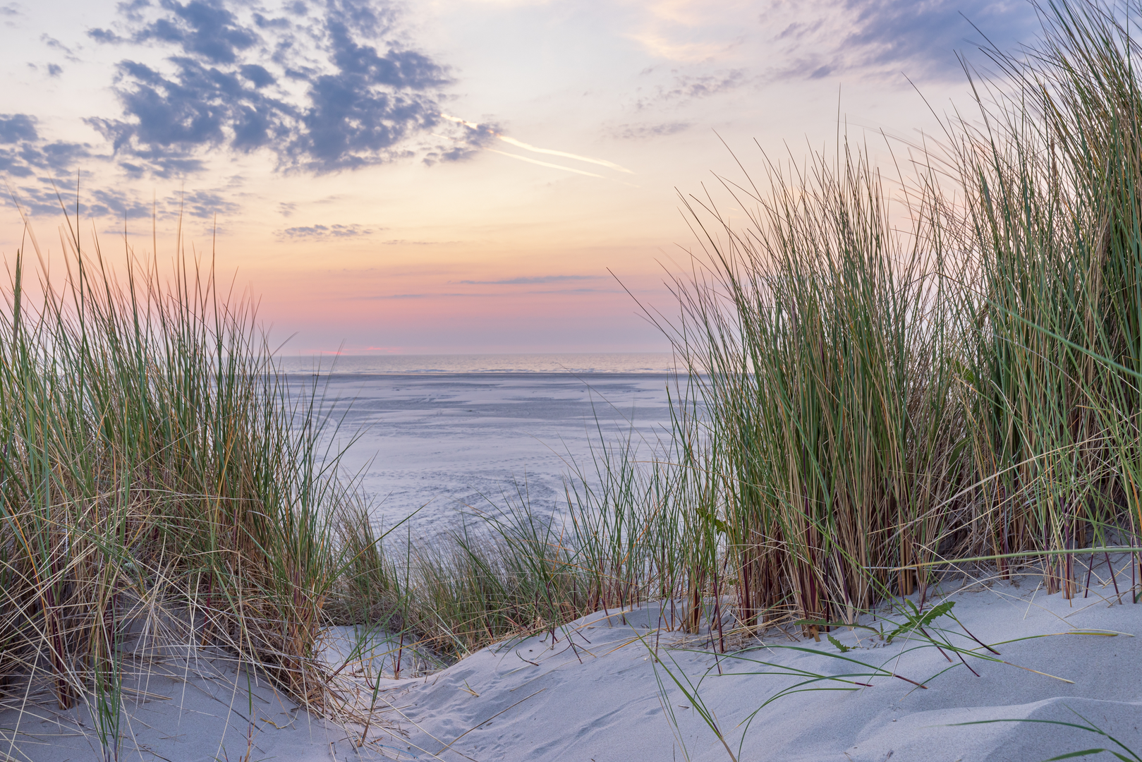
This is a low-stress, almost perfectly flat island loop of about 17 km / 10.6 mi with roughly 0 m / 0 ft of climbing—ideal for a steady pace, big skies, and lots of variety: sheltered woodland, open dune country, and wide sandy expanses shaped by wind. Expect a mix of firm paths, soft sand, and occasional exposed stretches where the sea wind can be the main “difficulty,” not the terrain.
Getting to the start (and where “near” actually is)
Because the hike details don’t include coordinates, the most reliable way to pin down the start is to use the named landmarks that sit right on the loop’s core features: Hoornsebos (Hoornse Bos), Bunkerdune (Bunkerduin), and Tordunen—all on Schiermonnikoog (Friesland, Netherlands), within/adjacent to National Park Schiermonnikoog. The best practical “start area” for this loop is typically near the main village and the forest edge, then you arc out toward the dunes and the bunker viewpoint.
- By public transport (typical approach): travel to Lauwersoog on the mainland, take the ferry to Schiermonnikoog, then continue from the harbor toward the village by local bus/shuttle or on foot/bike (car traffic on the island is limited; many visitors explore by walking/cycling). National Park information notes the ferry crossing is about three-quarters of an hour. (nationaleparken.nl)
- By car: drive to Lauwersoog ferry terminal, park there, and take the ferry over. Once on the island, plan to walk/bike to the trail area rather than relying on driving around.
For navigation, load the route in HiiKER before you arrive and download it offline—windy dune sections and multiple intersecting sandy tracks can make “obvious” lines less obvious when visibility drops.
What the terrain feels like underfoot
- Hoornsebos / forest sections: generally the most sheltered and easiest walking—packed paths, needles/leaves underfoot, and noticeably less wind.
- Dunes and open sand: the “effort spikes” come from soft sand and headwinds, not hills. Even with near-zero elevation gain overall, dunes can create short, rolling ups/downs that don’t add much total ascent but do change footing.
- After rain: forest paths can be damp; dune sand can firm up nicely, but low spots may hold water.
Along the loop: landmarks, nature, and what to look out for
Hoornsebos (woodland character and wildlife)
The woodland on Schiermonnikoog is notable because much of it was planted (including pine), and it’s been shaped by harsh coastal conditions—salt wind and shallow rooting can stress trees, and the forest is managed toward a more mixed structure over time. (vvvschiermonnikoog.nl)
In the quieter stretches, keep an eye and ear out for typical woodland birds (woodpeckers and small songbirds are common in these island forests), especially where the canopy opens into scrubby edges.
Watch-outs here: - Narrower paths can have cyclists on shared routes—stay predictable on bends. - In windy weather, listen for creaking branches at the forest edge where trees are most exposed.
Bunkerdune / Bunkerduin and the Wassermann bunker (history + viewpoint)
The “Bunkerdune” portion is where the loop’s history becomes tangible. The Wassermann bunker is a WWII-era structure built by German forces as part of the Atlantic Wall defenses; it’s now used as a viewpoint and is freely accessible. (vvvschiermonnikoog.nl)
A key detail that makes this site memorable: the planned radar installation never became operational—accounts describe how the mast/radar system didn’t fit as intended, and

Surfaces
Asphalt
Unknown
Sand
Ground
Paved
Comments and Reviews
User comments, reviews and discussions about the Hoornsebos, Bunkerdune and Tordunen Loop, Netherlands.
average rating out of 5
0 rating(s)