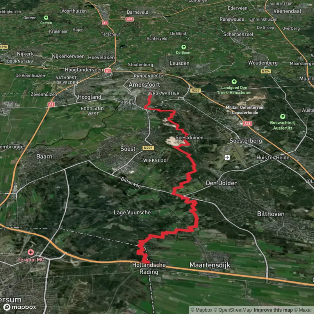
Hollandsche Rading to Amersfoort Centraal via Bosvijver and Marskrammerpad
Download
Preview
Add to list
More
23.2 km
~4 hrs 38 min
0 m
Point-to-Point
“Wander through whispering forests, wildflower meadows, and storied villages on this serene Dutch countryside stroll.”
Starting from the small village of Hollandsche Rading, this 23 km (about 14.3 miles) route to Amersfoort Centraal is a gentle, flat walk through the heart of the Dutch countryside, with virtually no elevation gain—ideal for those seeking an easy, scenic day out. The trailhead is conveniently located near Hollandsche Rading train station, making it easily accessible by public transport from Utrecht or Amsterdam. For those arriving by car, parking is available near the station.
Woodlands, Heath, and Water Features
The first stretch leads you into the lush forests of the Utrechtse Heuvelrug National Park. The path meanders beneath tall pines and broadleaf trees, with the peaceful Bosvijver (Forest Pond) appearing around 4 km (2.5 miles) in. This tranquil spot is a haven for birdlife—look out for woodpeckers, nuthatches, and the occasional deer grazing at the water’s edge. The forest floor is often carpeted with moss and wildflowers in spring and summer, and the air is filled with birdsong.
Marskrammerpad and Open Landscapes
After leaving the dense woodland, the route joins the Marskrammerpad, a long-distance path that traces the ancient border between Utrecht and Gelderland provinces. This section, roughly 10 km (6.2 miles) into the hike, opens up to heathland and meadows, dotted with grazing sheep and wild ponies. The Marskrammerpad is steeped in history, once used by medieval traders and pilgrims. Interpretive signs along the way provide insights into the region’s past, including remnants of old boundary markers and tales of local folklore.
Villages and Historical Sites
Passing through the charming village of Soest, about 16 km (10 miles) from the start, you’ll find traditional Dutch farmhouses and the striking Soestduinen sand dunes. This area is known for its shifting sands and unique flora, including rare orchids and juniper bushes. The village itself offers a chance to rest at a café or bakery, and the 15th-century Oude Kerk (Old Church) is worth a brief detour.
Final Approach to Amersfoort
The last stretch leads you through the outskirts of Amersfoort, following tree-lined avenues and quiet residential streets. The city’s medieval center, with its well-preserved walls and the iconic Koppelpoort gate, is a fitting end to the journey. Amersfoort Centraal station is well-signposted and offers frequent train connections to major Dutch cities.
Navigation and Preparation
The entire route is well-marked, but for added confidence, use HiiKER to download the trail map and track your progress. The flat terrain and well-maintained paths make this hike suitable for all fitness levels, though sturdy walking shoes are recommended, especially after rain when some sections can be muddy. Bring water and snacks, as services are limited between villages. Wildlife enthusiasts should carry binoculars for birdwatching, and history buffs will appreciate the interpretive panels along the Marskrammerpad.
Public transport is reliable at both ends of the hike, with Hollandsche Rading and Amersfoort Centraal both served by regular trains. If driving, park at Hollandsche Rading and return by train from Amersfoort. The route is accessible year-round, though spring and autumn offer the most vibrant scenery.

Surfaces
Sand
Unknown
Dirt
Asphalt
Grass
Unpaved
Concrete
Gravel
Paved
Ground
Comments and Reviews
User comments, reviews and discussions about the Hollandsche Rading to Amersfoort Centraal via Bosvijver and Marskrammerpad, Netherlands.
average rating out of 5
0 rating(s)