Download
Preview
Add to list
More
16.5 km
~3 hrs 18 min
0 m
Loop
“From Buurse’s quiet farm lanes to Witte Veen’s shimmering bog pools, the flat landscape keeps changing.”
This easy, mostly level loop of about 17 km / 10.6 mi with roughly 0 m / 0 ft of climbing wanders through the borderland landscapes around Buurse (municipality of Haaksbergen, Overijssel)—a mix of quiet farm lanes, streamside paths along the Buurserbeek, and the open, wet heath-and-bog mosaic of Het Witte Veen right up against Germany. Expect big skies, long straight sightlines, and a “flat-but-varied” feel: the terrain doesn’t rise, but the ground underfoot changes often.
For a practical start point, aim for the Buurse, Braambrug area (a named bridge and bus stop near Buurse). It’s a clear landmark and a common access point for routes in this area. ([reisinfo.rrreis.nl](https://reisinfo.rrreis.nl/nl/rrreis/lijnen/7595?utm_source=openai))
Getting to the start (car + public transport)
By car: Set navigation for Braambrug, Buurse (near Haaksbergen) and park considerately along the local roads where permitted (this is a rural area with narrow verges). Braambrug is a mapped bridge landmark near Buurse. ([mapcarta.com](https://mapcarta.com/W372463984?utm_source=openai))
By public transport: Use the regional bus network to reach “Buurse, Braambrug”—it’s served by RRReis bus line 595 between Haaksbergen, Busstation and Buurse. Check the current timetable close to your travel day and use HiiKER to align the stop with your chosen direction of travel on the loop. ([reisinfo.rrreis.nl](https://reisinfo.rrreis.nl/nl/rrreis/lijnen/7595?utm_source=openai))
What the walk feels like, section by section
0.0–4.5 km (0.0–2.8 mi): Stream-and-meadow edges near Buurse From the Braambrug area you’ll quickly settle into classic Twente countryside: hedgerows, drainage ditches, and the gentle presence of the Buurserbeek system nearby. Even when you’re not right beside the water, the landscape reads as “stream country”—flat, green, and stitched together by small bridges and culverts. This is a good place to do an early gear check: adjust layers, confirm your HiiKER track, and note wind direction (open fields can feel surprisingly chilly).
You’ll likely cross or pass other named bridges in the Buurse area—these crossings are part of how locals have historically moved through wet lowlands. One of the notable local bridges, Reinksbrug, was renewed in 2012, reflecting how important these small crossings remain for access and waterland management. ([arfgood-buurse.nl](https://arfgood-buurse.nl/bruggen-buurserbeek?utm_source=openai))
Underfoot: mostly firm paths/lanes; after rain, expect muddy margins where farm traffic and walkers share space.
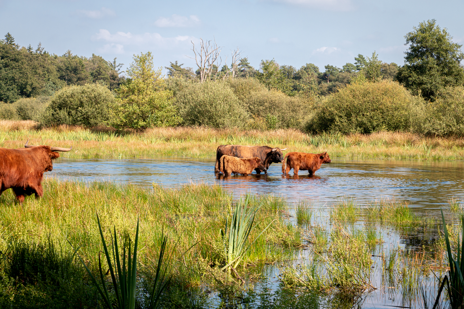
4.5–12.5 km (2.8–7.8 mi): Witte Veen—heath, pools, and raised-bog restoration As you approach Het Witte Veen, the scenery opens into a protected nature area of rough grassland, pools, heathland, forest patches, and raised bog. This reserve sits between Buurse and the German border, and the “wetland” character becomes obvious: darker soils, spongier ground, and water reflecting the sky in shallow basins. ([visittwente.com](https://www.visittwente.com/to-see-and-do/natural-areas/6866-het-witte-veen/?utm_source=openai))
This is the most distinctive part of the loop and the section where conditions can change fastest: - After wet weather: boardwalks and narrow paths can be slick; peat edges can be soft. - In dry spells: sandy/gritty stretches appear, and exposed heath can feel hot with little shade.
Wildlife and plants to look for: Witte Veen is known for amphibian-friendly habitat work (pools and ditches) and is a place where tree frogs are specifically noted in spring. Botanically, keep an eye out for wet-heath and bog species such as bell gentian and lavender heather in season.

Surfaces
Unknown
Asphalt
Ground
Dirt
Gravel
Wood
Grass
Comments and Reviews
User comments, reviews and discussions about the Reinksbrug, Witte Veen and Braambrug Loop, Netherlands.
average rating out of 5
0 rating(s)